Publications

L’émergence des Wazalendo dans la lutte contre l’AFC / M23 au Nord-Kivu: État des lieux, défis et perspectives
- Anonymized, IPIS | 5 février 2026
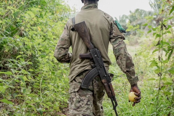
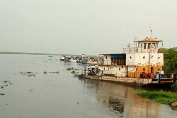
Le 27 janvier 2025, l’Alliance Fleuve Congo/Mouvement du 23 mars (AFC/M23) – soutenue par le Rwanda – a pris le contrôle de Goma, capitale de la province du Nord-Kivu en République démocratique du Congo (RDC), avant de progresser vers Bukavu, capitale du Sud-Kivu, tombée en février 2025. La réémergence du M23 en 2021 et sa progression rapide ont conduit le gouvernement congolais à faire appel à de

Shifting frontlines in October, November and December – Limits of diplomacy: AFC/M23 advances after Washington Accords
- IPIS | 19 décembre 2025
On 4 December 2025, Rwanda and the Democratic Republic of the Congo (DRC) signed the US-brokered Washington Accords for Peace and Prosperity, committing to cease hostilities, establish a permanent ceasefire, and implement the 25 April Declaration of Principles and the 27 June Peace Agreement. However, critical questions have been raised about the prospects for lasting peace in eastern DRC, as Kig
Le poids du silence: comment la révolte des Mobondo bouleverse l’ouest de la RDC
- CDJP Kinshasa, Caritas International Belgique, DIIS, IPIS | 17 novembre 2025
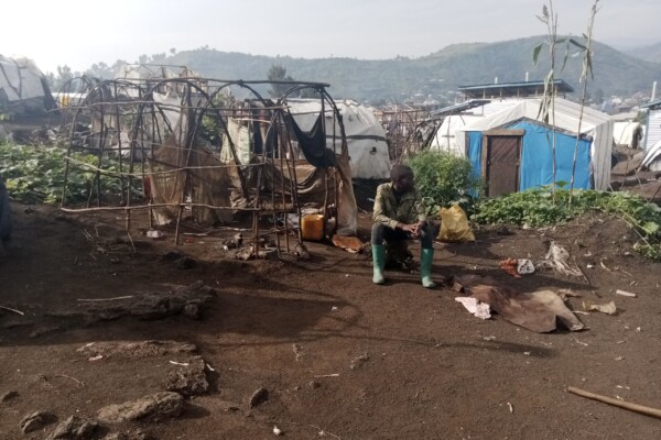
Depuis 2022, l’ouest de la République démocratique du Congo (RDC) est en proie à une grave crise sécuritaire et humanitaire, qui a causé la mort de plus de 5 000 personnes et provoqué le déplacement prolongé de 280 000 autres. Alors que l’attention internationale se focalise principalement sur les conflits violents dans l’est du pays, un conflit intercommunautaire aux abords de Kinshasa s’enlise d

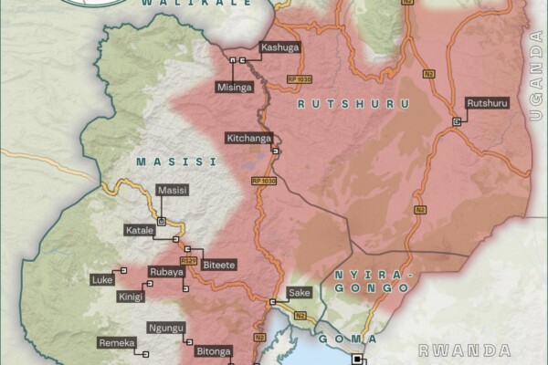
M23’s territorial advances in July, August, and September 2025 – Escalating violence and fragile peace in eastern DRC’s Kivu regions
- IPIS | 17 octobre 2025
New peace agreements from Washington and Doha have brought hope for initiating a pathway to resolve the ongoing M23-conflict in DRC’s eastern territories in recent months. However, after the signing of the Declaration of Principles in Doha on 19 July, direct negotiations between the DRC and AFC/M23 were intended to result in a comprehensive peace agreement and were planned to begin no later than 8

M23’s territorial advances in June – A long path to peace: Renewed efforts to resolve the M23 conflict in Eastern Congo
- IPIS | 18 juillet 2025
New mediation efforts have been made throughout June to end the ongoing conflict between the Rwandan-backed M23 rebels and pro-government forces in the North and South Kivu regions of eastern Congo. On June 27th, the Democratic Republic of Congo and Rwanda signed a peace agreement in Washington, D.C., aimed at de-escalating tensions and fostering regional stability after years of conflict in easte

M23’s territorial advances in May – From Doha to Goma: The disconnect between diplomacy and reality in Eastern Congo
- IPIS | 12 juin 2025
Despite the ongoing peace negotiations between the Rwandan-backed M23 rebels and the Congolese government in Doha (Qatar), and the signature of a declaration of principles between Rwanda and the DRC, under the patronage of the United States in Washington, D.C. in April, the evolution of the conflict in eastern DRC has shown no sign of abating.

« La (nouvelle) offensive du M23 sur Goma : pourquoi ce conflit de longue date ne concerne pas uniquement les minerais et quelles en sont les implications ? – Questions-Réponses »
- IPIS | 6 février 2025
Au matin du 29 janvier, les rebelles contrôlaient en grande partie la ville stratégique de Goma. Pour expliquer rapidement et clairement les causes de cette crise humanitaire, on surestime souvent le rôle des ressources naturelles, en particulier des minerais. Si l’exploitation minière et le commerce des minerais jouent inévitablement un rôle important, car ils constituent un élément essentiel de
Shifting frontlines: Visualizing the evolution of the M23’s territorial influence in early 2024
- Ken Matthysen | 20 juin 2024
In early 2024, IPIS, ASSODIP, and DIIS published a report on the stakes and motivations of the “March 23 Movement” (M23), a rebellion causing serious insecurity and humanitarian suffering in the eastern Democratic Republic of Congo (DRC). The movement took up arms again in 2021, and it rapidly seized vast territories in the south-east of North Kivu province in 2022, with military support from the
Le M23 « version 2 » : Enjeux, motivations, perceptions et impacts locaux
Depuis 2021, l’est de la République démocratique du Congo (RDC) est à nouveau sous l’emprise du groupe armé du « Mouvement du 23 mars » (M23). Défait en 2013, le M23 a repris les armes en 2021, et réussissait en 2022 à s’emparer rapidement de vastes territoires au sud-est de la province du Nord-Kivu.
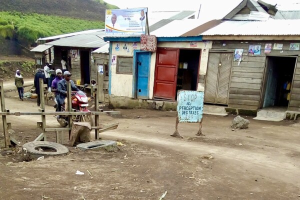
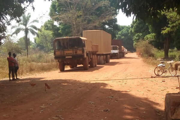
Barrages routiers à Masisi et Walikale: Prédation sur la circulation en période de troubles
Si les minerais sont au centre des recherches sur le financement des conflits en République démocratique du Congo, les acteurs armés ont souvent recours à d’autres sources de revenus pour financer leurs luttes. Lesbarrages routiers en font. Dans ce rapport, produit en collaboration avec ASSODIP et le Danish Institute for International Studies (DIIS), IPIS étudie le lien entre les barrages routiers
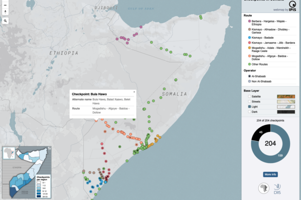
Mapping the political economy of checkpoints in Somalia
- IPIS | 20 décembre 2023
The maps inform users on the locations of roadblocks across Somalia, the distribution of violence at checkpoints as well as the density of checkpoints per administrative region. Different maps also identify varying characteristics of the roadblocks, including their operator, location on a primary/secondary road and the amount paid at the checkpoint as toll.
Checkpoint economy: the political economy of checkpoints in South Sudan, ten years after independence
- Ken Matthysen, Peer Schouten | 10 décembre 2021
Ten years after independence, the world’s youngest country is home to an entrenched political economy of conflict premised on checkpoint taxation. Humanitarian aid is not exempt, reveals a major new mapping report by DIIS and IPIS. When South Sudan became independent ten years ago, oil revenues were supposed to fuel the economy of the world’s newest country. But two years later in 2013, oil prices
Plaidoyer en faveur d’un environnement plus favorable à la production, au commerce et à l’exportation de minerais conformes au Guide OCDE sur le devoir de diligence (GDD) dans l’est de la RDC.
- Levin Sources | 23 novembre 2021
Dans le cadre du projet Madini, un examen de la situation actuelle, des tendances et des obstacles à la production, au commerce et à l’exportation d’étain, de tantale, de tungstène (3T) et d’or en provenance de l’est de la République démocratique du Congo (RDC) a été réalisé par Levin Sources, dans le but de recommander des actions concrètes susceptibles d’améliorer l’approvisionnement conforme à
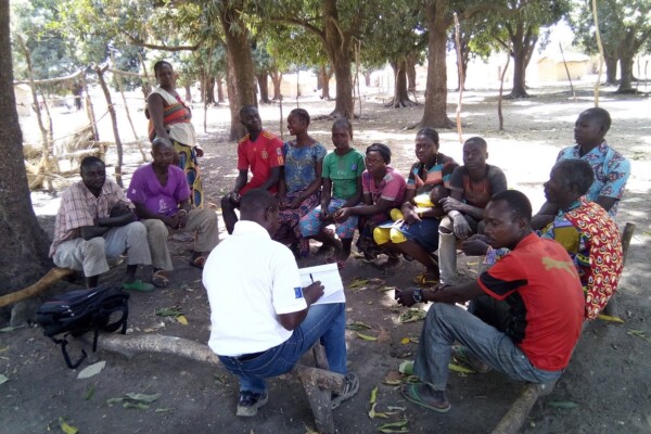
Promoting peaceful and seasonal migration in Northern Central African Republic
- Guillaume de Brier, Peer Schouten (DIIS/IPIS) | 9 février 2021
“You can negotiate with an armed group, not with the drought” The borderlands of the Central African Republic (CAR) are home to one of the largest seasonal livestock migrations (transhumance) in the world. Decades of unrest and crisis, however, have brutally disrupted most aspects of herding—the routes taken, the people involved, governance mechanisms, as well as relations to local populations. To
Annual Report 2019
- IPIS | 26 août 2020
This 2019 annual report provides an overview of IPIS’ research projects, capacity enhancement and outreach activities throughout last year. Read the full activity report to see what IPIS has been up to in 2019.
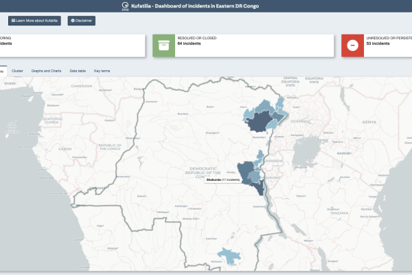
Dashboard of incidents in eastern DRC – Kufatilia
- Thomas Muller | 10 juin 2020
The Kufatilia platform (« to track » in Swahili) is an SMS based incident reporting and follow-up mechanism that has been launched in 2019 to increase transparency of minerals supply chains in Eastern DRC. Developed by IPIS in partnership with the Centre for Expertise on Mining Governance (CEGEMI) based in Bukavu, and powered by Ulula, Kufatilia is a tool for Congolese civil society organisations to
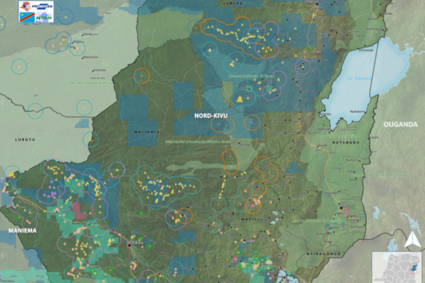
Maps of conflict minerals in Eastern DRC (2020)
- Alexandre Jaillon | 9 juin 2020
IPIS created maps of conflict minerals in eastern DRC, more particularly on Haut Uele, Ituri and North and South Kivu. These maps detail the type of minerals, the qualification of the mines, the mining titles and give an overview of armed presence in and around the mines. d Download the North Kivu map in full resolution Download the South Kivu map in full resolution Download the Haut
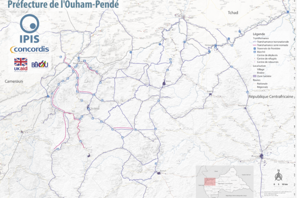
Map Pastoralism Ouham Pendé (2019)
- Alexandre Jaillon | 12 septembre 2019
Each year the annual migration of transnational transhumance through the prefecture of Ouham-Pende, in northwestern Central African Republic (CAR), uproots a deep-seated mistrust between nomadic and sedentary communities. Escalating militancy and environmental pressures in the region has only amplified these issues in recent years.In partnership with Concordis International, IPIS hopes to enhance
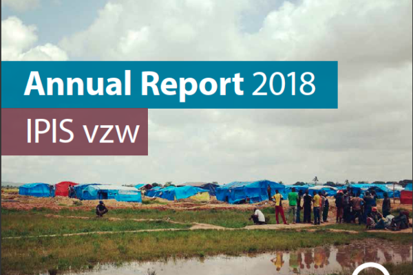
Annual Report 2018
- IPIS | 27 juin 2019
This 2018 annual report provides an overview of IPIS’ research projects, capacity enhancement and outreach activities throughout last year. IPIS consolidated its work in DRC, Central African Republic and Tanzania and deepened its expertise on mapping, data analysis and research on conflict drivers, natural resources, Business & Human Rights and arms trade. IPIS worked closely with civil societ

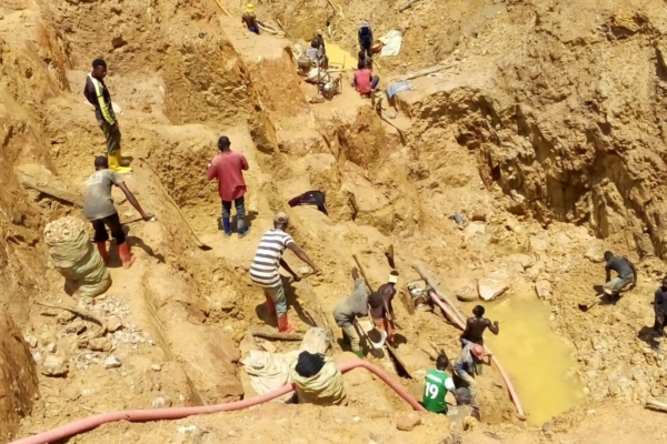
Cartographie des zones minières artisanales et des chaînes d’approvisionnement en minéraux dans l’est de la RDC
- Ken Matthysen, Peer Schouten (DIIS/IPIS), Steven Spittaels | 22 avril 2019
Dans son dernier rapport et sa dernière webmap, IPIS présente ses données actualisées sur l’impact des conflits armés et de l’ingérence des groupes armés dans le secteur minier artisanal dans l’est de la République Démocratique du Congo. En s’appuyant sur une vaste base de données collectées sur les dix dernières années, IPIS évalue l’impact des initiatives d’approvisionnement responsables qui vis