IPIS contributed to ‘Paying the Price: The Political Economy of Checkpoints in Somalia’ a project by the Danish Institute for International Studies (DIIS), the Rift Valley Institute (RVI) and XCEPT. IPIS supported the project by providing a frame for the project’s data collection, developing a questionnaire for project field researchers and a platform for the input and collation of their data. Aiding in analysis of the collected data, IPIS provided its expertise on data visualization through the development of various maps.
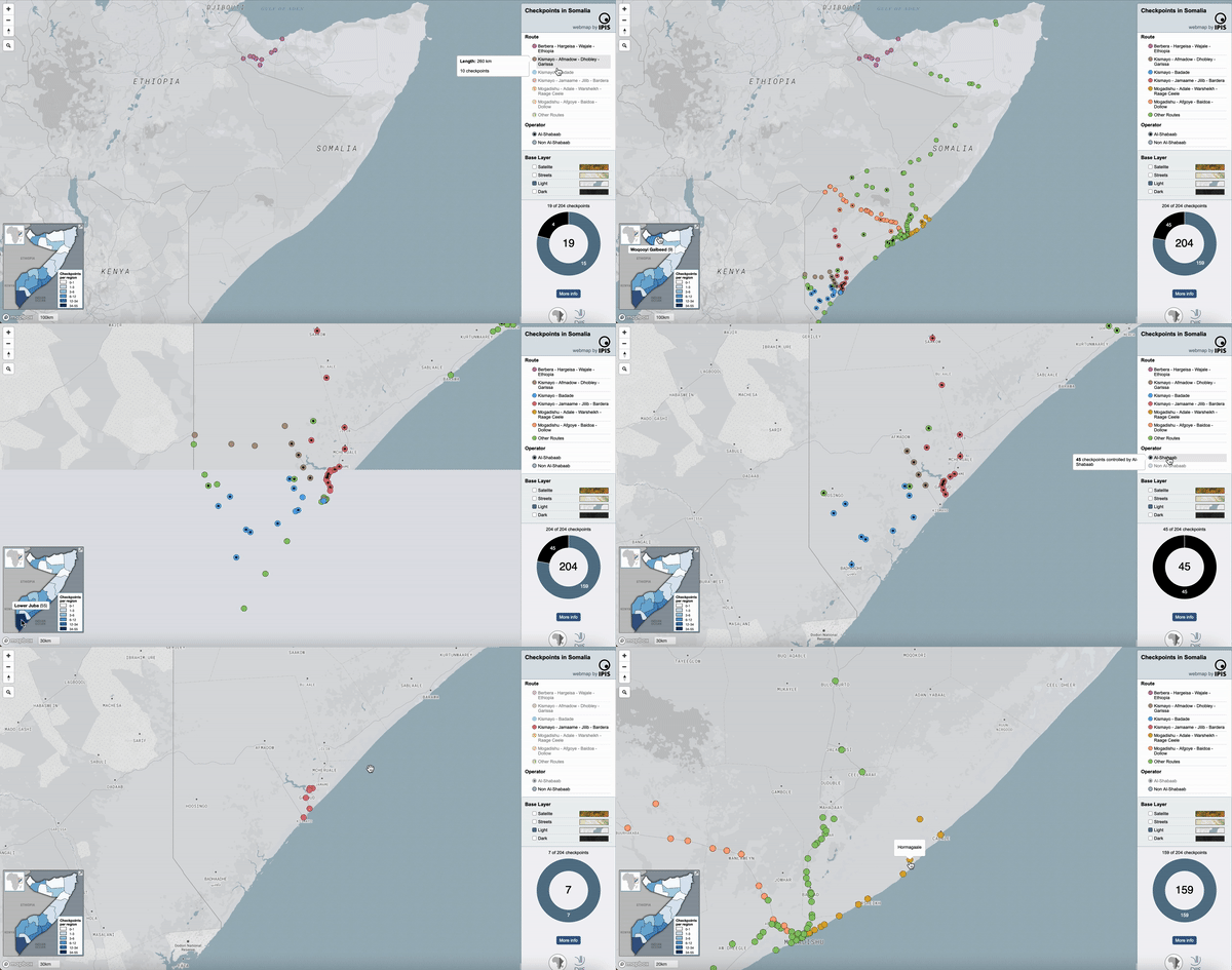
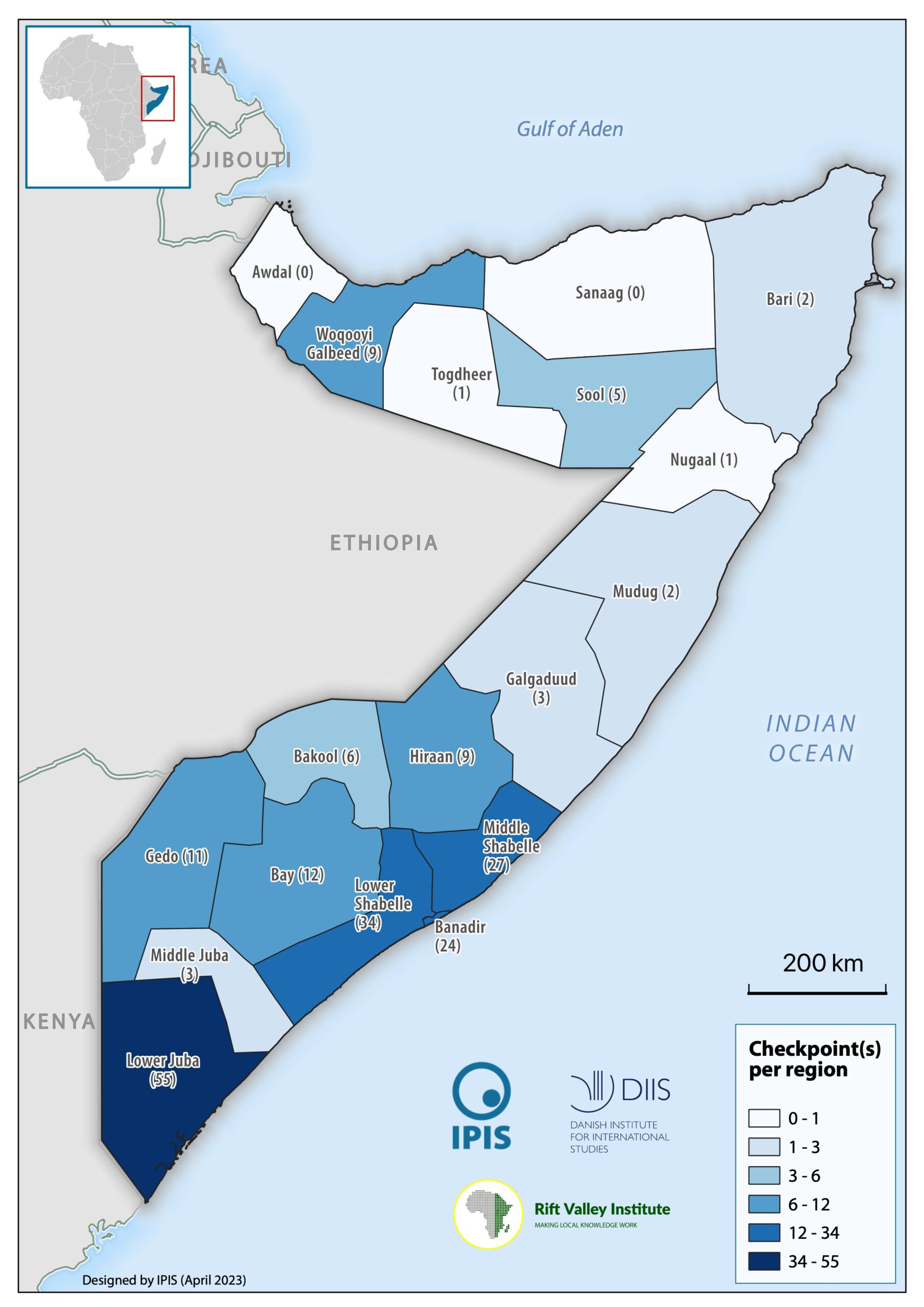
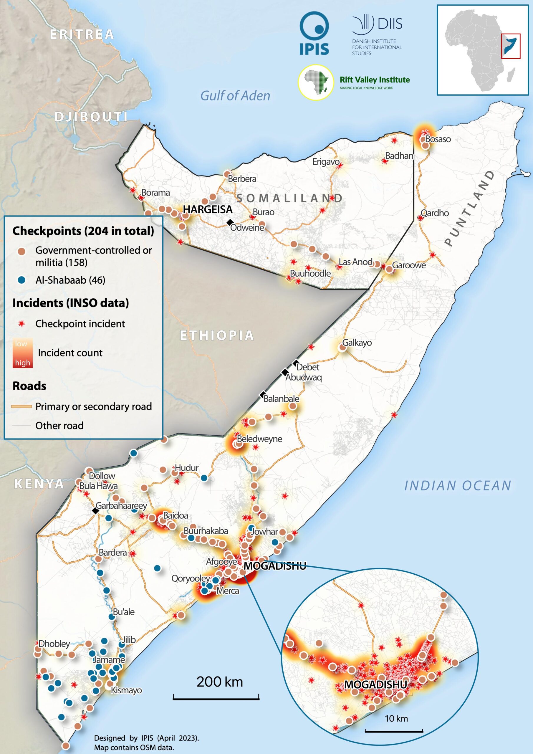
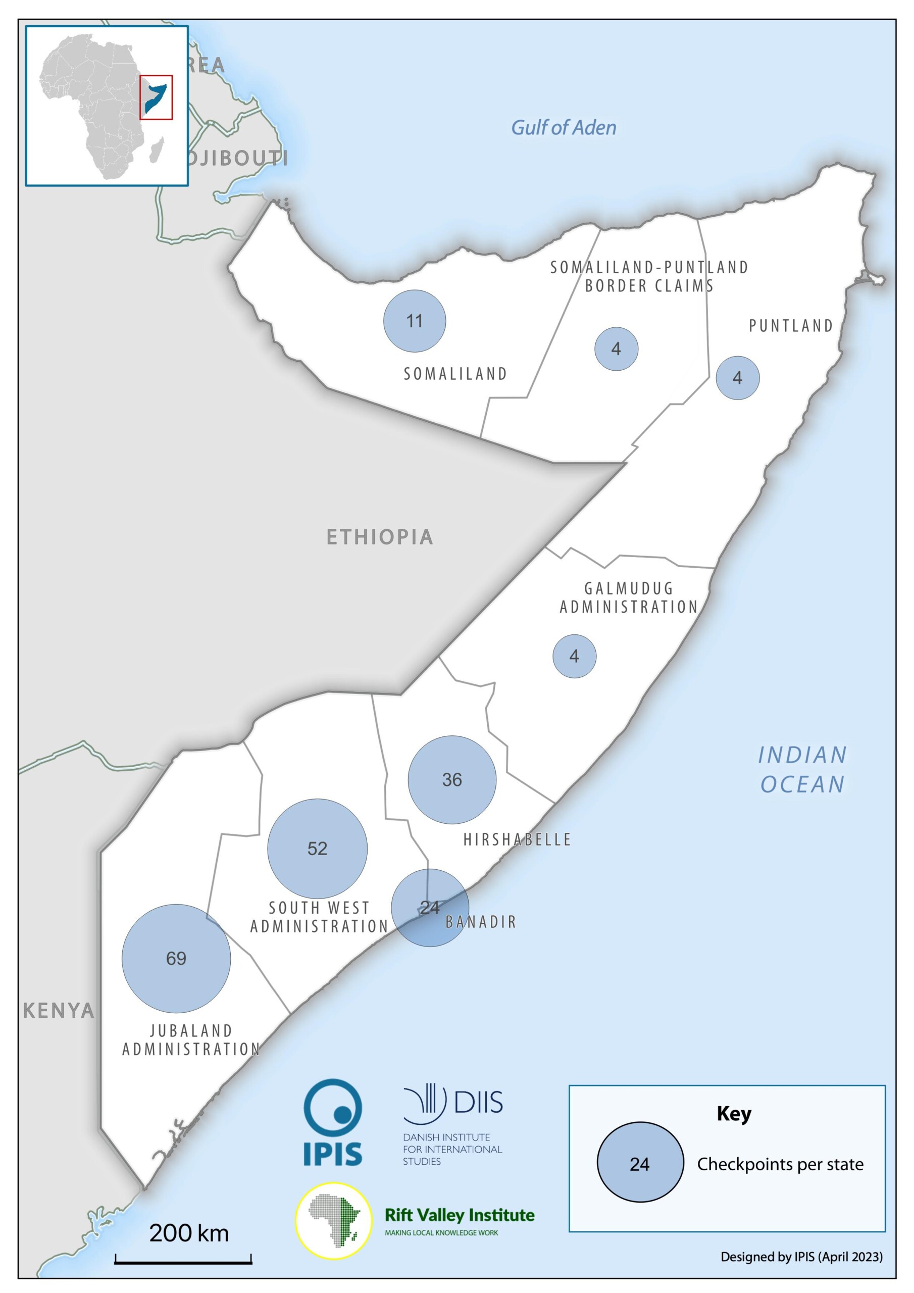
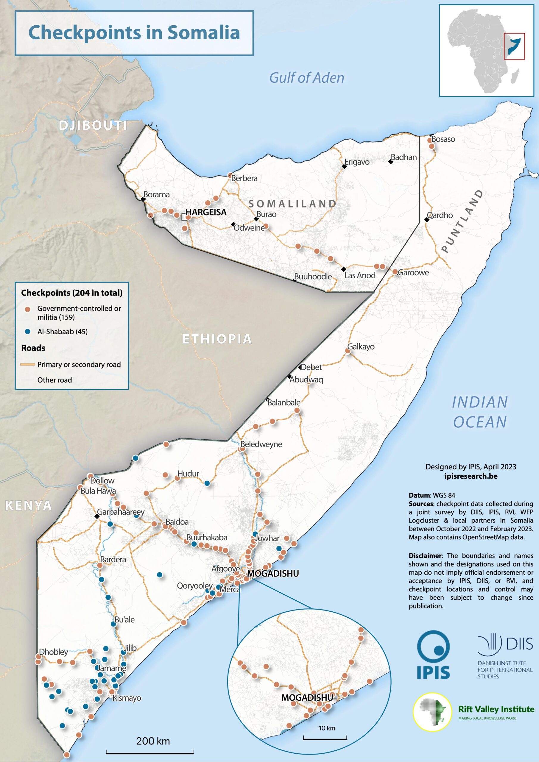
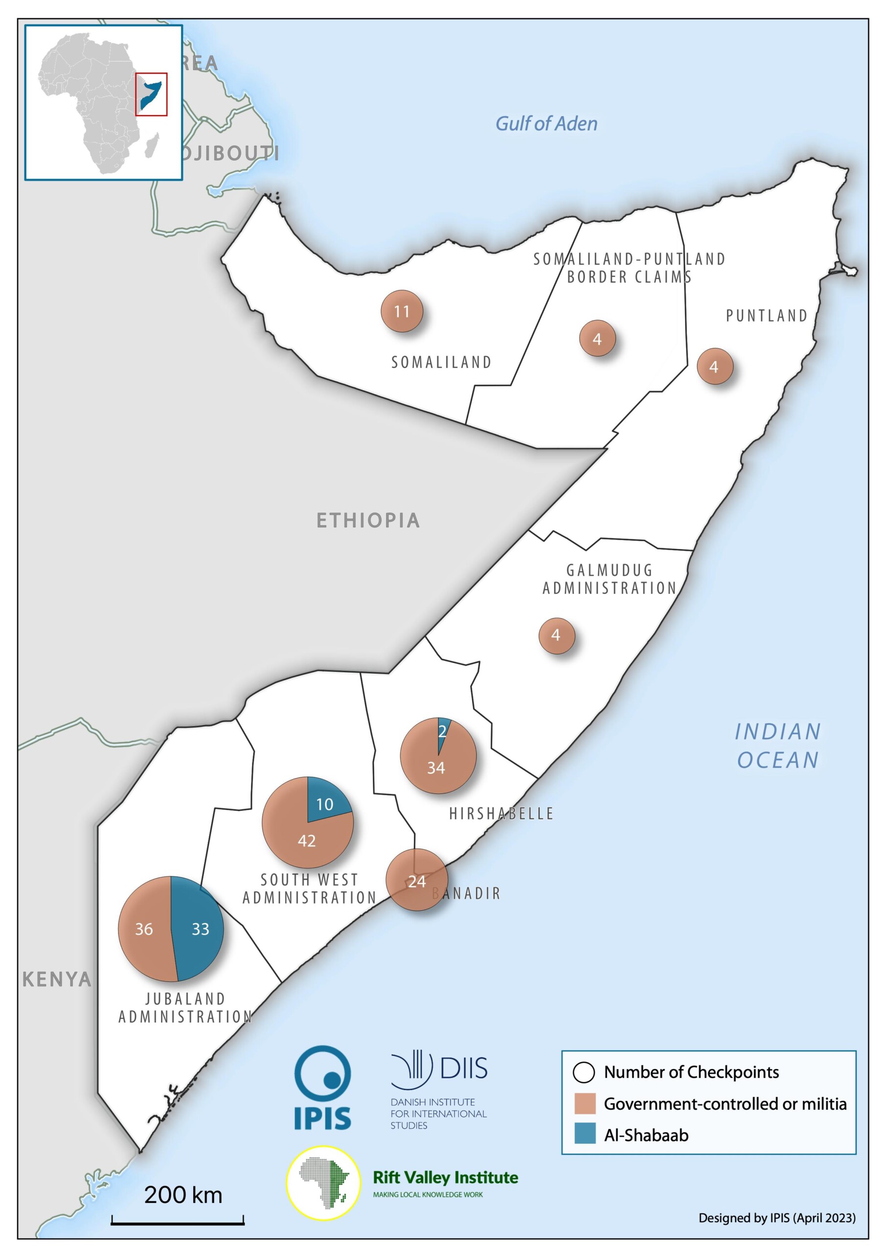
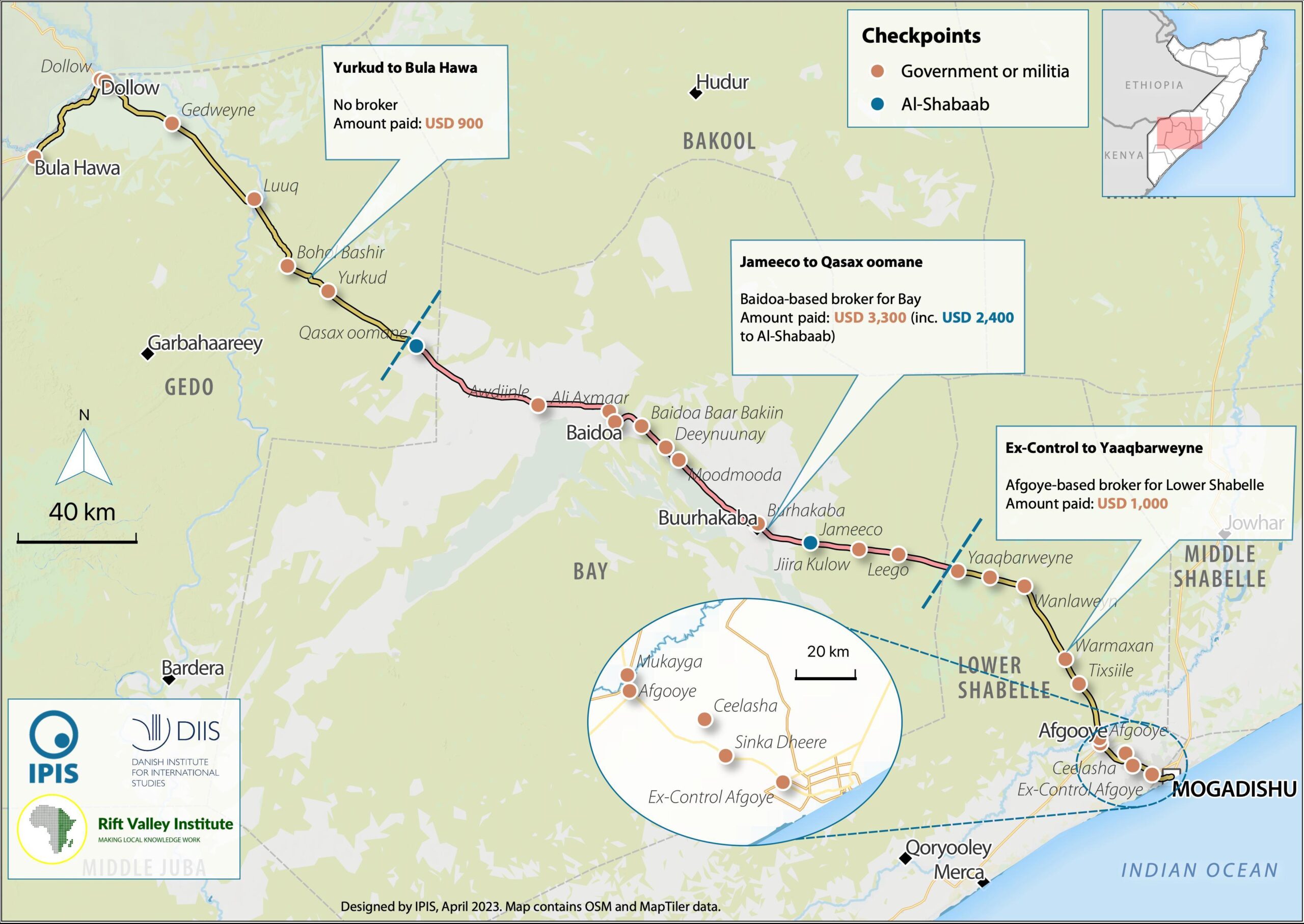
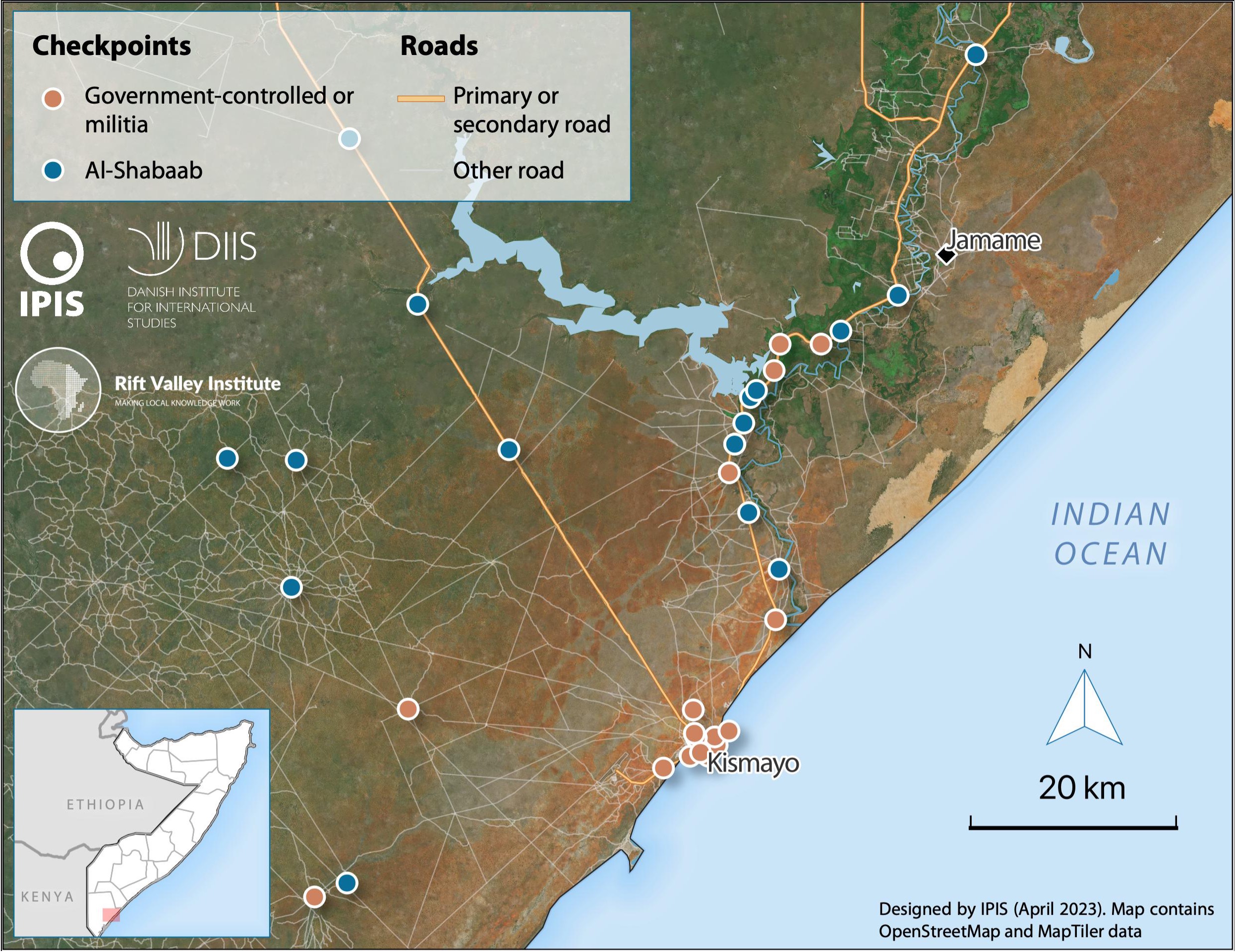
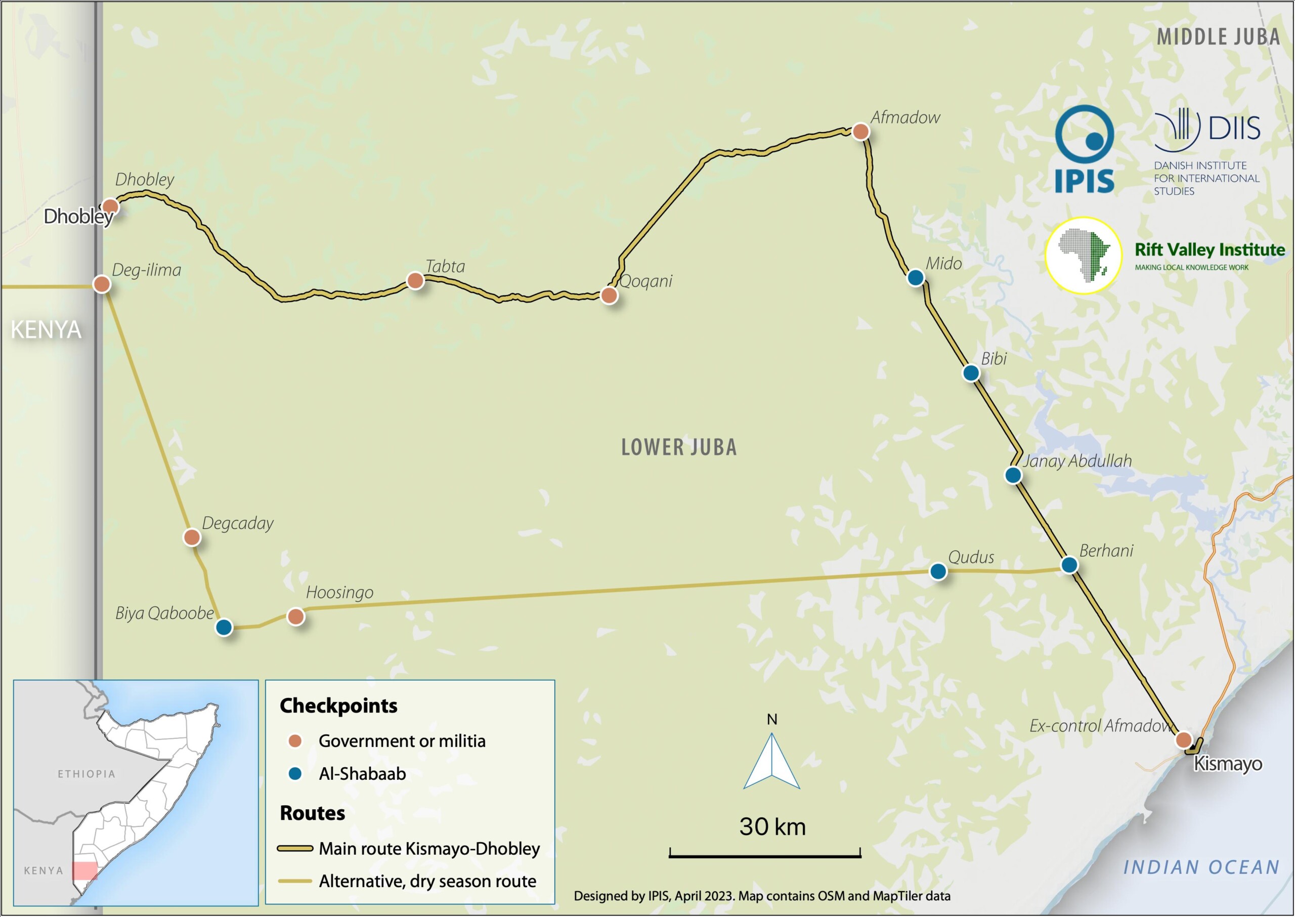
The static maps created by IPIS range across a variety of themes. The maps inform users on the locations of roadblocks across Somalia, the distribution of violence at checkpoints as well as the density of checkpoints per administrative region. Different maps also identify varying characteristics of the roadblocks, including their operator, location on a primary/secondary road and the amount paid at the checkpoint as toll. The interactive web map, complementary to the study, incorporates all aforementioned information to provide users with the ability to assess checkpoint location, distribution, density, alongside operator identity, alternative names, and location within the broader Somalian road network.
Static maps of checkpoints in Somalia
Interested in our other maps? Visit the Maps & Data page.

