Het conflict in de Centraal-Afrikaanse Republiek
January 27, 2017In 2014 deed IPIS een uitgebreid ‘conflict mapping’ onderzoek om inzicht te krijgen in de veiligheidssituatie in de Centraal-Afrikaanse Republiek (CAR). Dit leidde tot de publicatie van een publiek toegankelijke webkaart over belangrijke conflictdynamieken. IPIS bracht de gewapende groepen, mensenrechtenschendingen, natuurlijke rijkdommen, vluchtelingenstromen en migratieroutes van veehouders in k
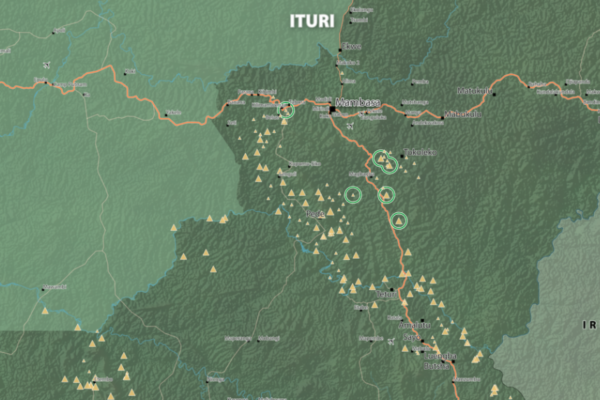
Map of Mambasa Territory
January 11, 2017Territory of Mambasa, Province of Ituri, DRC (Detail)
Training on cartography and artisanal mine site inspections in Mambasa
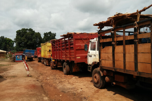
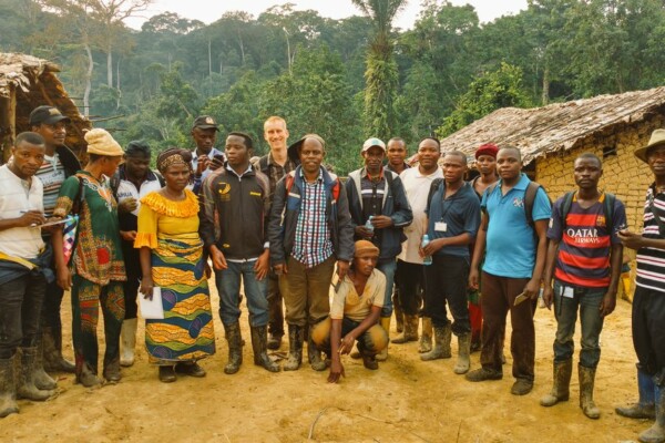
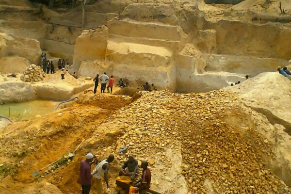
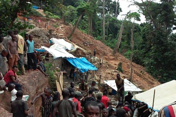
December 23, 2016French version below – version française ci-dessous Training on cartography and artisanal mine site inspections – Mambasa, Ituri, DRCongo From 10 to 14 December 2016, IPIS organised a training on cartography and artisanal mine site inspections in Mambasa, Ituri. The aim of this training was to launch and prepare the ground for IPIS’ artisanal gold monitoring pilot, financed by the Public-Private A
Het conflict in de Centraal-Afrikaanse Republiek in kaart gebracht.
December 1, 2016IPIS organiseert op dinsdag 20 december een filmvoorstelling en panelgesprek over het aanhoudende conflict in de Centraal-Afrikaanse Republiek. De Centraal-Afrikaanse Republiek (CAR) was de voorbije jaren het toneel van een bloedig conflict, een staatsgreep en voortdurend geweld. Het onderzoekscentrum IPIS analyseerde de motieven van de partijen bij het conflict, de conflictdynamiek, de roadblocks
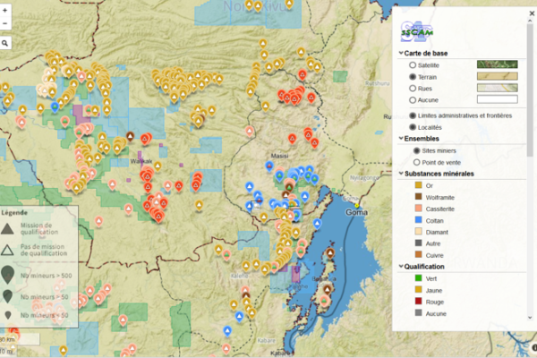
SAESSCAM database on artisanal and small-scale mining
November 15, 2016As part of a project to support good governance in the artisanal and small-scale mining sector in the Democratic Republic of Congo (DRC), IPIS has delivered a functional web application and database for SAESSCAM agents to record production data from artisanal mining sites as well as a publicly accessible interactive webmap. IPIS is engaged in a PROMINES project, in partnership with Pact and Estell
Forum on Conflict Minerals Supply Chain Compliance and Transparency (30 Nov – 2 Dec 2016)
November 15, 2016Business Intelligence Services (BIS group) announces the Conflict Minerals Supply Chain Compliance and Transparency Forum taking place on 30thNovember – 2nd December 2016, in Berlin, Germany. The meeting will focus on the industry and supplier engagement to eliminate conflict minerals, concepts and practice of collaboration among and across industries, methods for risk mapping for affected compone
A fresh look at IPIS data during the DataMinds Analytic-A-Thon
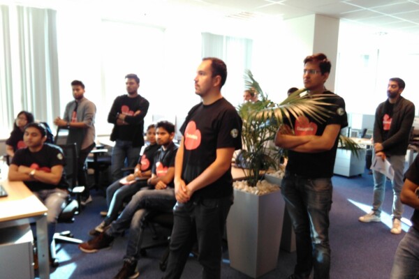
October 28, 2016IPIS was one of the NGO’s participating in the first Belgian DataMinds Analytic-A-Thon in the weekend of 22 October. The Analytic-A-Thon is a new event format organised by Cognizant, an international consulting firm, that brings together its employees and local NGO’s. About 25 young and bright consultants, equipped with specialised tools for data visualisation (including Tableau and Qlik) dedicate
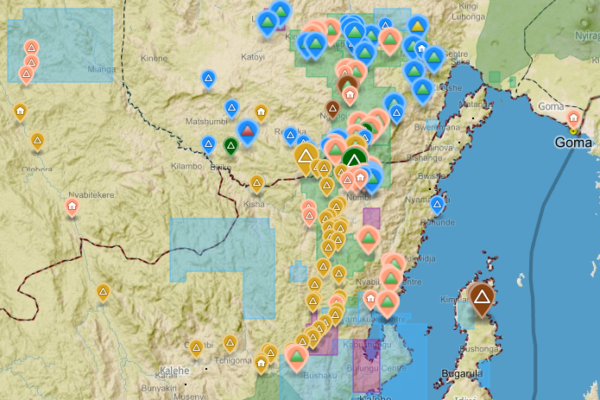
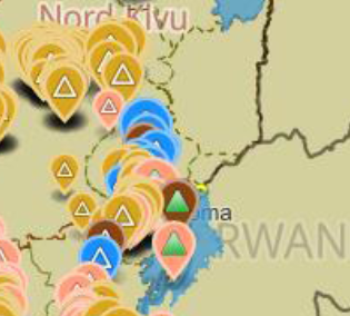
Analysis of the interactive map of artisanal mining areas in eastern DR Congo – 2015 update
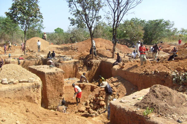
October 25, 2016The Belgian research group IPIS has collected data on 2026 artisanal mining sites in eastern DRC over the last couple of years. IPIS observed an armed presence in more than half of the mines. In an interactive map, updated in 2015, IPIS provides information about the on-site presence of armed groups and the Congolese army (FARDC) as well as indicators of the relative importance of the site. It als
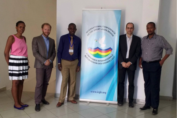
Design of the ICGLR regional database on mineral flows
September 6, 2016The Executive Secretariat of the International Conference on the Great Lakes Region (ICGLR), with the financial support of Partnership Africa Canada (PAC), has commissioned a consultancy to design the architecture of the ICGLR Regional Database on mineral flows, one of the six tools of the Regional Initiative on Natural Resources (Lusaka declaration). Estelle Levin Ltd. (ELL) and the International
Annual Report 2015
August 31, 2016Download pdf or open with issuu reader http://issuu.com/ipisresearch/docs/2016_10_10_ipis_jaarverslag_2015_20
Third Party Review of the Bisie Security Report
July 19, 2016The so-called ‘Bisie Mineral Stock’ encompasses about 1,000 tons of cassiterite, extracted by artisanal miners at Bisie mines between November 2010 and June 2015. A number of bans on mining and mineral trade in this region, as well as some hesitance further down the supply chain to buy untagged minerals, meant that mineral production was not marketed, but stored in warehouses. From 2014 onwards, n
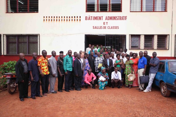
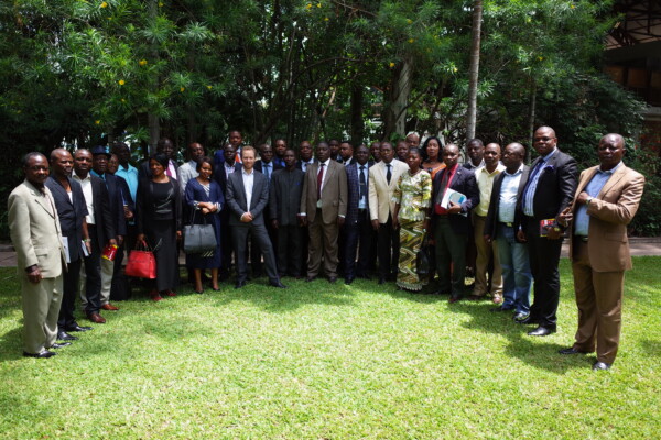
Bonne gouvernance des ressources naturelles: IPIS / DPDDA Atelier pour la société civile, Bangui
July 18, 2016Du 29 juin au 1er juillet 2016 IPIS a animé un atelier pour 25 organisations locales de la société civile à Bangui (République centrafricaine). (English below) La formation a été co-organisée avec le projet de l’USAID, Droit de propriété et Développement du diamant artisanal (DPDDA II). Les objectifs de cet atelier étaient de sensibiliser et d’améliorer la connaissance de la bonne gouvernance dans
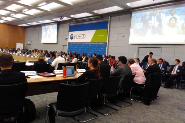
OECD Forum on Responsible Minerals
May 18, 2016Last week, three of our researchers were in Paris to represent IPIS at the 10th ICGLR-OECD-UN GoE Forum on Responsible Mineral Supply Chains. IPIS presented its three year project of mapping artisanal mining sites in Eastern DRC, a joint OECD-IPIS report on Congo mineral supply chains as well as our latest report on the Tourmaline exploitation sector in South-Kivu. IPIS researchers also participat

Coloured gemstones in eastern DRC: Tourmaline exploitation and trade in the Kivus
May 11, 2016Responsible sourcing efforts in the Democratic Republic of Congo (DRC) to date have focused predominantly on the so-called 3TG (tin, tungsten, tantalum and gold) sector. Nevertheless, the artisanal exploitation of other minerals including semi-precious gemstones, such as tourmaline, can also make notable contributions to local livelihoods […]
Extractive Orders: a political geography of public authority in Ituri, DR Congo
April 19, 2016Public authority is an essentially contested concept in the Democratic Republic of Congo (DRC). Not only is the ‘state of the state’ subject to profound disagreement in academic debates, but public authority on the ground is also the focal point of heated contestation. While some argue that the DRC does not exist as a state from the perspective of normative understandings of statehood, others argu
Business, Human Rights and Uganda’s oil. Part III: Respect and Remedy: Implementing corporate responsibility under the UN Framework on Business and Human Rights
December 31, 2015The following is the third in a series of four reports exploring business and human rights issues in Uganda’s oil sector. This series is a collaboration between IPIS vzw and ActionAid Uganda. The 2011 UN Guiding Principles on Business and Human Rights operationalise the 2008 Protect, Respect and Remedy Framework. In accordance herewith, this third report assesses the duty of businesses to respect

Thorns amongst the roses. A Cross-country analysis of human rights issues in flower farms in East Africa
December 31, 2015Floriculture is one of Africa’s most lucrative export sectors and can bring significant benefits to producer communities, but only where operations are conducted in a manner that is sustainable and respectful of the rights of workers and communities. Thorns Amongst the Roses summarises the human rights impacts that the International Peace Information Service (IPIS), the Global Horticultural Worker
Presentation of SAESSCAM database on Artisanal and Small-scale Mining
November 26, 2015From November 17 to 19, IPIS presented its work during a multi stakeholder meeting in Kinshasa as part of a project to support artisanal and small scale mining in DRC. In partnership with Pact and Estelle Levin LTD, IPIS has provided capacity reinforcement for the Service d’Assistance et d’Encadrement du Small Scale Mining (SAESSCAM), a governmental agency. IPIS focused on reviewing existing data
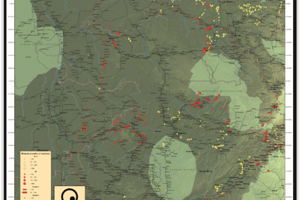
Mineral supply chains and conflict links in eastern democratic republic of congo
November 25, 2015Between 2009 and 2010 IPIS collected data on over 550 mining sites as part a conflict mapping exercise focusing on Eastern Democratic Republic of Congo (DRC). With the collaboration of Congolese researchers, IPIS collected the coordinates of the most important mining sites and information on on-site security in North and South Kivu provinces, Maniema, Northern Katanga and southeast Province Orient
Maniema province – A0 map (2015)
June 4, 2015This is an A0 map of the Lubutu, Punia and Pangi Territories in Maniema Province, DRC