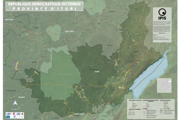
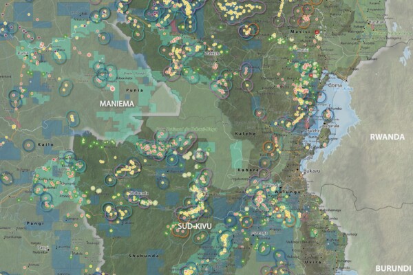
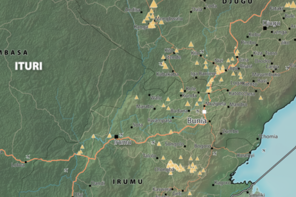
Maps of Mining Sites in Ituri (2017)
September 19, 2017Map of Ituri Province of Ituri, DRC (Detail) Map of Mambasa Territory Territory of Mambasa, Province of Ituri, DRC (Detail)
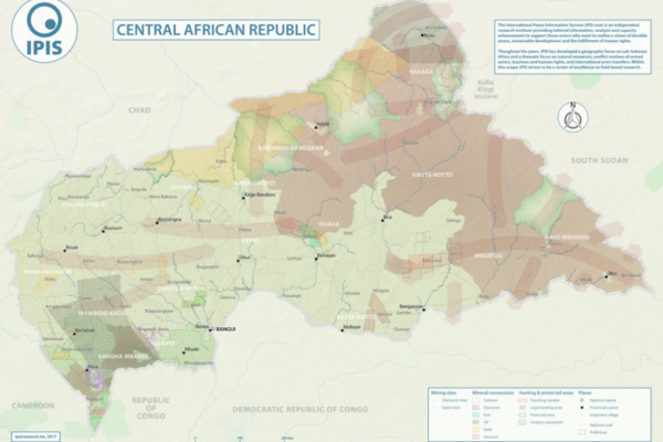
Natural Resources in Central African Republic (2017)
September 12, 2017With an area of 622 984km2, the Central African Republic is the 20th largest country in Africa and one of the poorest in the world. Its economy is highly dependent of the primary sector. Whereas distribution of income is deeply unequal, the unstable political situation and the violent confrontations between different armed groups all around the country weaken the economic growth, especially from
Voix du Congo: Study on the use of mercury and cyanide in artisanal gold mining in North and South Kivu
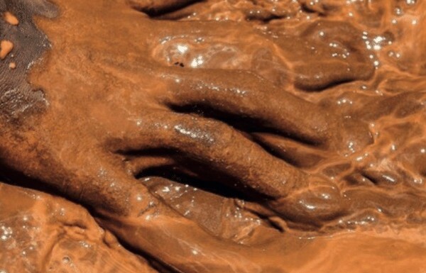
July 7, 2017See our series: VOIX DU CONGO This publication, by “Save Act Mine” SAM, presents a study on gold mining techniques in Eastern DRC. In these regions, the subsoil is very rich in minerals. Although this represents enormous potential for the economy, it also leads to particularly dangerous challenges such as environmental pollution and the degradation of the health status of local populations
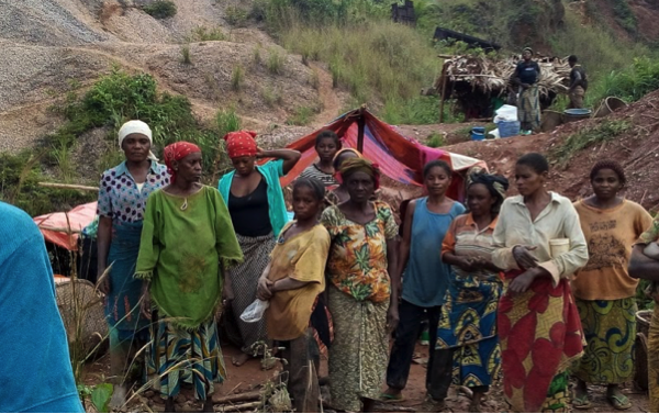
Voix du Congo: Artisanal miners and surrounding communities, victims of the security and justice services in South Kivu, eastern DRC
July 7, 2017See our series: VOIX DU CONGO This publication, by the non-profit organisation “Association Africaine de Défense des Droits de l’Homme” ASADHO, focuses on human rights violations carried out by members of the DRC’s armed forces in the mining sector in the South Kivu Province. Several violations are regularly committed by the Congolese armed forces, either in operation or when deploye
Voix du Congo: Sexual exploitation of underage girls in the mining areas of South Kivu province in the Democratic Republic of Congo
July 7, 2017See our series VOIX DU CONGO This publication, by the non-profit association “Centre pour l’Education, Animation et Défense des Droits de l’Homme” CEADHO, presents a research on the sexual exploitation of underage girls in mining areas in South Kivu. The sexual exploitation of underage girls in mining areas is an increasingly recurrent phenomenon in South Kivu and is taking on a more w
Annual report 2016
June 23, 2017In its 2016 annual report, IPIS gives an overview of its research projects and activities. It covers the four research programmes that IPIS focusses on: natural resources, arms trade, conflict mapping and business and human rights. In 2016, IPIS continued to be a rally point for hard to get data on natural resources, often visualised in maps. Our flagship map for 2016 is the interactive map of art
Open data FAQ & dictionary
June 21, 2017This page lists some Frequently Asked Questions (FAQ) about the IPIS Open Data, and helps you understand the meaning of the different columns and values that occur in the data. If you still have questions, don’t hesitate to contact us! 1. Frequently Asked Questions 1.1. FAQ’s about IPIS Open Data in general Which data does IPIS publish?IPIS publishes a selection of its datasets, which originate fr
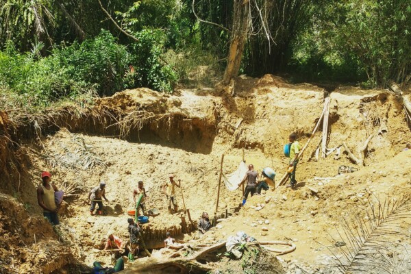
Artisanal Gold Monitoring Pilot – Progress reports
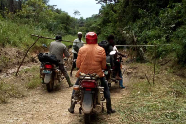
June 20, 2017With the support of the Public Private Alliance for Responsible Minerals Trade (PPA), IPIS set up its Artisanal Gold Monitoring Pilot in Mambasa (Ituri Province, DRC) between April 2016 and July 2017. The findings of the research are summarized in three progress reports, which can be found below, and a final monitoring report, which can be found here. Progress report August – September 2016
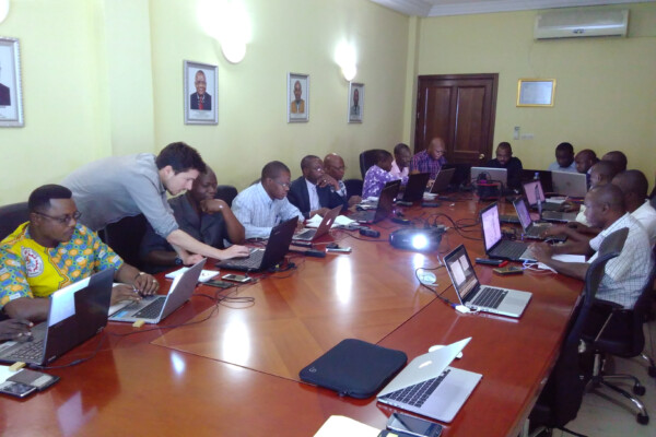
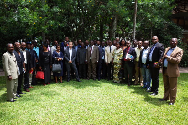
Capacity enhancement workshop on cartography with DRC mining authorities
May 16, 2017Capacity enhancement workshop on cartography with DRC mining authorities In the framework of its long standing partnership with DRC mining authorities, IPIS held a workshop in Kinshasa from May 8th to 12th, engaging with technical staff of ‘Cadastre Minier’, ‘SAESSCAM’ and ‘Division des mines’. The workshop focussed on Open Source solutions for mapping and web-mapping, such as ‘QGIS’ and ‘qgis2web
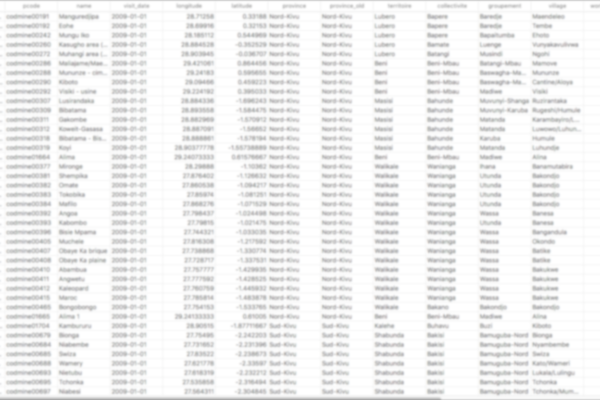
IPIS opens up its data!
May 2, 2017Data collection on peace, development and human rights is an essential part of the research work we do at IPIS. Because we believe in the power of Open Data to stimulate research that contributes to our vision of durable peace, sustainable development and the fulfilment of human rights, we are happy to announce that we are now providing structured access to some of our key datasets. Our data colle
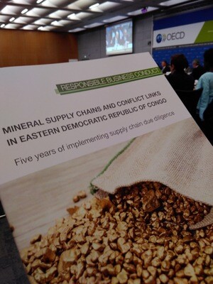
IPIS at the OECD Forum on responsible mineral supply chain
April 28, 2017IPIS is delighted to participate in the 11th Forum on responsible mineral supply chains in Paris, from 2 to 4 May . This meeting will provide the opportunity to review and discuss the implementation of the OECD Due Diligence Guidance for Minerals, the ICGLR Regional Certification Mechanism and other initiatives to enable responsible mineral supply chains. IPIS will play an active role on May 4, a
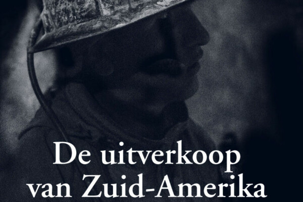
Boekvoorstelling Raf Custers “De uitverkoop van Zuid-Amerika”
April 20, 2017Op 11 mei 2017 om 19u00 is Raf Custers te gast bij IPIS om zijn boek “De uitverkoop van Zuid-Amerika” voor te stellen. Na een reis van 11 maanden door Brazilië, Uruguay, Argentinië, Chili en Bolivië beschrijft Raf Custers hoe burgers in Zuid-Amerika het opnemen tegen multinationale ondernemingen en overheden die hun natuurlijke rijkdommen, hun grondstoffen en hun leefwereld uitverkopen. De boekvoo
IPIS hosts new Missing Maps Mapathon with special focus on DRC National Parks
March 30, 2017IPIS, Missing Maps and OpenStreetMap Belgium organise another Missing Maps Mapathon on Wednesday April 26, in the IPIS library. Why do we organise this? NGOs working in the South need decent maps in order to reach people who need help. However, in many places the map is not yet complete. That’s why we need your help! How do we help? We teach volunteers how to trace satellite imagery
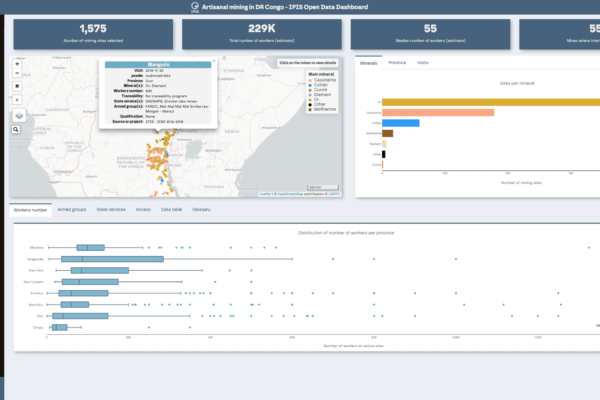
Open data
March 20, 2017Welcome to the IPIS Open Data page. IPIS publishes a growing number of datasets as Open Data. Here, you can find out how to access and use them. Open data dashboard on ASM in eastern DRC Webmap of ASM in eastern DRC About our Open Data The International Peace Information Service (IPIS) publishes a selection of its datasets as Open Data. These datasets originate from our data collection campaig
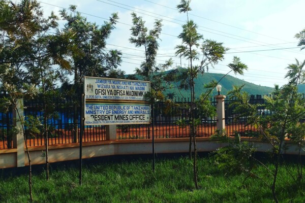
New IPIS project on mining, human rights and digitalization in Tanzania
March 13, 2017From late February to early March, two IPIS researchers were in Tanzania to lay the foundations for a new project funded by the Belgian development cooperation. It concerns a mapping of the socio-economic and human rights situation of artisanal and industrial mining in Northwest Tanzania. The project will run for 30 months (until June 2019), and has two main phases. In a first phase, IPIS will und
Development of the artisanal mining database for Congolese Ministry of Mines
March 9, 2017Consultancy Dates: 2015 – 2017 Location(s): DRC Research Programme(s): Natural Resources Funder(s): Promines Partner(s): Pact Congo & Levin Sources Activities: Capacity Enhancement Deliverable(s): ASM Database Project Coordinator Alexandre Jaillon Researcher & GIS manager e-mail This is the preview of the “Coordinator Project” View. News Launch of SAESSCAM database on artisanal and small-scale min

North Kivu Province – A0 Map
March 5, 2017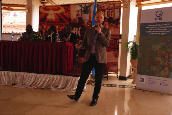
Launch of SAESSCAM database on artisanal and small-scale mining
March 3, 2017On February 23rd, IPIS presented in Kinshasa the results of a two years project done in partnership with Pact and Estelle Levin Ltd to support the activities of SAESSCAM (“Service d’accompagnement et d’encadrement du Small-scale mining”), a service of Congolese Ministry of mines. During this project IPIS developed and launched SAESSCAM ASM database, a database to register production and socio-econ
Map of Ituri
February 11, 2017Province of Ituri, DRC (Detail)
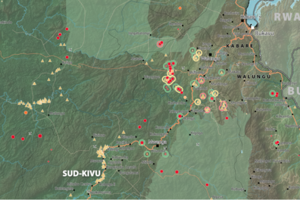
South Kivu Province – A0 Map
February 11, 2017South Kivu Province, DRC (Detail)