
Publications
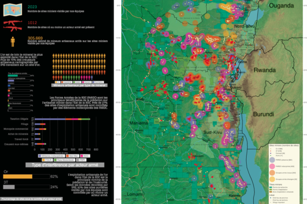
Conflict Minerals in Eastern DRC (2017)
- Alexandre Jaillon | September 22, 2017
Printing maps of conflict minerals in Eastern DRC.
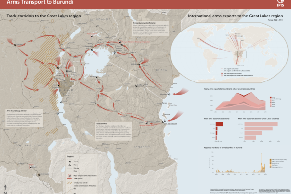
Arms Trade Corridors to Burundi
- IPIS | May 5, 2017
Burundi has seen a period of unrest following the failed coup d’état by a Burundian general in May 2015. In order to better understand the situation, IPIS drafted a new map entitled ‘Arms transport to Burundi’, which puts the 2015 unrest in the geographical perspective of the Great Lakes region and in the relevant timeframe covering 2008 to 2015. The map highlights two important factors in the rec
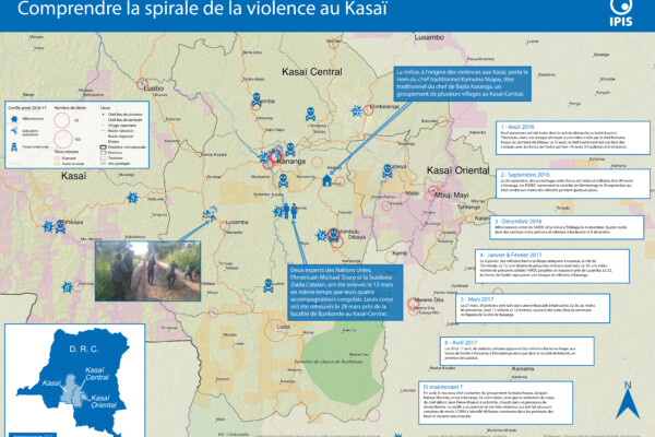
Comprendre la spirale de la violence au Kasaï (2017)
- Alexandre Jaillon | April 25, 2017
Le Kasaï Central et trois autres provinces voisines sont en proie à des violences mêlant miliciens, policiers et soldats et ayant fait, selon un rapport récent des Nations Unies, plus de 200 morts. Depuis septembre, un soulèvement des partisans du chef coutumier Kamwina Nsapu, tué en août par les forces de l’ordre après s’être rebellé contre les autorités congolaises, a embrasé la région. L’ONU a
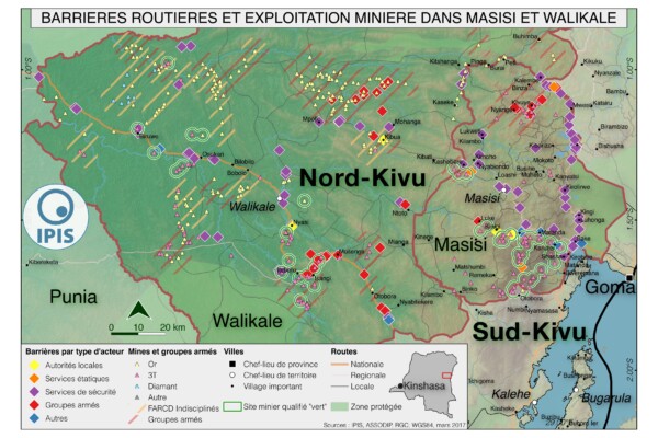
Pillage route: l’économie politique des barrages routiers à Walikale et Masisi (2017)
- Alexandre Jaillon, IPIS, Janvier Murairi, Peer Schouten (DIIS/IPIS), Saidi Kubuya Batundi | March 31, 2017
French version below – version française ci-dessous Roadblocks are a ubiquitous phenomenon in Eastern Congo. In an effort to map the scope of this phenomenon as well as its significance in the political economy of conflict, IPIS has embarked on a collaboration with the Danish Institute for International Studies. The point of departure is that control over the circulation of people and valua
Analysis of the interactive map of artisanal mining areas in eastern DR Congo – 2015 update
- Ken Matthysen, Lotte Hoex, Yannick Weyns | October 25, 2016
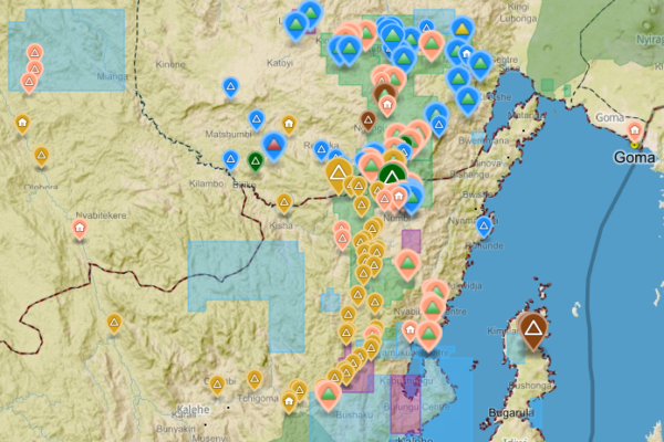
The Belgian research group IPIS has collected data on 2026 artisanal mining sites in eastern DRC over the last couple of years. IPIS observed an armed presence in more than half of the mines. In an interactive map, updated in 2015, IPIS provides information about the on-site presence of armed groups and the Congolese army (FARDC) as well as indicators of the relative importance of the site. It als
Mineral supply chains and conflict links in eastern democratic republic of congo
- Fiona Southward | November 25, 2015
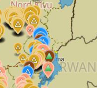
Between 2009 and 2010 IPIS collected data on over 550 mining sites as part a conflict mapping exercise focusing on Eastern Democratic Republic of Congo (DRC). With the collaboration of Congolese researchers, IPIS collected the coordinates of the most important mining sites and information on on-site security in North and South Kivu provinces, Maniema, Northern Katanga and southeast Province Orient
Analysis of the interactive map of artisanal mining areas in Eastern DRC – May 2014 Update
- Anna Bulzomi, Filip Hilgert, Ken Matthysen, Steven Spittaels, Yannick Weyns | April 30, 2014
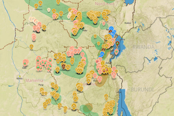
In collaboration with the Congolese mining cadastre (CAMI), mining service SAESSCAM and representatives from local civil society organisations, IPIS organised a series of field visits to monitor artisanal mining activities and the involvement of armed groups and criminal networks in mineral exploitation and trade. This resulted in the publication of an interactive web map providing information on
Analysis of the interactive map of artisanal mining areas in Eastern DR Congo (2013)
- Filip Hilgert, Steven Spittaels | November 13, 2013
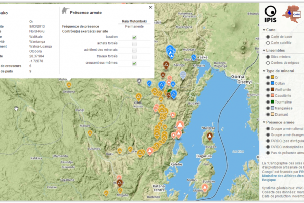
In August 2009 the ‘International Peace Information Service’ (IPIS) published a first map of militarised mining areas in Eastern DR Congo. By 2012, the international interest in the issue had grown but the map was out-dated. To find a structural solution, IPIS sat down with the Congolese mining cadastre (CAMI) and agreed to set up a permanent system to monitor artisanal mining activities and the i
Mapping Conflict Minerals (2012)
- Elisabeth Schoepfer, Filip Hilgert, Kristin Sproehnle | December 28, 2012
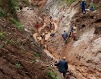
How GMES supports the International Peace Information Service (IPIS), in: Window on GMES, Special Issue: Discover the “S” in GMES, pp. 82-88 Exploitation of natural resources has, in most cases, a strong impact on the environment, often even spoiling natural habitats and affecting people’s way of life. The exploitation and trade of minerals can also fuel armed conflicts, as it is the case in the E
Mapping Conflict Motives: M23 (2012)
- IPIS | November 30, 2012
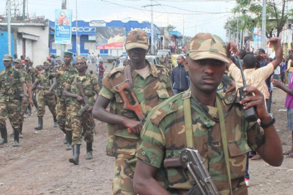
In light of the recent occupation of Goma by M23 and the renewed risk of large-scale armed conflict in the DRC, IPIS publishes an update to its 2007-2010 ‘mapping conflict motives’ report series focussing specifically on the intentions of M23. The M23 rebels show a clear political ambition and a tendency to establish political control over territory and challenge Kinshasa’s authority – strategic i
Bisie. A one-year snapshot of the DRC’s principal cassiterite mine (2011)
- Filip Hilgert | November 28, 2011
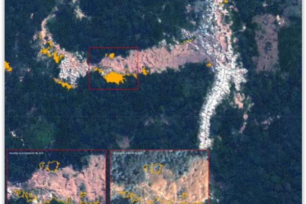
Much has happened in the mining sector of Eastern DRC over the last year. President Kabila imposed a ban on all mining activities last fall, during which production fell considerably. As soon as the suspension was lifted in the spring of this year, the major global electronic companies stopped buying minerals from the region, provoking a de facto embargo on Congo’s minerals with detrimental effect
Simplified maps illustrating the link between natural resources and armed conflict in the DR Congo (2011)
- Filip Hilgert | January 17, 2011
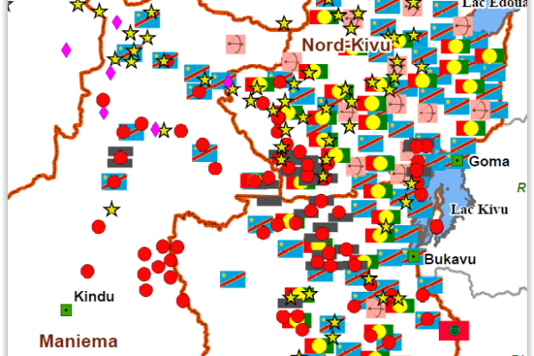
Simplified maps illustrating the link between natural resources and armed conflict in the DR Congo (in French) (January 2011) At the request of different users of the IPIS web maps, and with the support of the Belgian Development Cooperation (DGD), IPIS has produced a series of six simplified and printable PDF maps illustrating the link between mineral resources and armed conflict in the Democrati
The complexity of resource governance in a context of state fragility: An analysis of the mining sector in the Kivu hinterlands (2010)
- Filip Hilgert, Ken Matthysen, Steven Spittaels | November 30, 2010
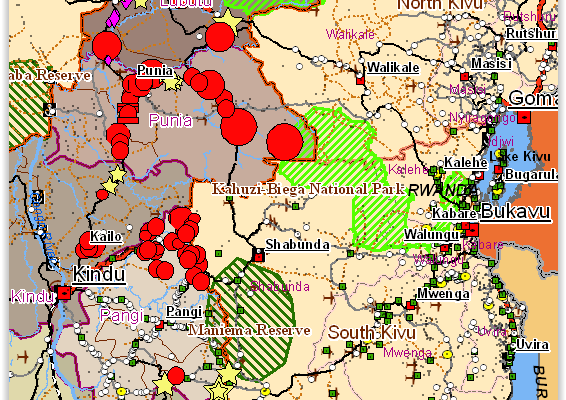
The report ‘Mining activity and mineral trade in the Kivu hinterland’ was commissioned by the Directorate General for Development (DG DEV) of the European Commission and aims to fill an information gap by identifying the principal mining sites and analysing the trade networks of the ‘eastern hinterland’ of the Democratic Republic of the Congo (DRC), located in Maniema, North Katanga and Orientale
Mining Concessions in the DR Congo (2010)
- Filip Hilgert | August 17, 2010
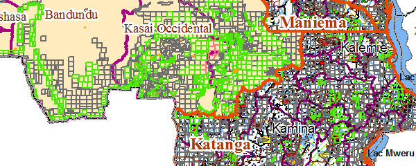
Mining Concessions in the DR Congo (August 2010) IPIS has produced an interactive web map of all mining concessions in the Democratic Republic of the Congo. The current map follows a concession map we published in August 2009 (as an addition to our Interactive Map of Militarised Mining Areas in the Kivus – MiMiKi), which shows concession areas in the Kivu provinces. The idea for an extended and up
Mapping Conflict Motives: ‘Province Orientale’ (DRC) (2010)
- Filip Hilgert, Steven Spittaels | March 22, 2010
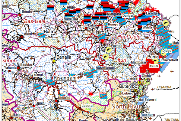
The districts of Ituri, Haut-Uele, Bas-Uele and the territory of Bafwasende continue to suffer from armed groups. Generally speaking, the strength of the armed groups throughout Orientale is limited and their effectives are few. Moreover, there is a considerable presence of the Congolese army. The Uele districts are the two most northern districts of Orientale bordering the Central African Republi
Accompanying note on the interactive map of militarised mining areas in the Kivus (2009)
- Filip Hilgert, Steven Spittaels | August 16, 2009
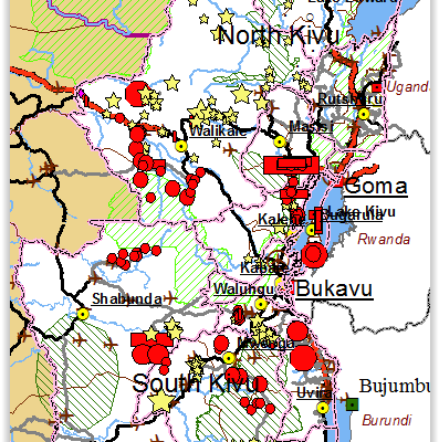
The MiMiKi map is a snapshot of the situation as it was in the period May-July 2009. All the armed groups deployed in the region profit directly from the mining activities. Armed groups have positions at more than half of the sites listed on the MiMiKi map where they obtain an (extra) income. The FARDC control some of the most important mining sites and do not restrain themselves from intervening
Mapping Conflict Motives: Katanga. (Update December 2007 – May 2008)
- Filip Hilgert, Steven Spittaels | June 8, 2008
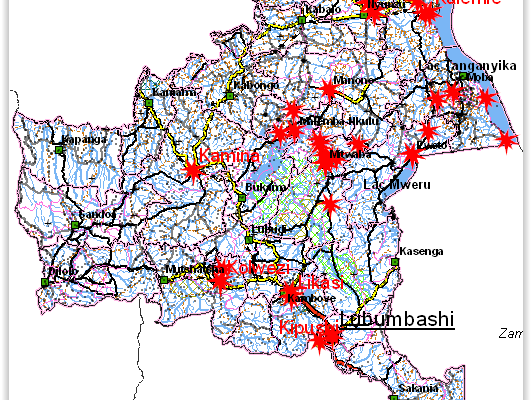
This report is the second in a series of updates following an initial report on conflict motives in the Congolese province of Katanga. It analyses the most important security developments from December 2007 until May 2008. Download in pdf or open with issuu reader. http://issuu.com/ipisresearch/docs/mapping_conflict_motives-_katanga_u December 2007-May 2008 This report is the second in a se
Mapping Conflict Motives: Eastern DRC (March 2008)
- Filip Hilgert, Steven Spittaels | March 4, 2008
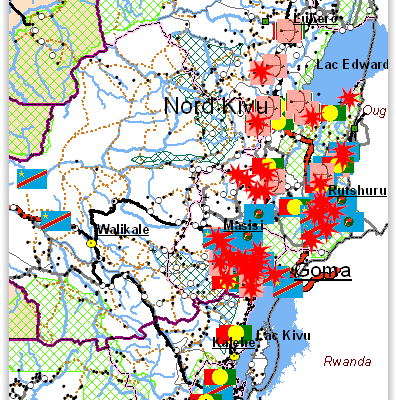
The eastern DRC is still plagued by violent conflict. The centre of the conflict is the ‘Petit Nord’ region where two large armed groups, a coalition of smaller bands of armed men and the government army are all involved in a persisting battle causing enormous human suffering. In the neighbouring regions of the ‘Grand Nord’ and northern South-Kivu open warfare no longer takes place, but there is s
Mapping interests in conflict areas: Katanga. (Update September-November 2007)
- Filip Hilgert, Steven Spittaels | January 23, 2008
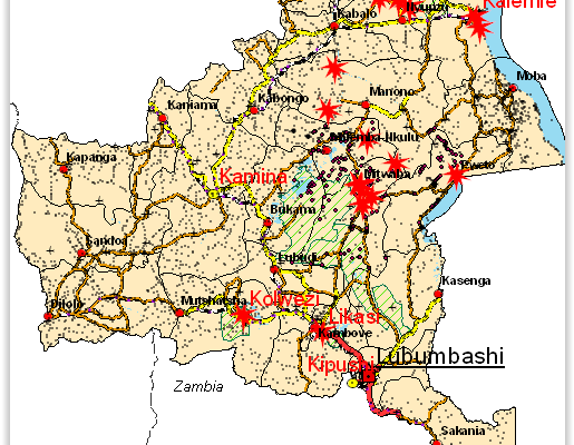
The International Peace Information Service (IPIS), a Belgium based research NGO, is a member of the Fatal Transactions consortium, which carries out the action ‘From Fatal to Fair Transactions’ with co-funding from the EU. IPIS’ contribution to this action is to develop a tool for the analysis of conflict drivers. Making use of GIS (Geographic Information Systems) software, we visualise possible
Mapping interests in conflict areas: Katanga (August 2007)
- Nick Meynen, Steven Spittaels | August 23, 2007
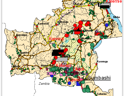
Revised version August 2007. ‘Mapping interests in conflict areas: Katanga’ reports on the presence of (ex-) combatants in the Congolese province of Katanga. It focuses on two broad categories: the ‘Forces Armées de la République Démocratique du Congo’ (FARDC) and the Mayi-Mayi militias. There is no significant presence of other armed groups in the region. After the surrender of the warlord Gédéon