The (new) M23 offensive on Goma: Why this long-lasting conflict is not only about minerals and what are its implications? – Q&A
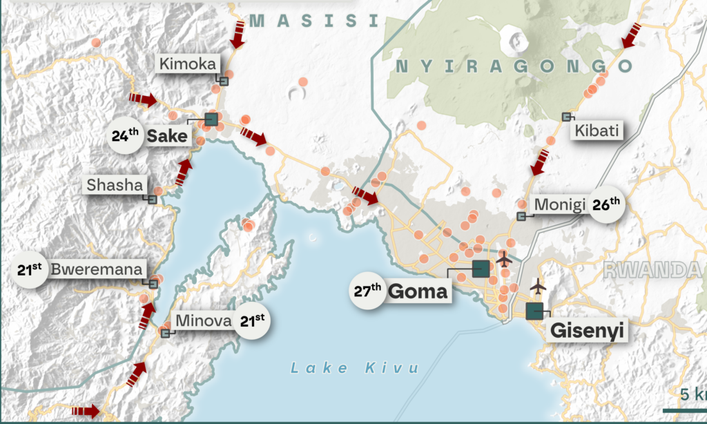
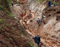
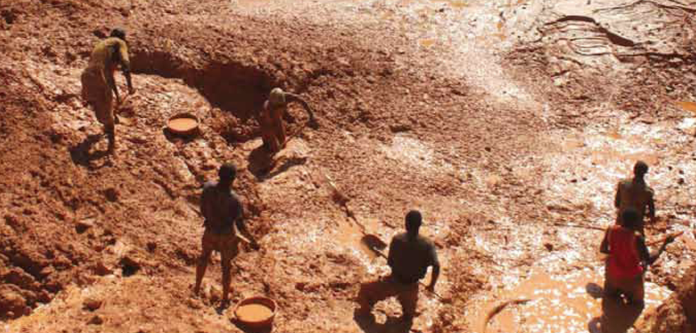
By the morning of January 29th, the rebels largely controlled the strategic city of Goma. To provide a quick and understandable explanation of the causes of this humanitarian crisis, the role of natural resources, and in particular minerals, is often overemphasized. While mining and mineral trade inevitably play an important role — being a vital part of the local economy — it is important to assess economic assets more broadly, as well as political interests and social grievances.
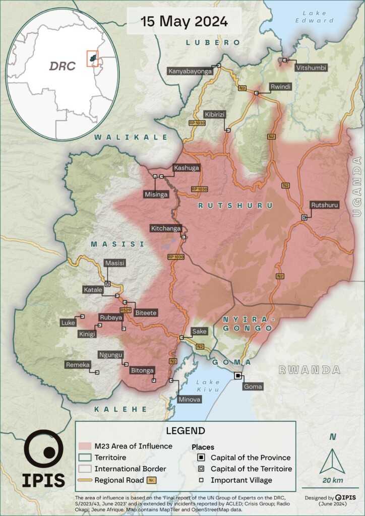
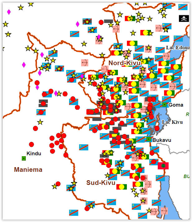
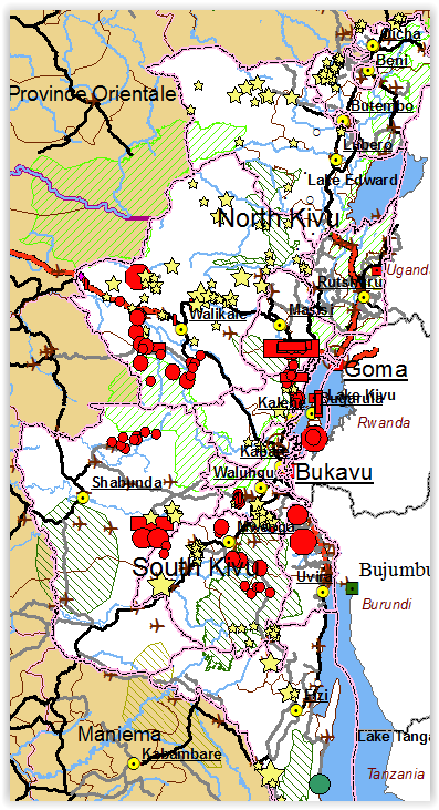
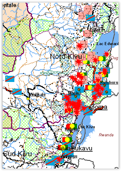
Shifting frontlines: Visualizing the evolution of the M23’s territorial influence in early 2024
In early 2024, IPIS, ASSODIP, and DIIS published a report on the stakes and motivations of the “March 23 Movement” (M23), a rebellion causing serious insecurity and humanitarian suffering in the eastern Democratic Republic of Congo (DRC). The movement took up arms again in 2021, and it rapidly seized vast territories in the south-east of North Kivu province in 2022, with military support from the Rwandan army. The IPIS-ASSODIP report included several maps, displaying the areas influenced by M23 up to 2023 […]
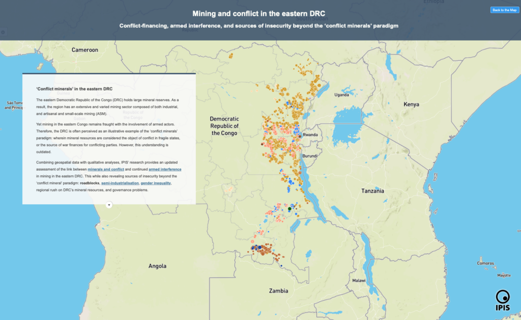
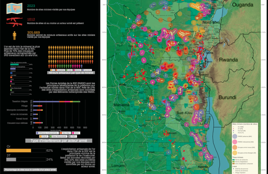
Exploitation minière et conflit dans l’est de la RDC: Une carte narrative interactive
Financement des conflits, ingérence armée et sources d’insécurité au-delà du paradigme des « minerais de conflit » Dans cette carte narrative, IPIS présente les résultats
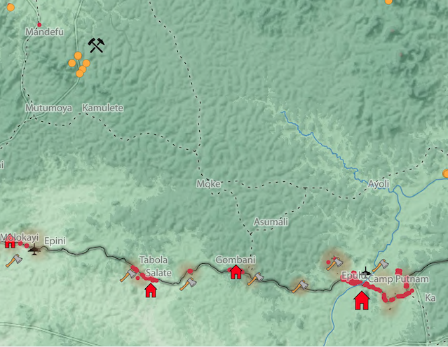
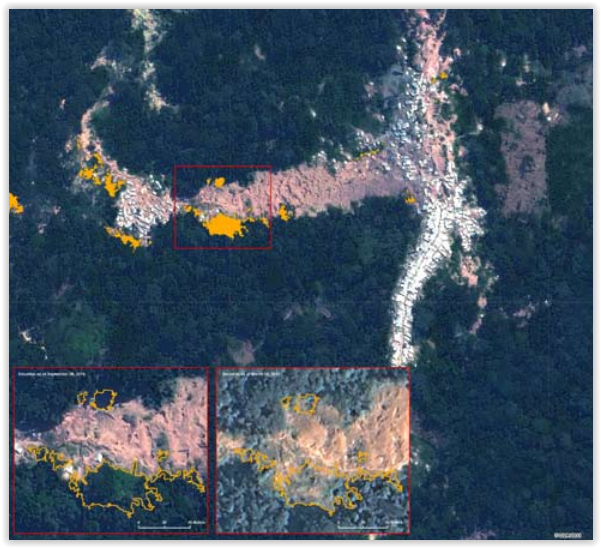
Cartographie des sites minieres artisanaux dans la région du Mambasa occidental, province de l’Ituri, République démocratique du Congo
La partie occidentale du territoire de Mambasa, dans la province de l’Ituri, fait l’objet d’une attention limitée de la part des autorités nationales et des
Responsible mining scorecard in eastern DRC
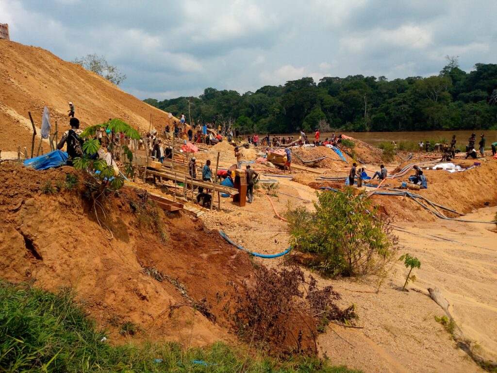
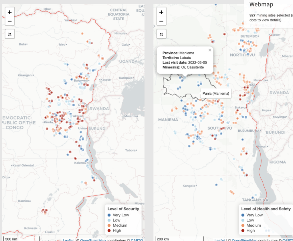
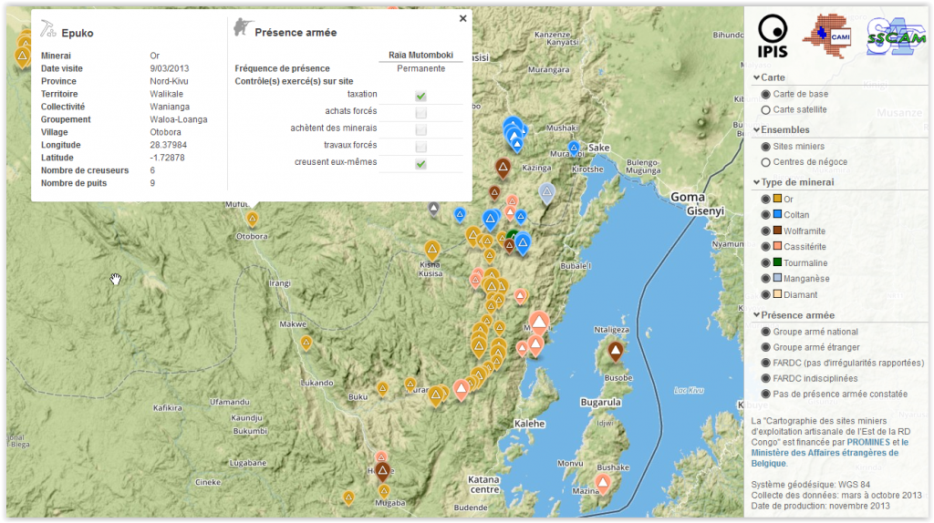
Over the years, IPIS has systematically collected mine site and trade hub level data on artisanal and small-scale mining (ASM) in eastern DRC. This data collection has enabled IPIS to generate a sizable database of more than 3,000 ASM sites that draws both on sites visited by IPIS and data from third party sources including the Congolese mining cadastre and the Ministerial qualification teams. This database is the point of departure of the Responsible mining scorecard (RMS).
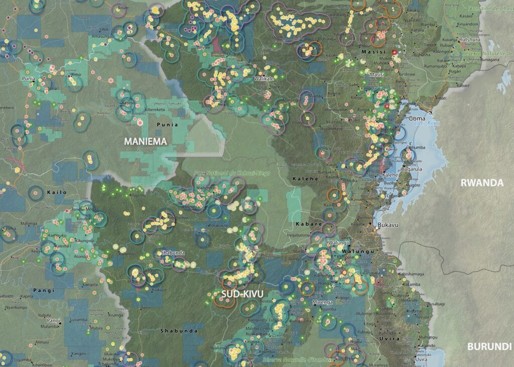
Maps of artisanal and small-scale mining in eastern DRC
IPIS has created large format maps of known past and present ASM sites in eastern DRC. These A0 maps cover the provinces of Haut Uele,
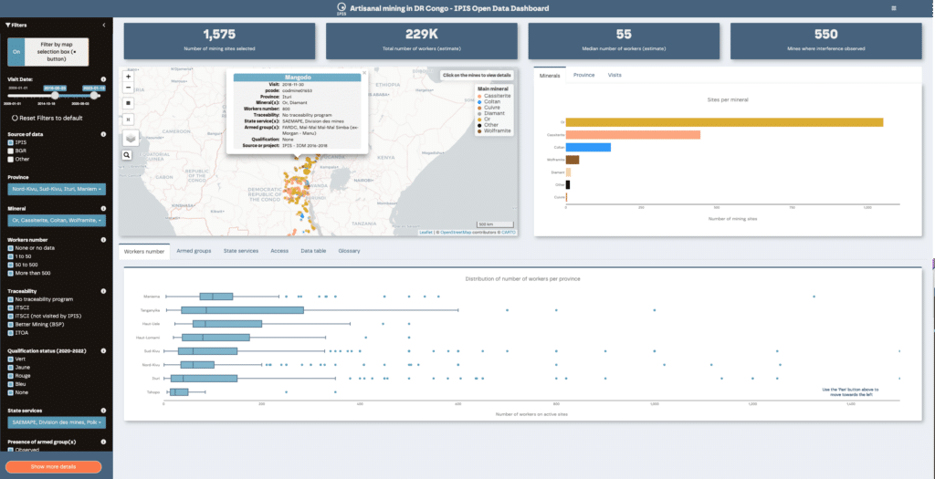
IPIS Open Data dashboard on Artisanal and Small-Scale Mining in eastern DRC
The IPIS Open Data dashboard on artisanal and small-scale mining (ASM) sector in the eastern Democratic Republic of the Congo (DRC) enables users to query and subset IPIS Open Data using various combinations of filters. The dashboard was designed to complement the IPIS Webmap of DRC.
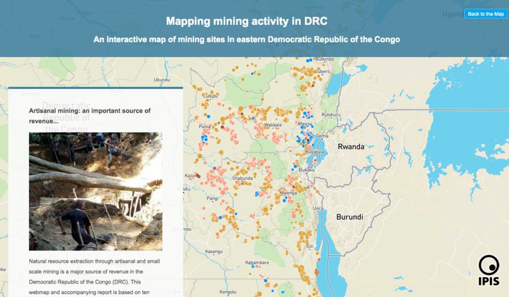
Story map of ASM sites in the DRC
Explore IPIS’ web map of the eastern Democratic Republic of the Congo (DRC) with a guided narrative In its new story map, IPIS presents data
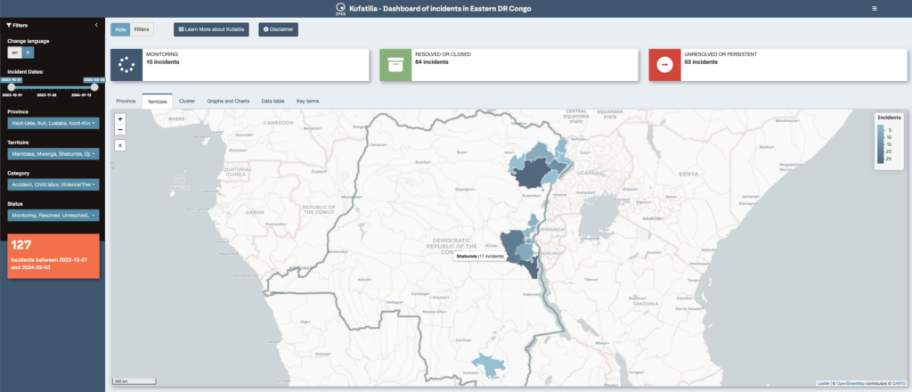
Dashboard of incidents in eastern DRC – Kufatilia
The Kufatilia platform (« to track » in Swahili) is an SMS based incident reporting and follow-up mechanism that has been launched in 2019 to increase transparency
Maps of conflict minerals in Eastern DRC (2020)
IPIS created maps of conflict minerals in eastern DRC, more particularly on Haut Uele, Ituri and North and South Kivu. These maps detail the type

Cartographie des zones minières artisanales et des chaînes d’approvisionnement en minéraux dans l’est de la RDC
Dans son dernier rapport et sa dernière webmap, IPIS présente ses données actualisées sur l’impact des conflits armés et de l’ingérence des groupes armés dans

ASM Incident Tracker
Bienvenue sur la plateforme Kufatilia de suivi des incidents de l’artisanat minier développée par IPIS avec le soutien d’Ulula et en partenariat avec le Centre
Barrières routières et sites miniers artisanaux – Provinces du Nord- et du Sud-Kivu (2018)
Cette carte montre l’emplacement des barrières routières et des sites miniers artisanaux dans les provinces du Kivu. Elle a été créé en combinant les jeux données
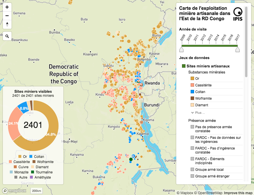
Interactive map of artisanal mining exploitation in eastern DR Congo – 2018 update
Résumé français ci-dessous – French summary below IPIS launched a major update of it’s DRC webmap displaying data on more than 2400 artisanal mining sites
Okapi Wildlife Reserve: Illegal Sourcing of Gold and Timber (2018)
A map of the Okapi Wildlife Reserve in DRC, created as a result of two mapathons focussing on illegal activities in the park.
« Tout ce qui bouge sera taxé » : l’économie politique des barrières routières au Nord et Sud Kivu
IPIS dresse la carte des barrages routiers et pointe leur rôle clé dans les mécanismes de financement des conflits en Afrique centrale et des acteurs
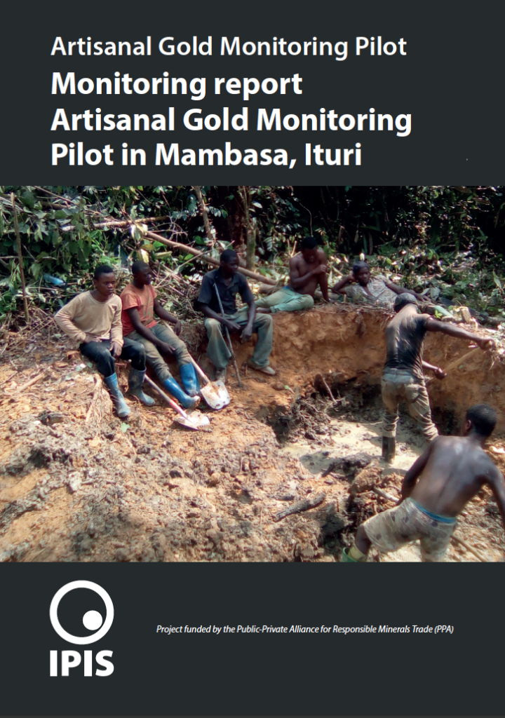
Projet pilote de monitoring de l’or artisanal
Appuyé par la Public Private Alliance for Responsible Minerals Trade (PPA), IPIS a mis en place son projet pilote de monitoring de l’or artisanal à
Conflict Minerals in Eastern DRC (2017)
Printing maps of conflict minerals in Eastern DRC.
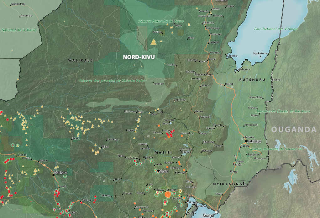
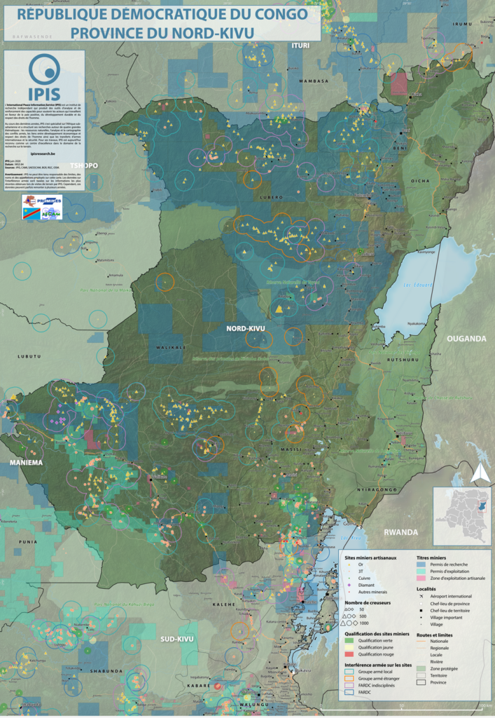
Maps of Mining Sites in North Kivu (2017)
North Kivu Province – AO Map Lubero, Oicha, Butembo and Beni Territories – A0 Map Masisi Territory – A0 Map Masisi Territory, North
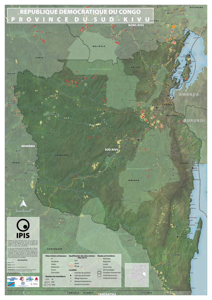
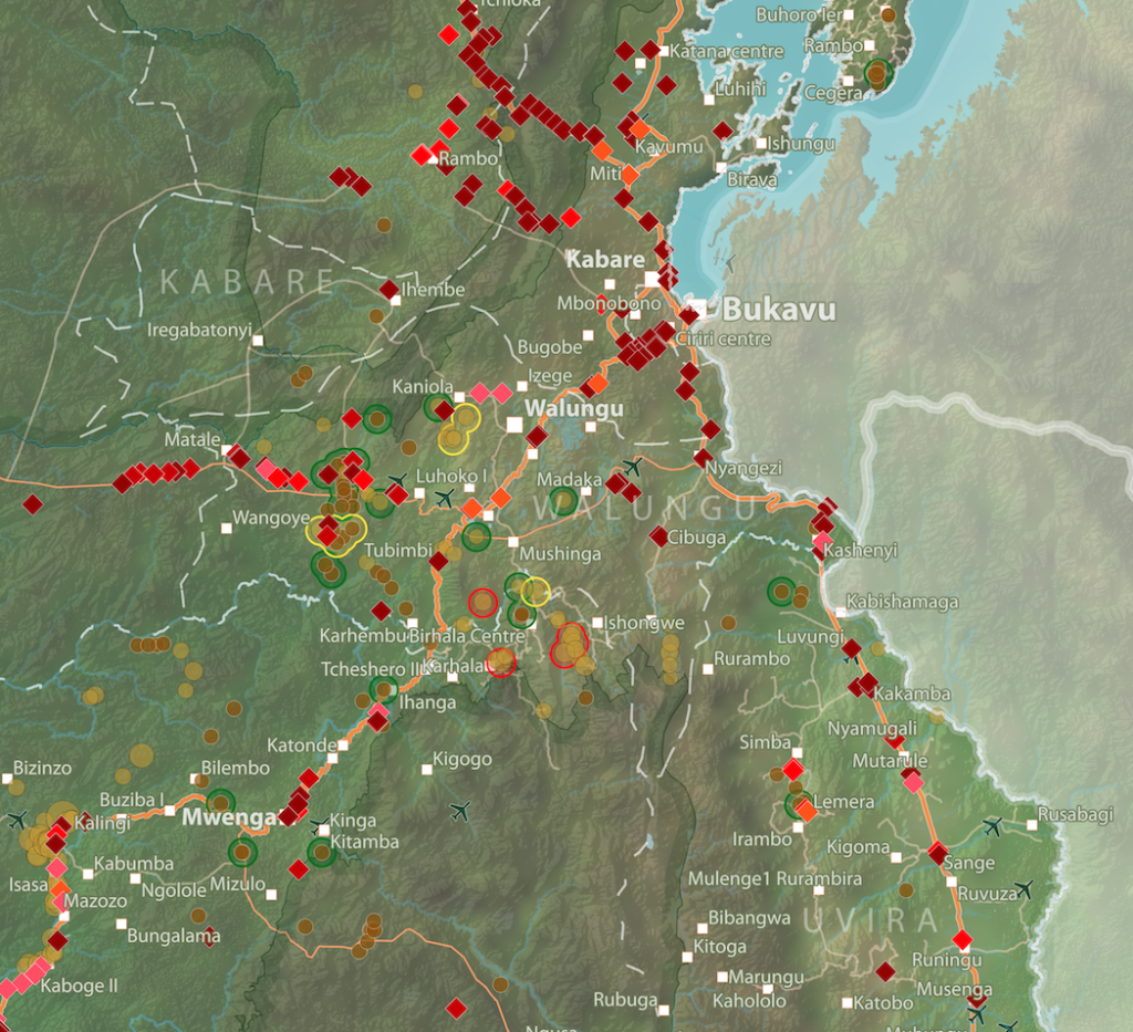
Maps of mining sites in South Kivu (2017)
South Kivu Province – A0 Map Walungu Territory – A0 Map Idjwi Territory – A0 Map Kabare Territory, South Kivu – A0 Map Kalehe Territory
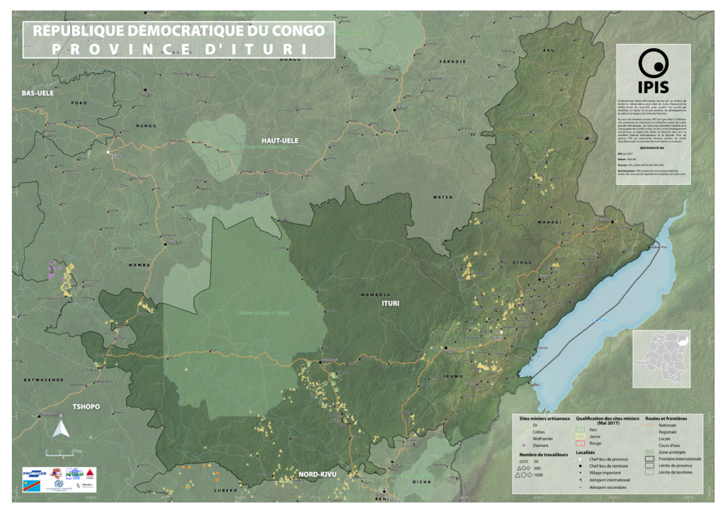
Maps of Mining Sites in Ituri (2017)
Map of Ituri Province of Ituri, DRC (Detail) Map of Mambasa Territory Territory of Mambasa, Province of Ituri, DRC (Detail)
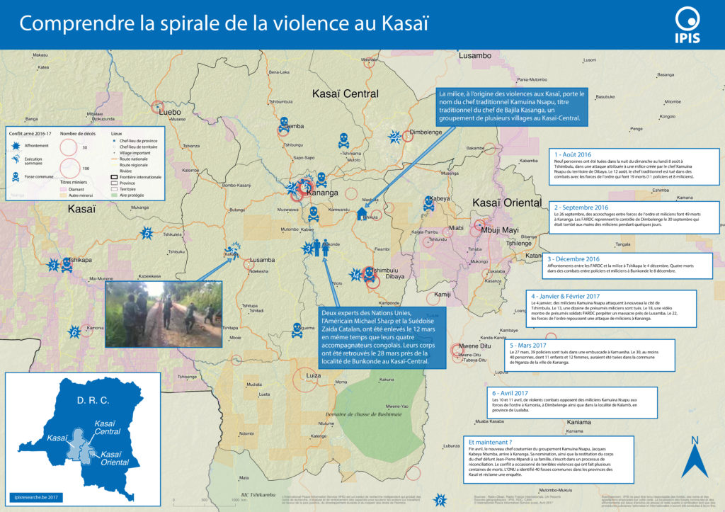
Comprendre la spirale de la violence au Kasaï (2017)
Le Kasaï Central et trois autres provinces voisines sont en proie à des violences mêlant miliciens, policiers et soldats et ayant fait, selon un rapport
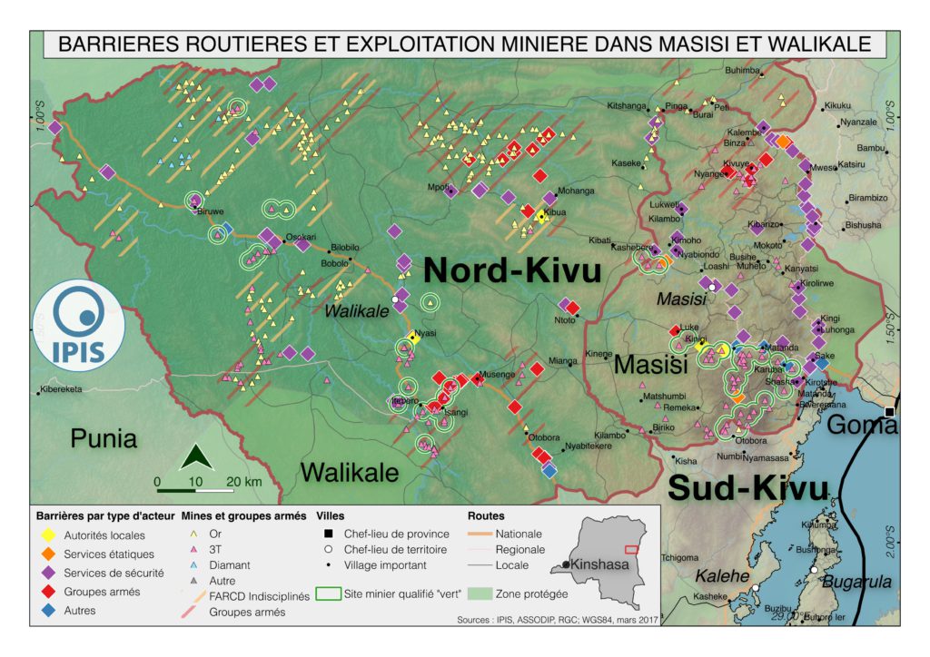
Pillage route: l’économie politique des barrages routiers à Walikale et Masisi (2017)
French version below – version française ci-dessous Roadblocks are a ubiquitous phenomenon in Eastern Congo. In an effort to map the scope of this
Analysis of the interactive map of artisanal mining areas in eastern DR Congo – 2015 update
The Belgian research group IPIS has collected data on 2026 artisanal mining sites in eastern DRC over the last couple of years. IPIS observed an
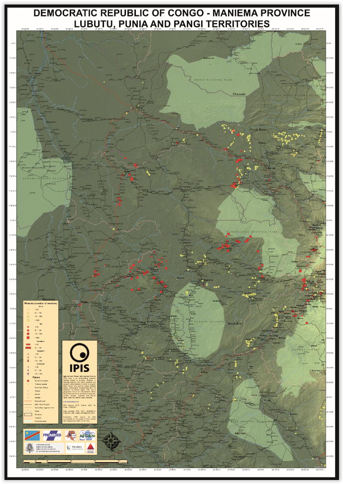
Maniema province – A0 map (2015)
This is an A0 map of the Lubutu, Punia and Pangi Territories in Maniema Province, DRC
Analysis of the interactive map of artisanal mining areas in Eastern DRC – May 2014 Update
In collaboration with the Congolese mining cadastre (CAMI), mining service SAESSCAM and representatives from local civil society organisations, IPIS organised a series of field visits
Analysis of the interactive map of artisanal mining areas in Eastern DR Congo (2013)
In August 2009 the ‘International Peace Information Service’ (IPIS) published a first map of militarised mining areas in Eastern DR Congo. By 2012, the international
Mapping Conflict Minerals (2012)
How GMES supports the International Peace Information Service (IPIS), in: Window on GMES, Special Issue: Discover the “S” in GMES, pp. 82-88 Exploitation of natural
Cartographie des motivations derrière les conflits: le M23
Depuis 2004, IPIS a publié divers rapports sur le conflit qui affecte la République démocratique du Congo (RDC). De 2007 à 2010, IPIS a porté
Bisie. A one-year snapshot of the DRC’s principal cassiterite mine (2011)
Much has happened in the mining sector of Eastern DRC over the last year. President Kabila imposed a ban on all mining activities last fall,
Cartes simplifiées illustrant le lien entre ressources naturelles et conflits armés en RD Congo
A la demande de plusieurs utilisateurs des cartes web d’IPIS, et avec l’appui de la Coopération au Développement belge (DGD), IPIS a produit une série
La complexité de la gestion des ressources dans un contexte de fragilité de l’État : une analyse du secteur minier dans l’arrière-pays du Kivu
Le rapport intitulé « Exploitation minière et commerce des minerais dans l’arrière-pays du Kivu » est une commande de la Direction générale du développement (DG
Concessions minières en RD Congo
IPIS a établi une carte web interactive de toutes les concessions minières en République démocratique du Congo. Cette carte fait suite à une carte de
Cartographie des motivations derrières les conflict: ‘Province Orientale’ (RDC)
Les districts de l’Ituri, du Haut-Uele et du Bas-Uele ainsi que le territoire de Bafwasende continuent de souffrir de la présence de groupes armés. De
Note accompagnatrice de la carte interactive des zones minières militarisées au Kivu
La carte MiMiKi constitue une première tentative systématique de jeter un éclairage sur la question des profits tirés par des groupes armés du secteur de
Cartographie des motivations derrière les conflits : le cas du Katanga. Mise à jour mai – septembre 2008
L’aggravation des hostilités dans le nord du Kivu, et dans une moindre mesure en Ituri, a contribué à détourner l’attention de la presse des problèmes
Cartographie des motivations derrière les conflits : le cas du Katanga. Mise à jour décembre 2007 – mai 2008
Cette seconde mise à jour aborde deux problèmes centraux. Premier problème : la fragile sécurité dans le nord de la province. Les territoires septentrionaux de
Cartographie des motivations derrière les conflits : le cas de l’Est de la RDC
L’Est de la DRC reste affecté par des conflits violents. La région centrale est le ‘Petit Nord’ où deux grands groupes armés, une coalition de
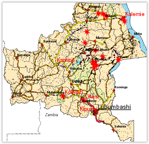
Cartographie des intérêts dans les zones de conflit : le cas du Katanga. Mise à jour septembre-novembre 2007
IPIS (International Peace Information Service) est une ONG belge membre du consortium Fatal Transactions à l’origine de l’action ‘From Fatal to Fair Transactions’ cofinancée par
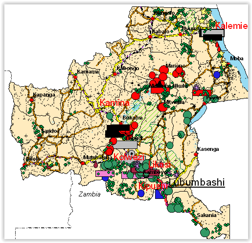
Cartographie des intérêts dans les zones de conflit : le cas du Katanga
Version révisée août 2007. Ce rapport traite de la présence d'(anciens) combattants dans la province congolaise du Katanga. Il porte son attention sur deux types