Shifting frontlines in 2026: New year – old challenges. Hostilities in eastern DRC continue amid increased diplomatic efforts
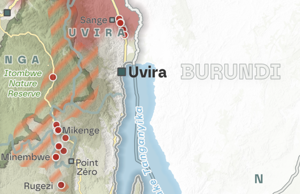
As the conflict in eastern DRC entered its third year of major hostilities between the Rwanda-backed AFC/M23 alliance and the FARDC/Wazalendo coalition, diplomatic efforts continued in early 2026 to advance the peace process. Despite renewed diplomatic momentum and both parties’ stated commitment to the peace processes, the situation on the ground remained marked by continuous violent clashes, shifting frontlines, and sustained civilian suffering.
As the conflict continues, both sides are increasingly deploying kamikaze and combat drones in military operations, repeatedly causing civilian casualties.
In the first five months of 2026, the number of drone strikes recorded by ACLED (65) already exceeded the total number of strikes in 2025 (56).
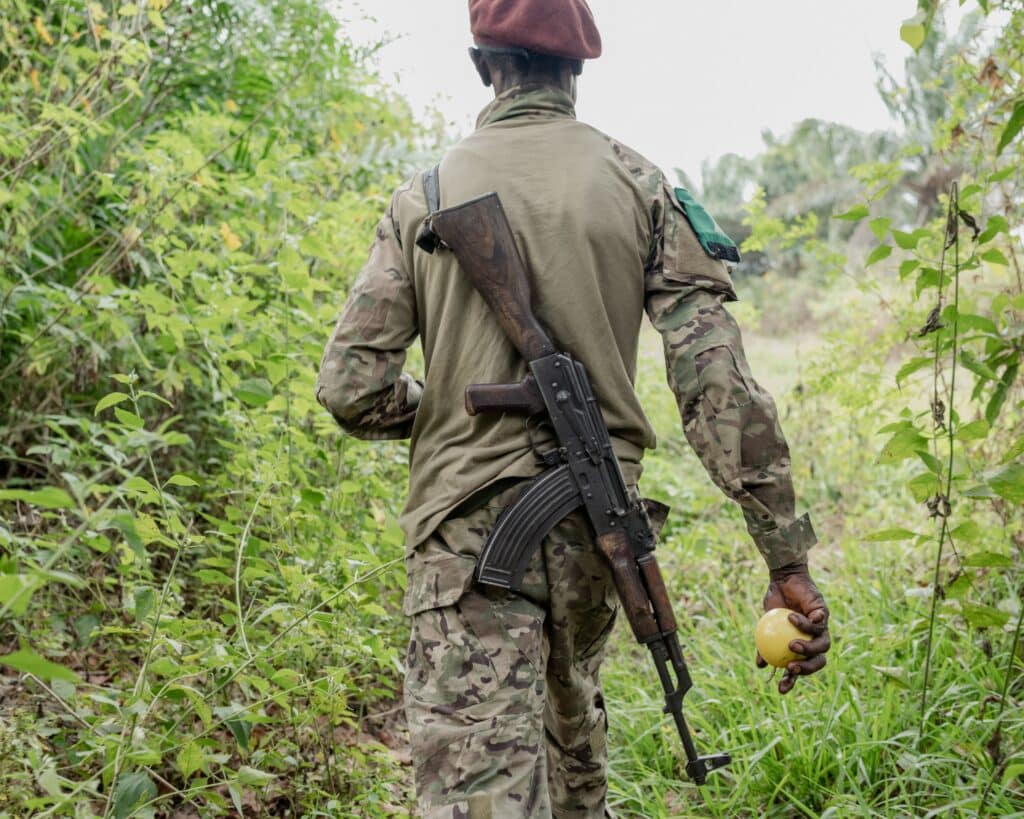
The emergence of the Wazalendo in the fight against the AFC/M23 in North Kivu: Current situation, challenges and prospects

On January 27, 2025, the Congo River Alliance/March 23 Movement (AFC/M23) – supported by Rwanda – took control of Goma, the capital of North Kivu province in the Democratic Republic of Congo (DRC), and then moved on to Bukavu, the capital of South Kivu, which fell in February 2025.
The re-emergence of M23 in 2021 and its rapid advance prompted the Congolese government to resort to non-state armed groups – the so-called Wazalendo – to fight the rebellion, alongside the Armed Forces of the Democratic Republic of Congo (FARDC). Given the problematic attempts to integrate rebels into the army in the past, this strategy could jeopardise current and future peace processes. It also contradicts earlier government commitments to disarmament and demobilisation, namely the new implementation of the Disarmament, Demobilisation, Community Recovery and Stabilisation Programme (P-DDRCS).
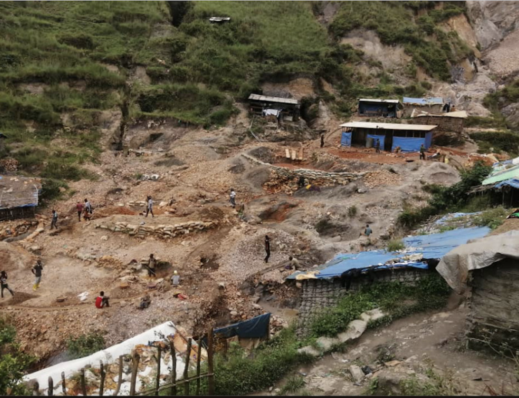
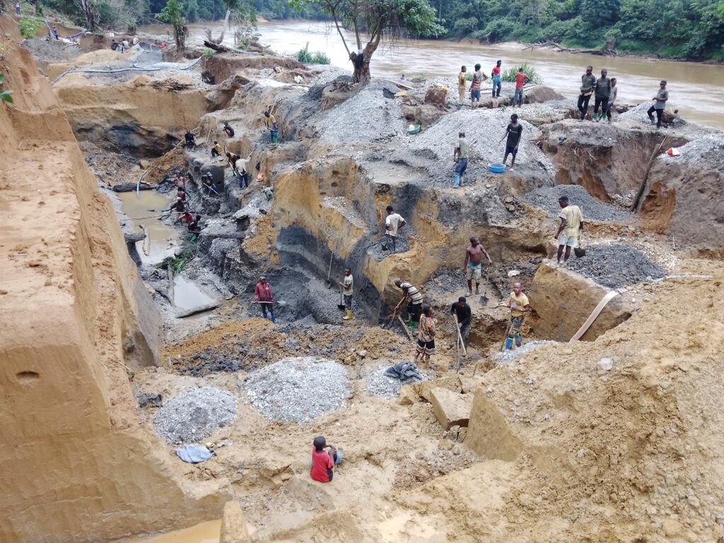
Mapping artisanal mining sites in the Kibali gold mine concession in Faradje territory, Haut-Uélé, DRC

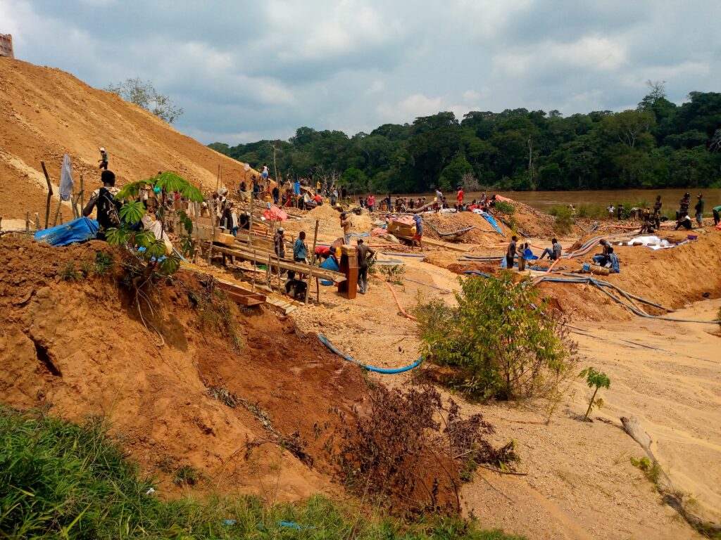
In the Faradje administrative territory in the northeastern Democratic Republic of Congo’s Haut-Uélé province, more than 5,000 people rely on artisanal gold mining to earn a living and support their families. Many artisanal-mining families have done so for generations. They currently work on sites that now fall largely within mining permits owned by Kibali Goldmines (Kibali), a joint venture of Barrick Mining Corporation, AngloGold Ashanti, and the Congolese parastatal Société minière de Kilo-Moto (SOKIMO). Community members have long criticized the lack of dialogue with both the company and the Congolese authorities.
The weight of silence: How the Mobondo revolt is shaking western DRC
Since 2022, western Democratic Republic of Congo (DRC) has been plagued by a major security and humanitarian crisis, with more than 5,000 dead, and 280,000 still displaced. While international attention has focused on the violent conflicts in eastern DRC, an intercommunity conflict at the on the outskirts of Kinshasa is sinking into a spiral of violence, with very little attention from national authorities and international partners. Against this backdrop, and as part of the awareness-raising campaign led by Caritas International Belgium and Justice & Paix, this report seeks to draw attention to the Mobondo crisis and its consequences.
M23’s territorial advances in July, August, and September 2025 – Escalating violence and fragile peace in eastern DRC’s Kivu regions

New peace agreements from Washington and Doha have brought hope for initiating a pathway to resolve the ongoing M23-conflict in DRC’s eastern territories in recent months. However, after the signing of the Declaration of Principles in Doha on 19 July, direct negotiations between the DRC and AFC/M23 were intended to result in a comprehensive peace agreement and were planned to begin no later than 8 August. By the end of September, however, these negotiations had still not commenced. Despite the new permanent ceasefire agreed on in Doha, continuous clashes between the AFC/M23 and the FARDC-Wazalendo coalitions persist in the DRC’s North and South Kivu provinces.
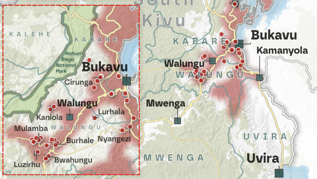
Voix du Congo – The smuggling of coltan from South Kivu to Rwanda: Routes, factors, and implementation
The escalation of conflict in eastern DRC has sparked increased media attention on coltan and its role as a driver of violence. While most coverage has focused on the production and (il)legal trade of coltan in North Kivu, smuggling is also widespread in South Kivu. This report examines the key smuggling routes, contributing factors, and practices.
M23’s territorial advances in June – A long path to peace: Renewed efforts to resolve the M23 conflict in Eastern Congo
New mediation efforts have been made throughout June to end the ongoing conflict between the Rwandan-backed M23 rebels and pro-government forces in the North and South Kivu regions of eastern Congo. On June 27th, the Democratic Republic of Congo and Rwanda signed a peace agreement in Washington, D.C., aimed at de-escalating tensions and fostering regional stability after years of conflict in eastern DRC. While Trump described the peace agreement as a “tremendous breakthrough”, critics caution that its successful implementation hinges on the political and diplomatic commitment from all parties involved. Although frontlines remained relatively calm in the first half of June, heavy clashes resumed in the second half of the month in both North and South Kivu.
Diamonds in the DRC: A sector struggling to shine again

The Democratic Republic of the Congo (DRC) is an important player in the global diamond industry, with considerable untapped potential. This report discusses the current state of play in the DRC’s diamond mining sector, including production trends, key challenges, as well as efforts and opportunities to revive the sector and to increase its impact on local development and socio-economic well-being.
The (new) M23 offensive on Goma: Why this long-lasting conflict is not only about minerals and what are its implications? – Q&A
By the morning of January 29th, the rebels largely controlled the strategic city of Goma. To provide a quick and understandable explanation of the causes of this humanitarian crisis, the role of natural resources, and in particular minerals, is often overemphasized. While mining and mineral trade inevitably play an important role — being a vital part of the local economy — it is important to assess economic assets more broadly, as well as political interests and social grievances.
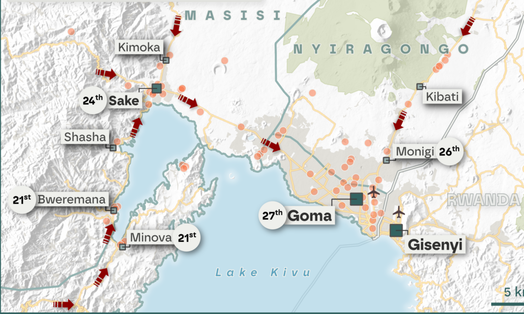
Shifting frontlines: Visualizing the evolution of the M23’s territorial influence in early 2024
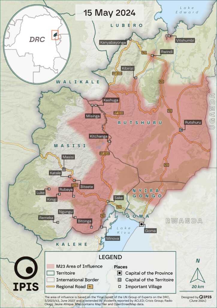
In early 2024, IPIS, ASSODIP, and DIIS published a report on the stakes and motivations of the “March 23 Movement” (M23), a rebellion causing serious insecurity and humanitarian suffering in the eastern Democratic Republic of Congo (DRC). The movement took up arms again in 2021, and it rapidly seized vast territories in the south-east of North Kivu province in 2022, with military support from the Rwandan army. The IPIS-ASSODIP report included several maps, displaying the areas influenced by M23 up to 2023 […]
The M23 “version 2” – Local stakes, motivations, perceptions, and impacts

Since 2021, the eastern part of the Democratic Republic of Congo (DRC) has once again fallen victim to the “March 23 Movement” (M23). Supposedly defeated in 2013, the M23 took up arms again in 2021, and by 2022 had rapidly seized vast territories in the south-east of North Kivu province.
Mining and conflict in the eastern DRC: An interactive story map
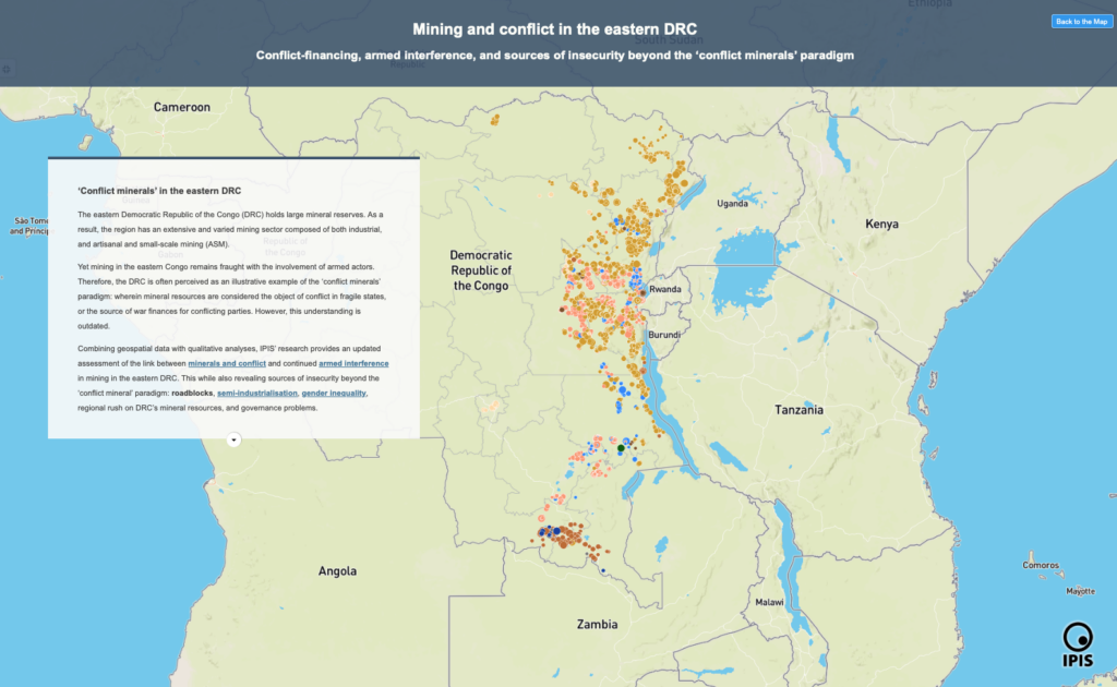
Conflict-financing, armed interference, and sources of insecurity beyond the ‘conflict minerals’ paradigm In this story map, IPIS presents its findings on the linkage between mining and conflict-financing in the eastern Democratic Republic of the Congo (DRC). Based on a survey conducted between 2021-2023 of 829 active mining sites (representing over 132,320 artisanal miners), IPIS’ research […]
Analysis of the interactive map of artisanal mining areas in eastern Democratic Republic of Congo (2023 update)
Since 2009, IPIS has mapped and collected data at more than 2,800 Artisanal and Small-scale Mining (ASM) sites in the eastern Democratic Republic of the Congo (DRC). In this report, IPIS provides its 2023 update of the state of ASM in the eastern DRC, based on data from over 829 ASM sites in the eastern […]
Mapping of artisanal mining sites in western Mambasa, Ituri Province, Democratic Republic of the Congo
The western part of Mambasa territory, in Ituri province, has been overlooked by national authorities and international partners. This despite major expansions of artisanal and small-scale gold mining (ASM) operations, including in the Okapi Wildlife Reserve (OWR). These mining operations have caused tensions between native inhabitants, miners, armed actors, officials and conservationists. Seeking to provide an […]
Responsible mining scorecard in eastern DRC
Over the years, IPIS has systematically collected mine site and trade hub level data on artisanal and small-scale mining (ASM) in eastern DRC. This data collection has enabled IPIS to generate a sizable database of more than 3,000 ASM sites that draws both on sites visited by IPIS and data from third party sources including the Congolese mining cadastre and the Ministerial qualification teams. This database is the point of departure of the Responsible mining scorecard (RMS).
Maps of artisanal and small-scale mining in eastern DRC
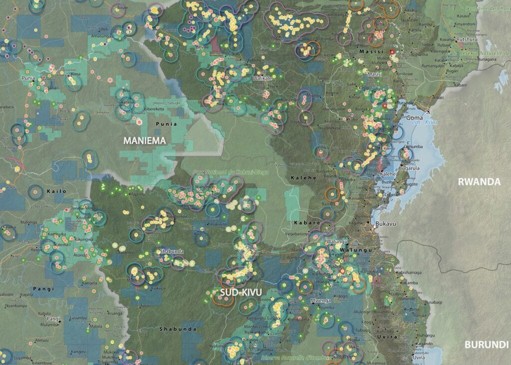
IPIS has created large format maps of known past and present ASM sites in eastern DRC. These A0 maps cover the provinces of Haut Uele, Maniema, Ituri and North and South Kivu. Each map details the type of minerals, the qualification status by official authorities, the mining titles and provide with an overview of armed […]
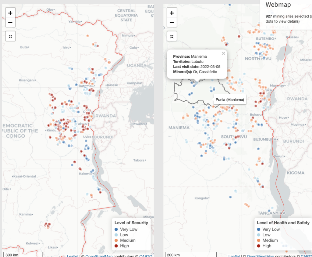
IPIS Open Data dashboard on Artisanal and Small-Scale Mining in eastern DRC
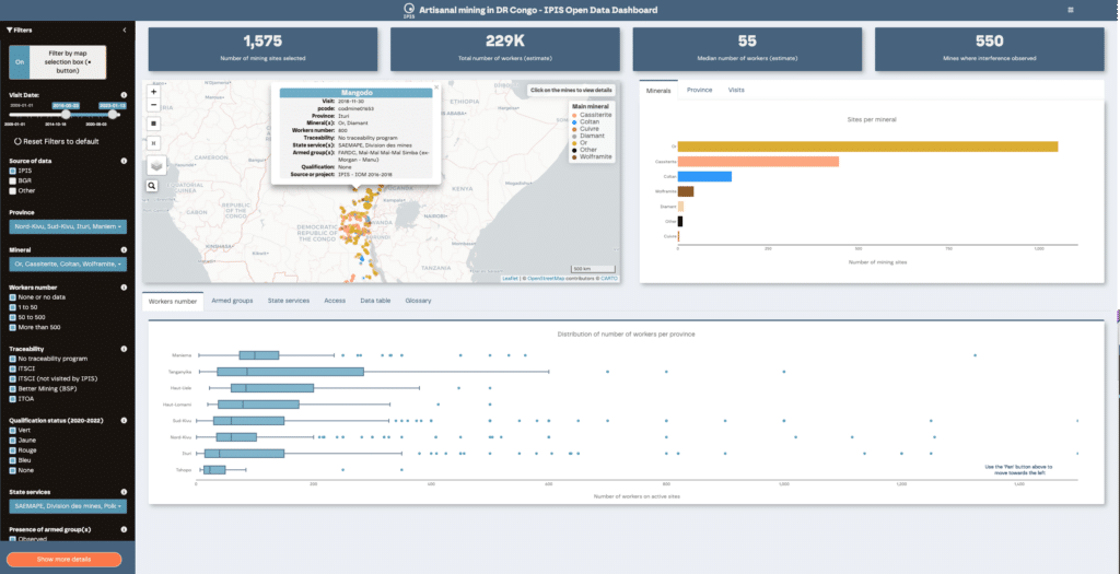
The IPIS Open Data dashboard on artisanal and small-scale mining (ASM) sector in the eastern Democratic Republic of the Congo (DRC) enables users to query and subset IPIS Open Data using various combinations of filters. The dashboard was designed to complement the IPIS Webmap of DRC.
Story map of ASM sites in the DRC
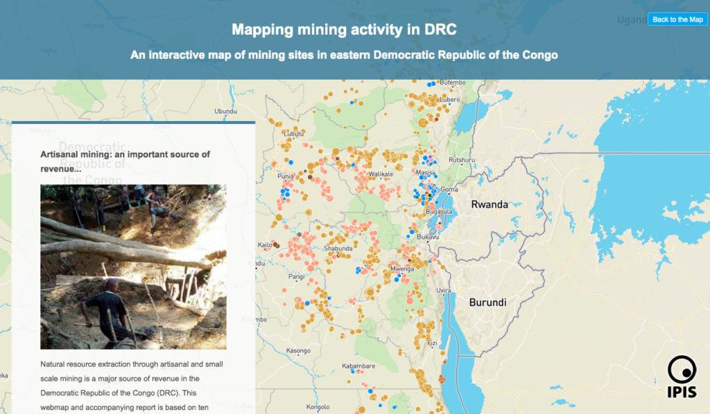
Explore IPIS’ web map of the eastern Democratic Republic of the Congo (DRC) with a guided narrative In its new story map, IPIS presents data gathered on eastern DRC’s artisanal mining sector and highlights key information from its reports investigating the interactions between natural resources and conflict dynamics in the region. Data was gathered on […]
Dashboard of incidents in eastern DRC – Kufatilia
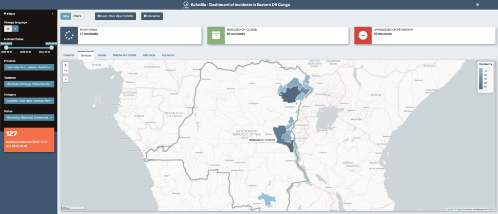
The Kufatilia platform (“to track” in Swahili) is an SMS based incident reporting and follow-up mechanism that has been launched in 2019 to increase transparency of minerals supply chains in Eastern DRC. Developed by IPIS in partnership with the Centre for Expertise on Mining Governance (CEGEMI) based in Bukavu, and powered by Ulula, Kufatilia is […]
Maps of conflict minerals in Eastern DRC (2020)
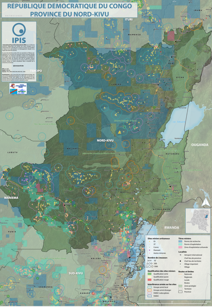
IPIS created maps of conflict minerals in eastern DRC, more particularly on Haut Uele, Ituri and North and South Kivu. These maps detail the type of minerals, the qualification of the mines, the mining titles and give an overview of armed presence in and around the mines. d Download the North Kivu map in full […]