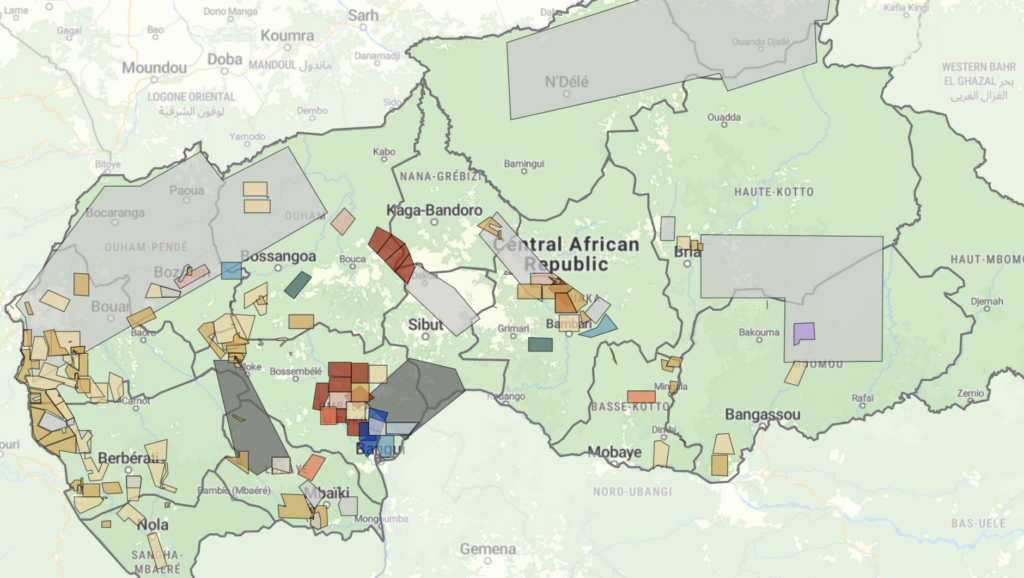
Mapping mining permits in the Central African Republic: A new dashboard to support extractive sector transparency
The mining sector of the Central African Republic is entering a new phase, but its trajectory remains uncertain. A revised mining code, the lifting of the Kimberley Process conflict diamond embargo and a rapidly expanding gold sector may create new opportunities for investment and public revenues. At the same time, CAR’s suspension from the Extractive Industries Transparency Initiative (EITI) exposed gaps in civil society participation, contract disclosure and beneficial ownership transparency. Persistent concerns around conflict, elite capture and mercenary-linked business actors raise further questions about oversight and who ultimately benefits from the country’s mineral wealth. Together, these developments underline the need for greater transparency.

Diamonds, conflict and crime in the Central African Republic: The lifting of the last Kimberley Process embargo
For over a decade, the Central African Republic (CAR) has been at the center of international efforts to curb the trade in conflict diamonds. In 2013, the Kimberley Process (KP) imposed a rough diamond export embargo following a violent coup and widespread reports of rebel financing through diamond mining and trade. While the embargo was partially eased between 2015 and 2019, further progress stalled amid rising geopolitical tensions. Most mining zones remained under embargo until November 2024, when the KP – rather abruptly – lifted the remaining restrictions, citing improved conditions.
Promoting peaceful and seasonal migration in Northern Central African Republic
“You can negotiate with an armed group, not with the drought” The borderlands of the Central African Republic (CAR) are home to one of the
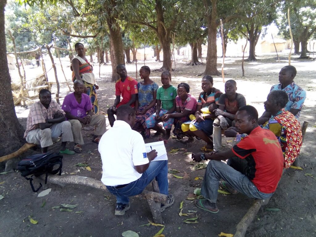
Story map of ASM sites in Central African Republic
Discover a new approach to IPIS’ interactive webmap of artisanal and small-scale mining (ASM) sites in the Central African Republic through this interactive story map.
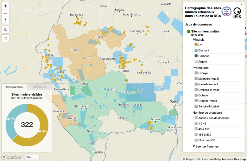
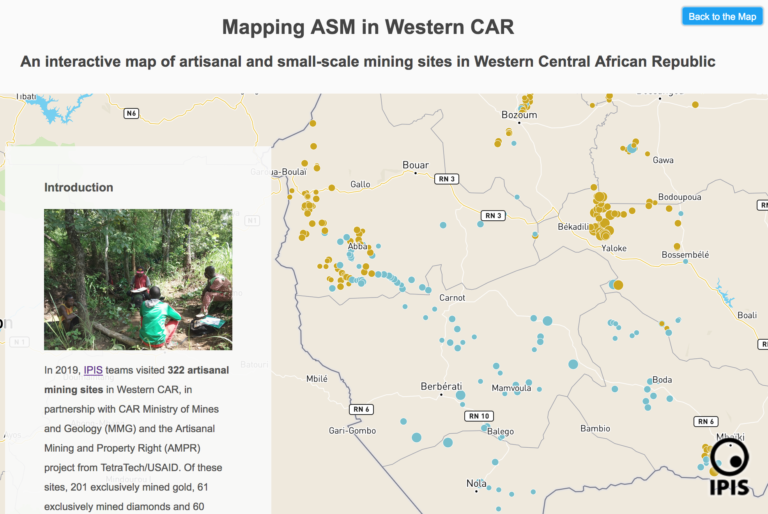
Mapping artisanal mining sites in the Western Central African Republic (2019)
This report presents an analysis of the artisanal mining sector in western Central African Republic (CAR) and outlines some of the challenges surrounding gold and
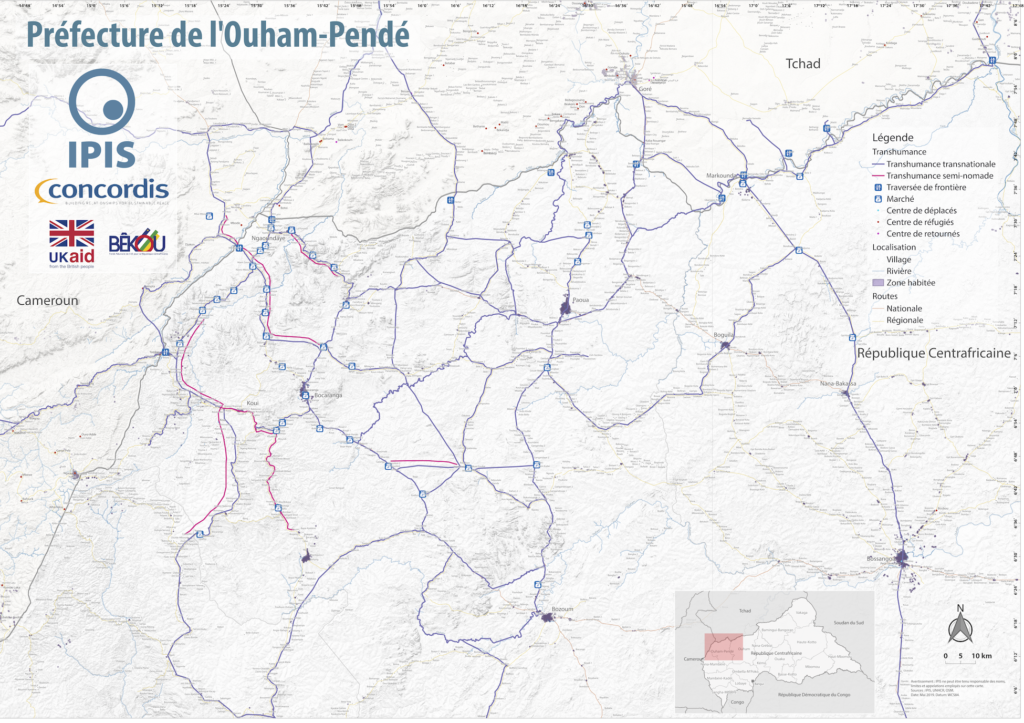
Map Pastoralism Ouham Pendé (2019)
Each year the annual migration of transnational transhumance through the prefecture of Ouham-Pende, in northwestern Central African Republic (CAR), uproots a deep-seated mistrust between nomadic

Central African Republic – Ouham-Pende Basemap (2019)
Each year the annual migration of transnational transhumance through the prefecture of Ouham-Pende, in northwestern Central African Republic (CAR), uproots a deep-seated mistrust between nomadic
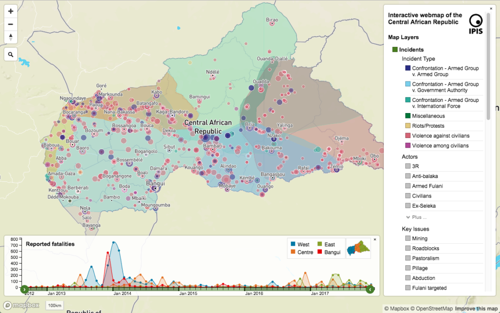
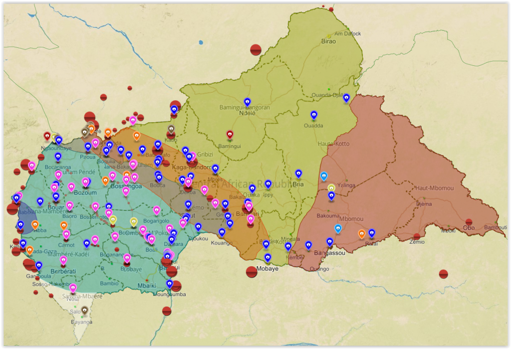
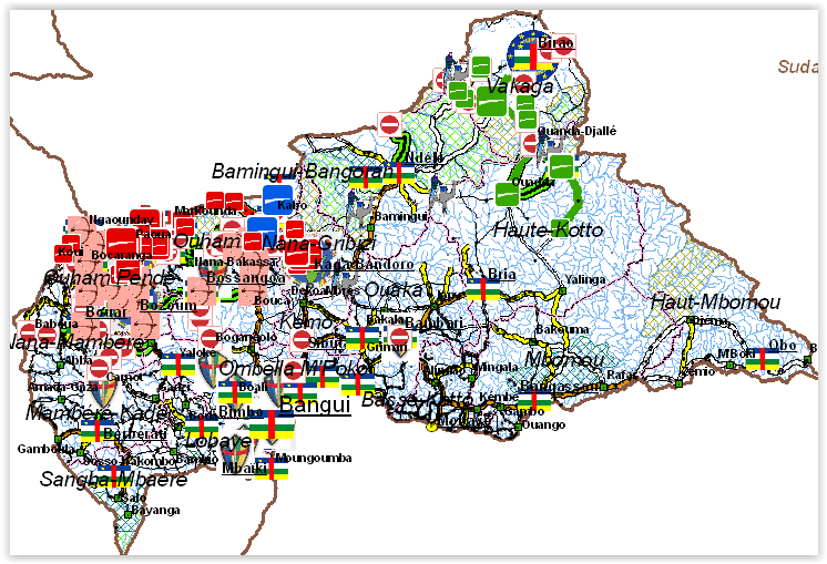
Central African Republic: A Conflict Mapping (2018)
In a new report and webmap on the longstanding crisis in the Central African Republic (CAR), IPIS points out that access to resources remains the
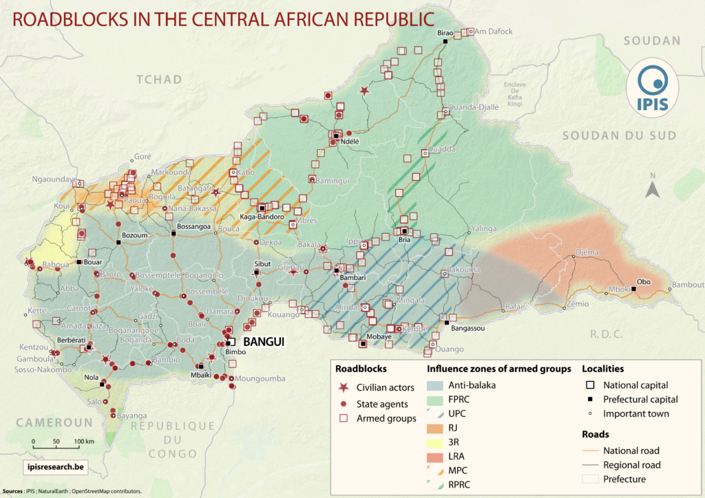
The Politics of Pillage: the political economy of roadblocks in the Central African Republic (2017)
IPIS puts roadblocks on the map as key mechanism of conflict funding besides natural resources, revealing its devastating scope in funding armed actors in Democratic
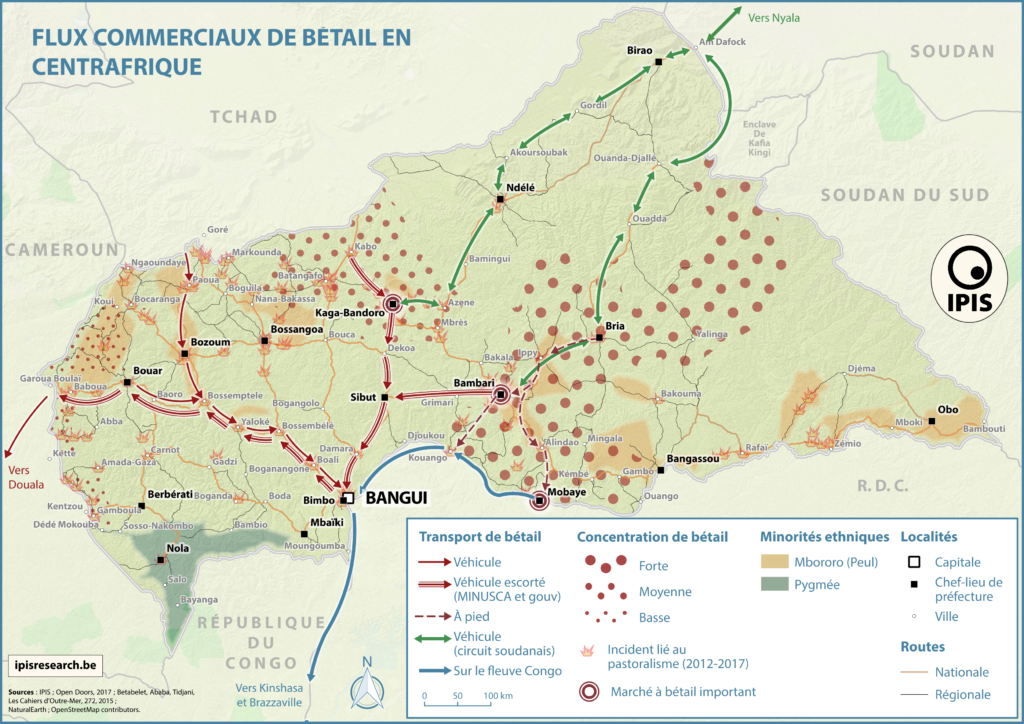
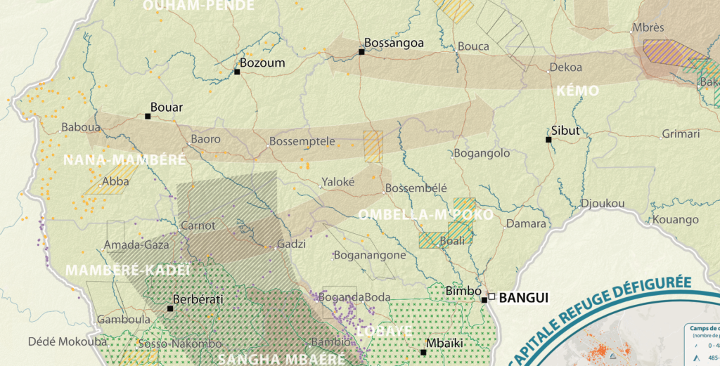
Pastoralism corridors in Central African Republic (2017)
While pastoralism can generates wealth and economic interdependence between farmers and cattle herders, it can also causes tension and conflicts. In the current Central African
République Centrafricaine: Portait d’un territoire riche en crises (2012 – 2017)
This poster is a compilation of maps and graphics related to the situation in the Central African Republic. A map of natural resources and poaching
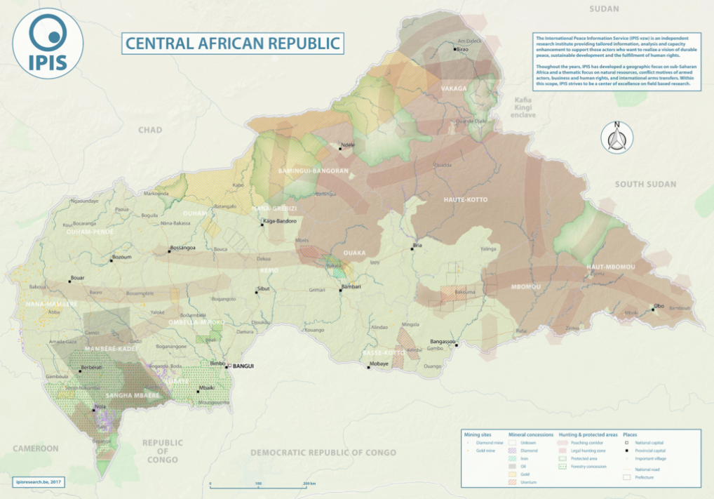
Natural Resources in Central African Republic (2017)
With an area of 622 984km2, the Central African Republic is the 20th largest country in Africa and one of the poorest in the world.
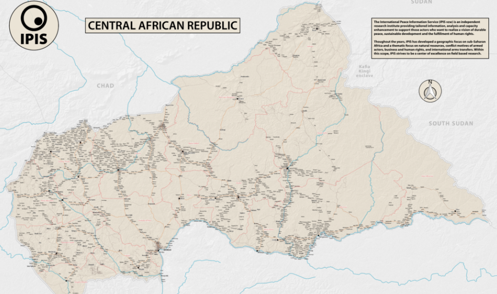
Central African Republic – Road Map (2017)
In 2013 the Central African Republic entered a period of great instability. The predominantly Muslim rebel coalition, Seleka, seized power. A group of mostly Christian
Mapping Conflict Motives: the Central African Republic (2012-2014)
In this study, IPIS analyses the conflict dynamics in the Central African Republic (CAR) since the outbreak of the latest crisis in September 2012 up
A Taxonomy of Non-State Armed Actors in the Central African Republic (2012)
This report hopes to provide an overview of how the Central African Republic got to where it is now, as well as to present the
Mapping Conflict Motives: Central African Republic (2009)
Not many areas in the Central African Republic are really secure. Although the country is scarcely populated, it is tormented by a multitude of armed