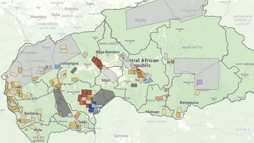
Cartographie des permis d’exploitation minière en République centrafricaine : un nouveau tableau de bord pour favoriser la transparence du secteur extractif
Le secteur minier de la République centrafricaine entre dans une nouvelle phase, mais son évolution reste incertaine. Un code minier révisé, la levée de l’embargo du Processus de Kimberley sur les diamants de conflit et un secteur aurifère en pleine expansion pourraient créer de nouvelles opportunités d’investissement et de recettes publiques. Dans le même temps, la suspension de la RCA de l’Initiative pour la transparence dans les industries extractives a mis en évidence des lacunes en matière de participation de la société civile, de publication des contrats et de transparence sur la propriété effective. Les préoccupations persistantes concernant les conflits, la mainmise des élites et les acteurs économiques liés au mercenariat soulèvent de nouvelles questions quant au contrôle et à l’identité de ceux qui tirent profit des richesses minérales du pays. Ensemble, ces évolutions soulignent la nécessité d’une plus grande transparence.

Diamants, conflits et criminalité en République centrafricaine : la levée du dernier embargo du Processus de Kimberley
For over a decade, the Central African Republic (CAR) has been at the center of international efforts to curb the trade in conflict diamonds. In 2013, the Kimberley Process (KP) imposed a rough diamond export embargo following a violent coup and widespread reports of rebel financing through diamond mining and trade. While the embargo was partially eased between 2015 and 2019, further progress stalled amid rising geopolitical tensions. Most mining zones remained under embargo until November 2024, when the KP – rather abruptly – lifted the remaining restrictions, citing improved conditions.
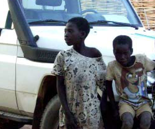
Promoting peaceful and seasonal migration in Northern Central African Republic
“You can negotiate with an armed group, not with the drought” The borderlands of the Central African Republic (CAR) are home to one of the
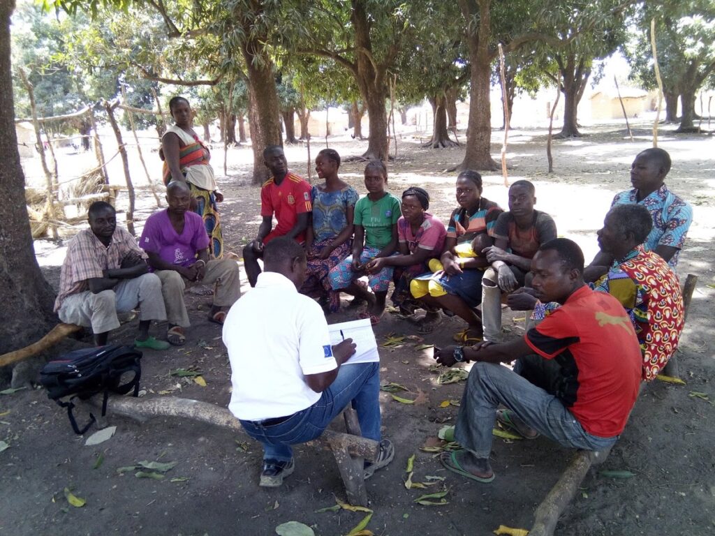
Story map of ASM sites in Central African Republic
Discover a new approach to IPIS’ interactive webmap of artisanal and small-scale mining (ASM) sites in the Central African Republic through this interactive story map.
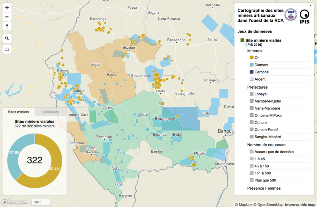
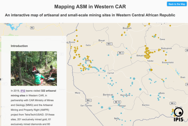
Cartographie des sites miniers artisanaux dans l’ouest de la Centrafrique
Le présent rapport constitue un diagnostic du secteur minier artisanal dans l’ouest de la République de Centrafrique (RCA) et présente les enjeux de l’exploitation, du
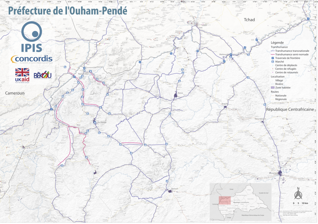
Map Pastoralism Ouham Pendé (2019)
Each year the annual migration of transnational transhumance through the prefecture of Ouham-Pende, in northwestern Central African Republic (CAR), uproots a deep-seated mistrust between nomadic

Central African Republic – Ouham-Pende Basemap (2019)
Each year the annual migration of transnational transhumance through the prefecture of Ouham-Pende, in northwestern Central African Republic (CAR), uproots a deep-seated mistrust between nomadic
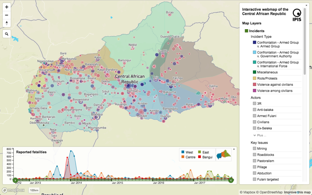
République centrafricaine: cartographie du conflit
Dans un nouveau rapport et une nouvelle carte web sur la crise en République centrafricaine (RCA), IPIS souligne que l’accès aux ressources reste le principal
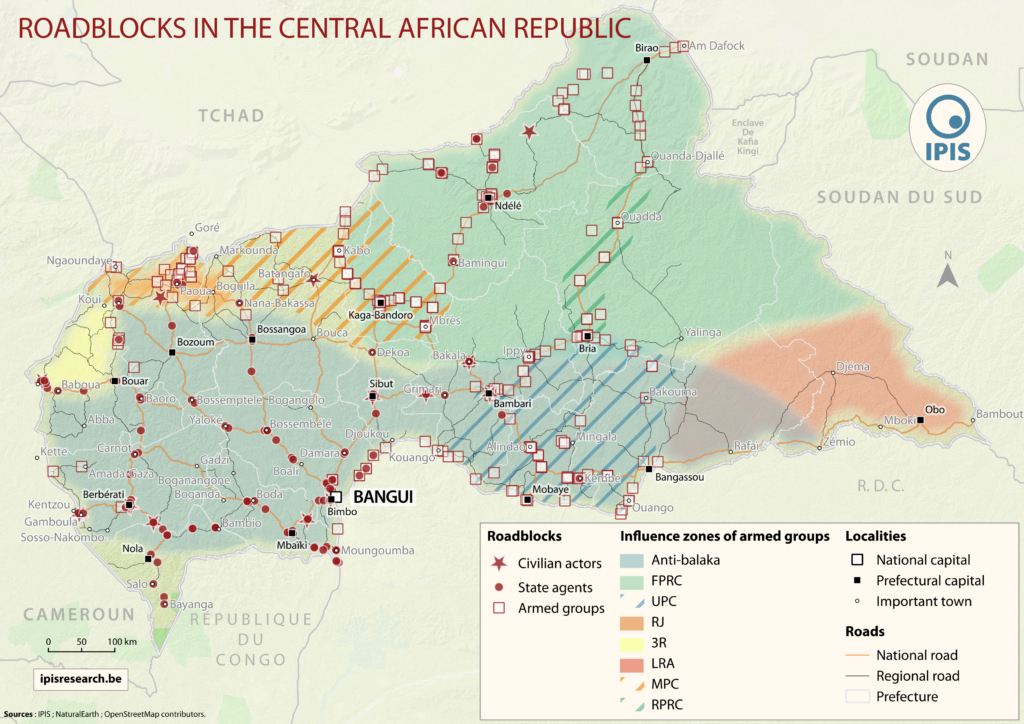
« Laissez-piller » L’économie politique des barrières routières en République centrafricaine
IPIS, l’institut belge de recherche, dresse la carte des barrages routiers et pointe leur rôle clé dans les mécanismes de financement des conflits en Afrique
Pastoralism corridors in Central African Republic (2017)
While pastoralism can generates wealth and economic interdependence between farmers and cattle herders, it can also causes tension and conflicts. In the current Central African
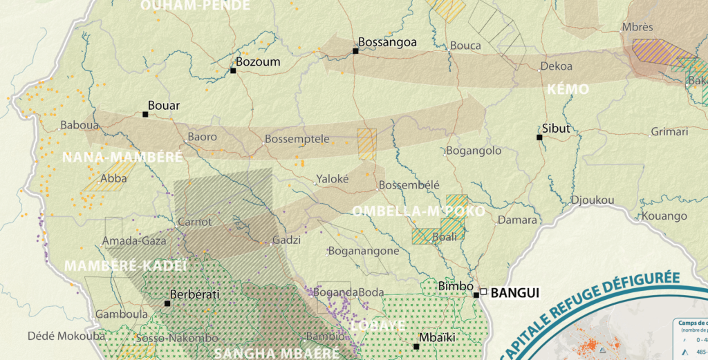
République Centrafricaine: Portait d’un territoire riche en crises (2012 – 2017)
This poster is a compilation of maps and graphics related to the situation in the Central African Republic. A map of natural resources and poaching
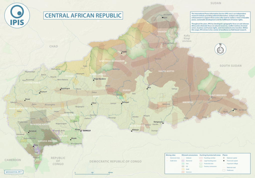
Natural Resources in Central African Republic (2017)
With an area of 622 984km2, the Central African Republic is the 20th largest country in Africa and one of the poorest in the world.
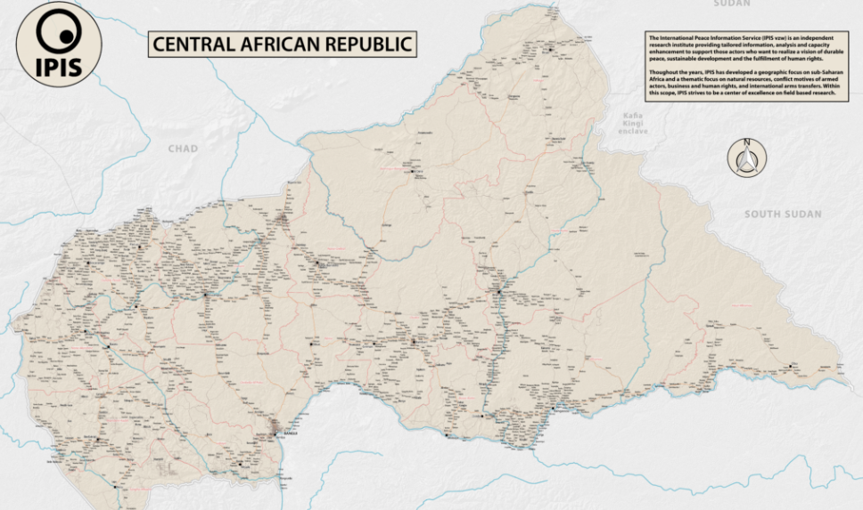
Central African Republic – Road Map (2017)
In 2013 the Central African Republic entered a period of great instability. The predominantly Muslim rebel coalition, Seleka, seized power. A group of mostly Christian
Cartographie des motivations derrière les conflicts: la République centrafricaine
En 2009, l’International Peace Information Service (IPIS) a publié un rapport et une série de cartes analysant la situation de la République centrafricaine en termes
A Taxonomy of Non-State Armed Actors in the Central African Republic (2012)
This report hopes to provide an overview of how the Central African Republic got to where it is now, as well as to present the

Cartographie des motivations derrière les conflits : la République centrafricaine
Peu de zones en République centrafricaine sont réellement sécurisées. Même si le pays est faiblement peuplé, il est déchiré par une multitude d’acteurs armés. Ces