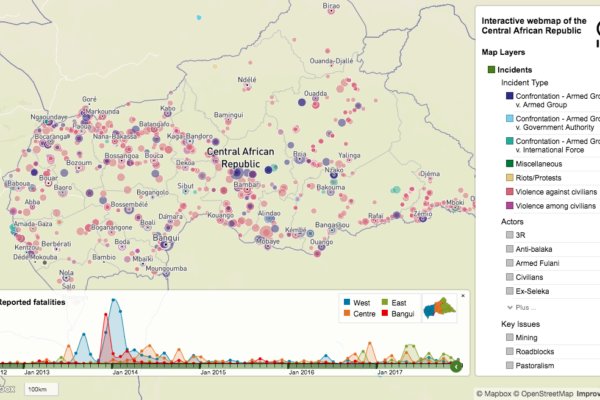
Pastoralism in the Central African Republic conflict: new IPIS research launched
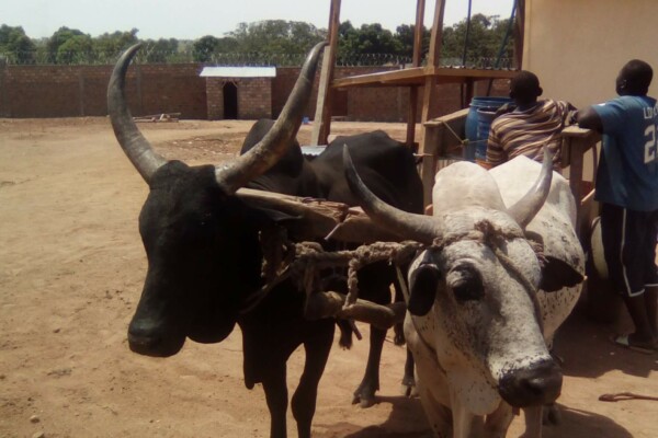
10 mai 2019With thorough conflict mapping and analysis of the drivers and actors of conflict in the Central African Republic, IPIS has contributed to a better understanding of the Central African Republic conflict. In 2019, IPIS will be focussing on one particular activity that generates conflict on the one hand, but is fundamental for strengthening peace on the other: Pastoralism. This research will t
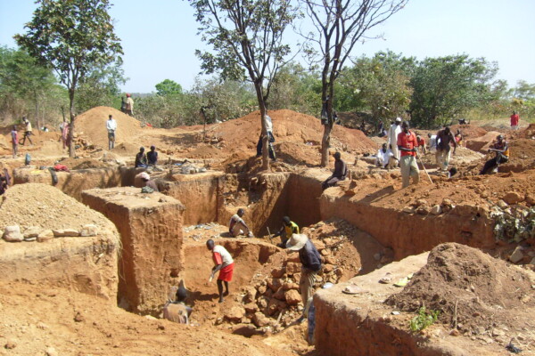
New project of mapping artisanal and small-scale mining sites in the Central African Republic
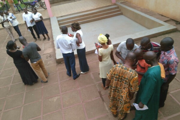
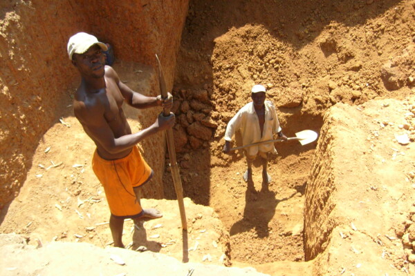
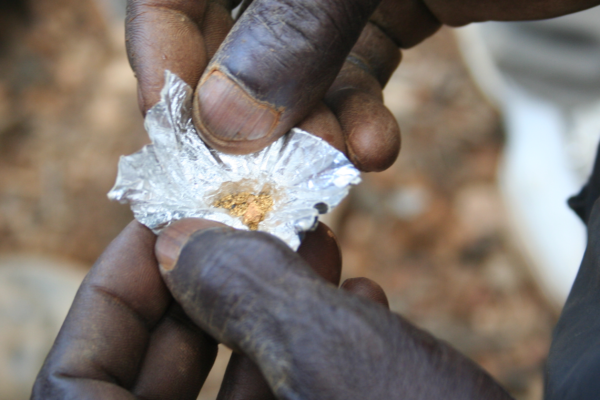
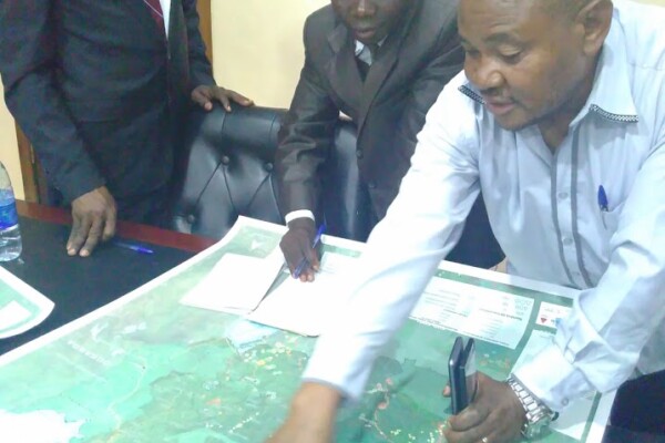
2 mai 2019Following a successful training in Bangui with members from civil society organizations and field officers from the Kimberley Process focal point at the Ministry of mines and geology of the Central African Republic (CAR), IPIS will start field based research to map artisanal and small-scale gold and diamond mining sites in Western CAR. This study will focus on quantitative research through Mobile

Multi-stakeholder dialogue on Business and Human Rights in Tanzania identifies ‘land rights and environment’ as priority topic
17 avril 2019Dodoma, 21 March 2019. Over 60 key stakeholders from civil society, business and government agencies from Tanzania mainland and Zanzibar gathered at the Royal Village Hotel, Dodoma for the first annual multi-stakeholder dialogue on Business and Human Rights. This event was organized by the Tanzanian Commission for Human Rights and Good Governance (CHRAGG), Business and Human Rights Tanzania

Les Nations Unies doivent aider le Processus Kimberley à être à la hauteur de son mandat de prévention des conflits
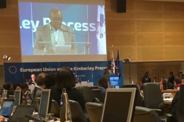
1 mars 20191er mars 2019 La Coalition de la société civile du Processus de Kimberley (CSC PK) a participé, en marge de l’Assemblée générale des Nations unies le Jeudi 28 février 2019, à un panel de discussion intitulé « Des diamants du sang aux diamants de la paix : la prévention des conflits via le Processus de Kimberley ». La CSC PK a exhorté l’ONU à s’engager davantage dans le Processus de

Kufatilia : un nouveau système de Suivi des Incidents de l’Or (SIOr)
4 décembre 2018« Aujourd’hui un éboulement a fait un mort dans un site minier artisanal près de Numbi. » Voici le type d’information que reçoivent régulièrement par SMS les organisations de la société civile congolaise qui luttent chaque jour pour améliorer les conditions de vie des artisans miniers dans l’Est de la République Démocratique du Congo. Depuis quelques semaines au Sud-Kivu et en Ituri, il est désorm
La coalition de la Société civile du PK déçue par la résistance à la réforme du Processus de Kimberley
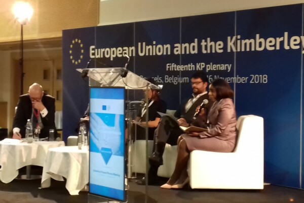
16 novembre 201816 novembre 2018 La Coalition de la Société Civile du Processus de Kimberley (CSC PK) a fortement insisté dans le sens d’une réforme lors de la session plénière 2018 du PK à Bruxelles et ce, avec des propositions très concrètes parmi lesquelles, une modification de la définition des diamants de la guerre au-delà de la portée limitée et dépassée des diamants bruts finançant les mouvements rebelle
La coalition de la Société Civile du Processus Kimberley demande à tous les membres d’améliorer la gouvernance globale des diamants.
14 novembre 201814 novembre 2018 Cette année, la réforme est prioritaire dans l’agenda de la session plénière du processus Kimberley présidé par l’UE. Le processus Kimberley, autrefois pionnier dans l’effort tripartite d’arrêter le financement de groupes rebelles par le diamant, peine aujourd’hui à fournir une réponse adéquate à une série de défis actuels relatifs aux droits de l’Homme et associés au secteur du d
22 November – IPIS panel discussion on the Central African Republic
19 octobre 2018Central African Republic: A Conflict Mapping IPIS kindly invites you to a panel discussion on the conflict in the Central African Republic on Thursday November 22, 4:30pm at the Jacqmotte Conference Center, Hoogstraat/Rue Haute 139 in Brussels. Please register at events@ipisresearch.be Programme 4:30 – Welcome Honorary Ambassador Johan Swinnen, Chair IPIS 4:40 – Keynote speech
IPIS welcomes UA Summer School students for workshop on responsible sourcing using IPIS maps
10 septembre 2018On September 6th, 30 students from the University of Antwerp ‘Mine to Finger’ Summer School on diamonds participated in a responsible sourcing workshop organised by IPIS. They explored the upstream context of the diamond supply chain in Central African Republic (CAR) and the Democratic Republic Congo (DRC) using IPIS webmaps. They engaged in a critical and nuanced discussion on various due dilig
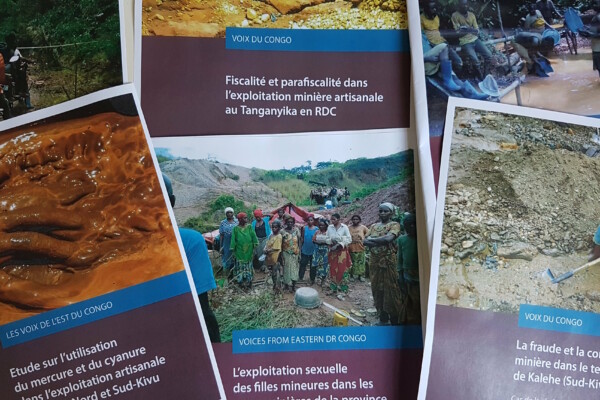
Strengthening local voices: discover IPIS’ partner publication series “Voices from the South”
3 septembre 2018Since 2017, IPIS has been closely collaborating with civil society actors from central and east Africa who want to share their perspective on subjects related to IPIS’ work. Their hands-on experience, unique knowledge and access to information offer local insights relevant to a large audience. With the editorial support from IPIS, local partners are encouraged to write down their research. This ha
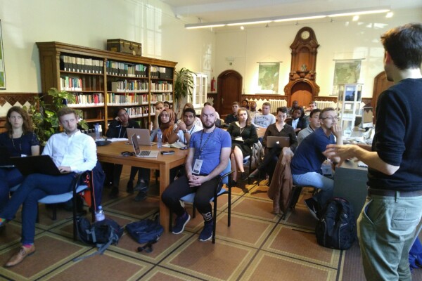
Training workshop: “Field Research and Report Writing on Business and Human Rights”
22 août 2018At the start of August 2018, five Tanzanian civil society organisations gathered in Dar es Salaam for a three-day training on field research and report writing. The training forms part of the EU-funded project ‘Improving monitoring, research and dialogue on Business & Human Rights in Tanzania’ which is implemented by IPIS, the Tanzanian Commission for Human Rights and Good Governance (CHRAGG),
Réunion intersessionnelle du Processus Kimberley : la Coalition de la Société Civile demande une réforme significative de la définition des diamants de conflits
28 juin 201829 juin 2018 Lors de la réunion intersessionnelle du Processus Kimberley qui s’est tenue à Anvers du 18 au 22 juin, la Coalition de la Société Civile du PK (CSC PK) a demandé des réformes significatives sur la portée de la définition des diamants de conflits, les structures de gouvernance du PK ainsi que sur les contrôles internes des gouvernements afin d’assurer des chaines d’approvisionnement de
How IPIS uses data from subscribers to our briefings
22 mai 2018French below/Français ci-dessous We’re making some updates to IPIS’ Privacy Policy to ensure you know exactly what information we have from you and what we do with it, in compliance with the new European data protection laws. Our policy comes into effect on May 25, 2018. To receive IPIS’ news and publications, you can subscribe to our mailing list (When you are currently subscribed, we’ve sent
Voting D4D is open! Vote for « Watching over the Okapis »
19 avril 2018Would you like to encourage participatory science to map vulnerable areas? Support IPIS by voting for our Okapi Wildlife Reserve map in the D4D prize 2018 Vote now IPIS has submitted its “Okapi Wildlife Reserve” map to the 2018 Digital 4 Development- Prize initiative of the Belgian Development Cooperation and the Royal Museum for Central Africa. The D4D prize goes to initiatives that use digital
IPIS lance une mise à jour majeure de sa carte interactive en RDC
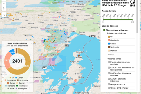
19 mars 2018Version française IPIS lance une mise à jour majeure de sa carte interactive en RDC, qui affiche des données sur plus de 2400 sites miniers artisanaux et plus de 800 barrages routiers dans l’est du pays. Depuis décembre 2016, les équipes d’IPIS ont visité plus de 500 mines artisanales dans la région, collectionnant des données qui ont été ajoutées sur la carte interactive. IPIS a également intégré
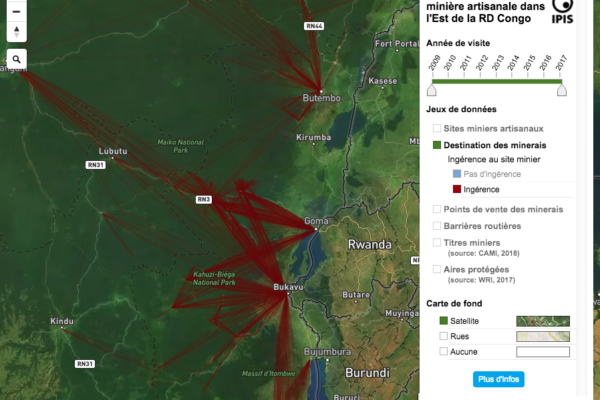
New data on mining sites and roadblocks on IPIS’ upgraded DRC interactive web map
19 mars 2018IPIS launches a major update of it’s DRC webmap displaying data on more than 2400 artisanal mining sites in eastern DRC and more than 800 roadblocks. Since December 2016, IPIS teams have visited more than 500 artisanal mines in eastern DRC, gathering data that has been added to IPIS’ interactive webmap. IPIS also integrated other datasets gathered during its projects in the region, including the d
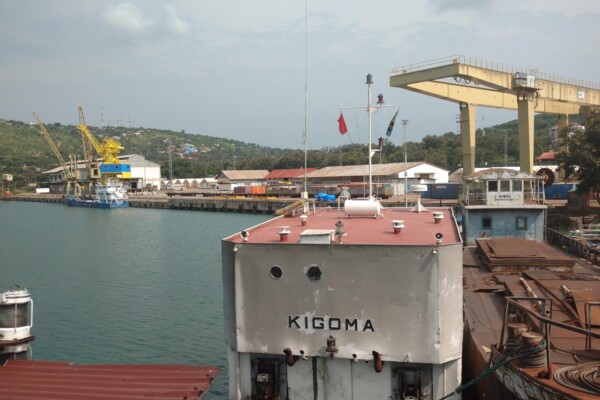
Mobile data collection on mining sites in Kigoma, Tanzania
26 février 2018IPIS is undertaking a large-scale mobile data collection exercise on operational, socio-economic and human rights aspects of artisanal and industrial mining in northwest Tanzania. Building on this baseline data, IPIS will develop and implement a phone-based incidents reporting mechanism for local and mining communities. With better and more accessible data, IPIS aims to contribute to improving the
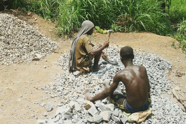
Training and workshop on mapping artisanal mining in Eastern DRC
9 février 2018(French version below) 2373 Mining sites visited, including 470 visits in the last thirteen months. 300 Roadblocks visited on a total of 798 mapped roadblocks. More than 18 000 km travelled by plane, bus, motorbikes and by foot… These are a few of the impressive results achieved by the twelve IPIS researchers in Eastern DRC. Late January, a workshop held in Goma gave IPIS researchers an opportun
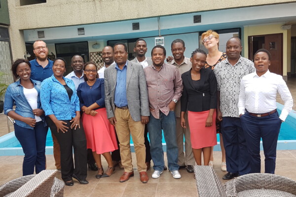
Improving monitoring, research and dialogue on Business and Human Rights in Tanzania
2 février 2018IPIS was in Dar es Salaam to launch its new project on Business & Human Rights with the Tanzanian Commission for Human Rights and Good Governance (CHRAGG) and Business and Human Rights Tanzania (BHRT). Tanzania is bearing the fruits of the accelerating economic growth and rising influx of foreign direct investment (FDI), but is also struggling with the enormous challenges in the ar
IPIS continues to call for reform in the Kimberley Process
18 décembre 2017IPIS attended the Kimberley Process Plenary (9-14 December) as a member of the KP Civil Society Coalition. Over the last couple of years, IPIS has repeatedly voiced its concerns on the functioning of the KP. Within the CSO coalition, IPIS has been calling for meaningful reforms, both on the scope of the definition of conflict diamonds and the internal controls on governments to e