Story maps
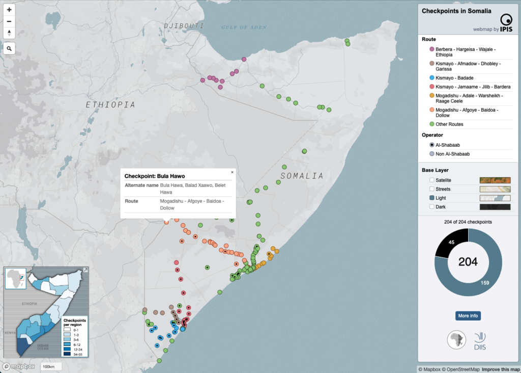
Maps of Somalia
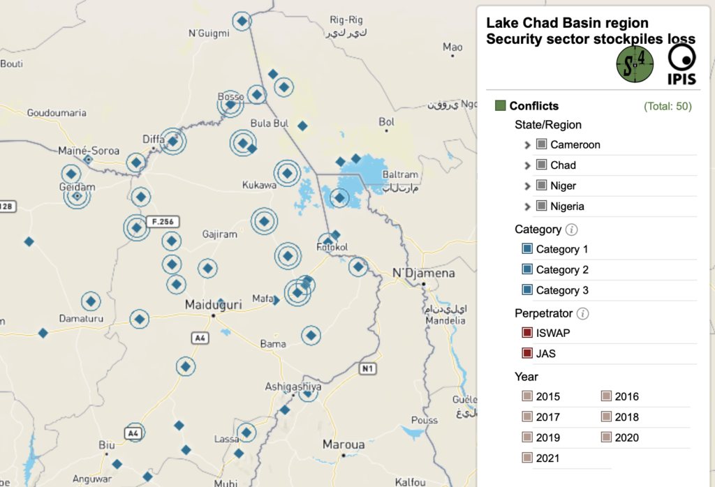
Maps of Arms Trade & Security
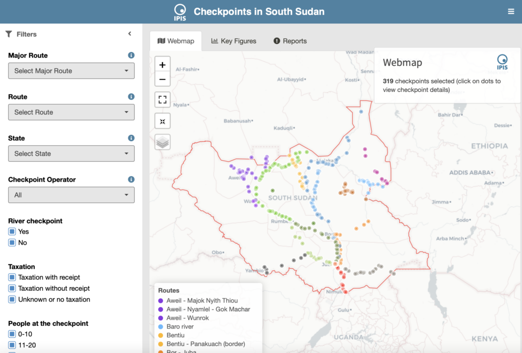
Maps of South Sudan
Maps of Zimbabwe

Maps of Tanzania

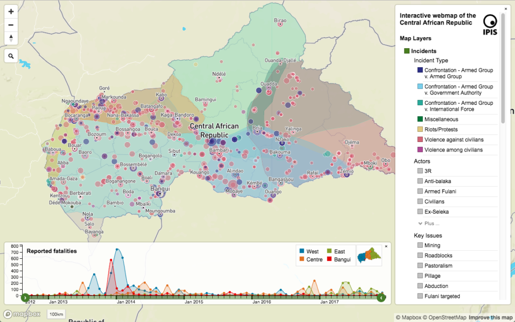
Maps of CAR
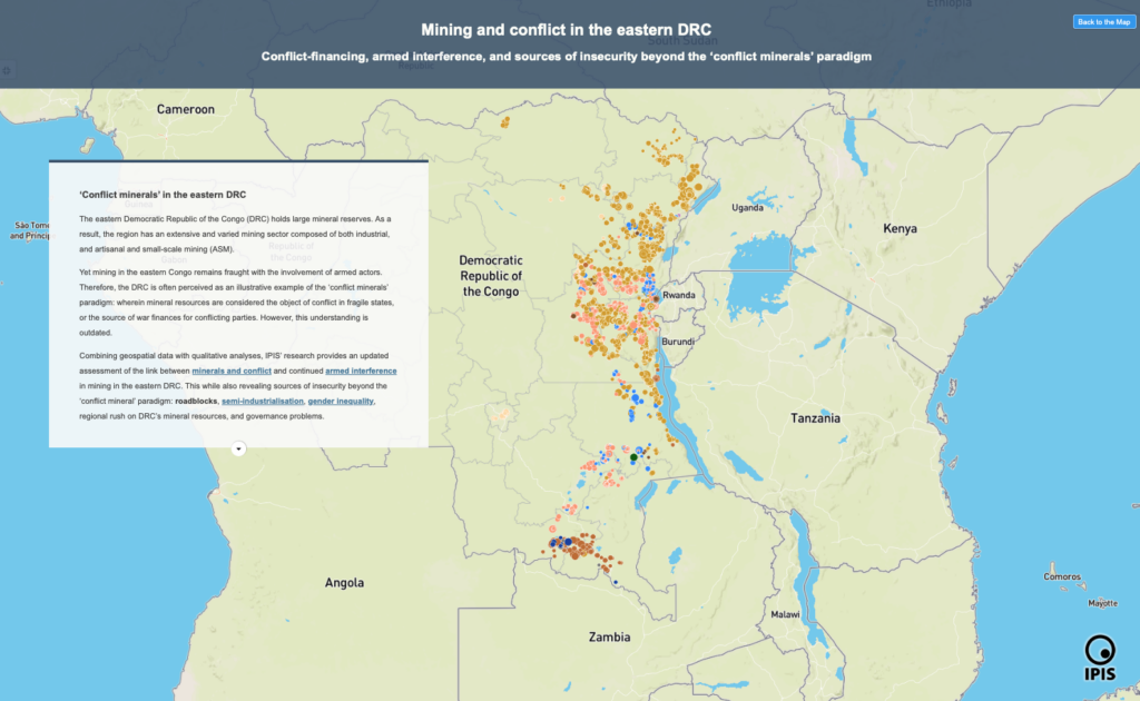
Maps of DRC

Open data
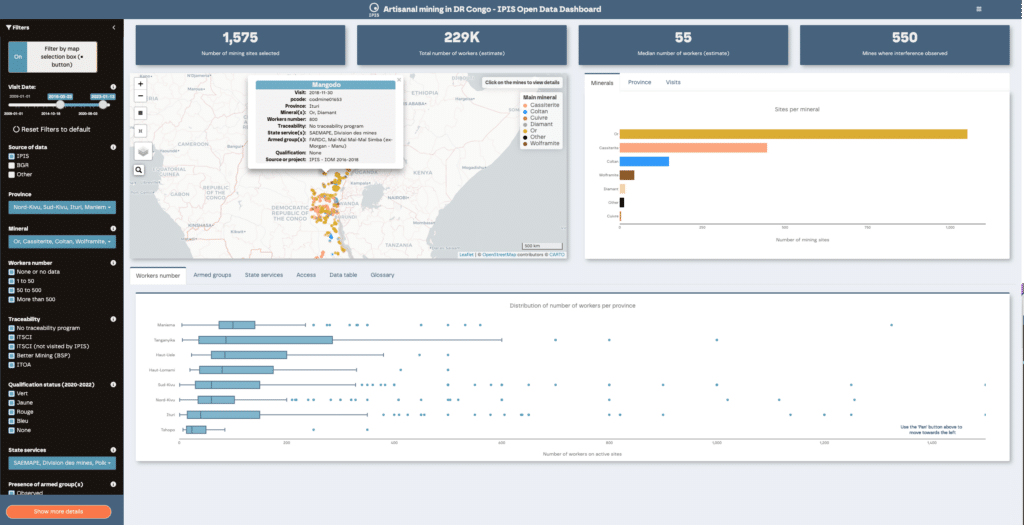
Welcome to the IPIS Open Data page. IPIS publishes a growing number of datasets as Open Data. Here, you can find out how to access and use them. Open data dashboard on ASM in eastern DRC Webmap of ASM in eastern DRC About our Open Data The International Peace Information Service (IPIS) publishes […]
Stakeholder and power mapping tools
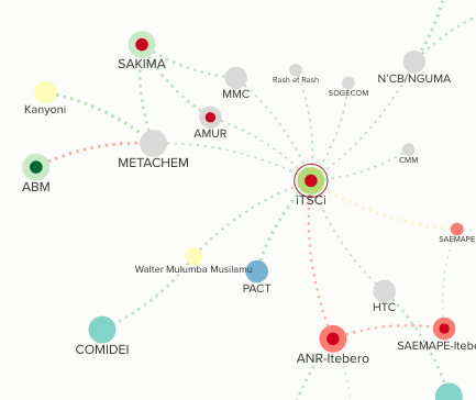
IPIS has developed a methodology to map stakeholders and power structures. Following an in depth study through interview and literature review, this approach uses modern visualisation techniques to create interactive tools that map and visualize the power dynamics in conflict and post-conflict areas. These tools can be used to describe local, provincial, national, regional and […]
IPIS technical consultancy

Across various projects, IPIS has built-up an expertise in field-data collection, GIS mapping, data management, geospatial analysis and the development of visualization tools such as interactive web-maps and dashboards. Confident in its ability to deliver high-quality recommendations and outputs, IPIS places its expertise at the disposal of other NGOs interested in engaging in similar mapping […]