


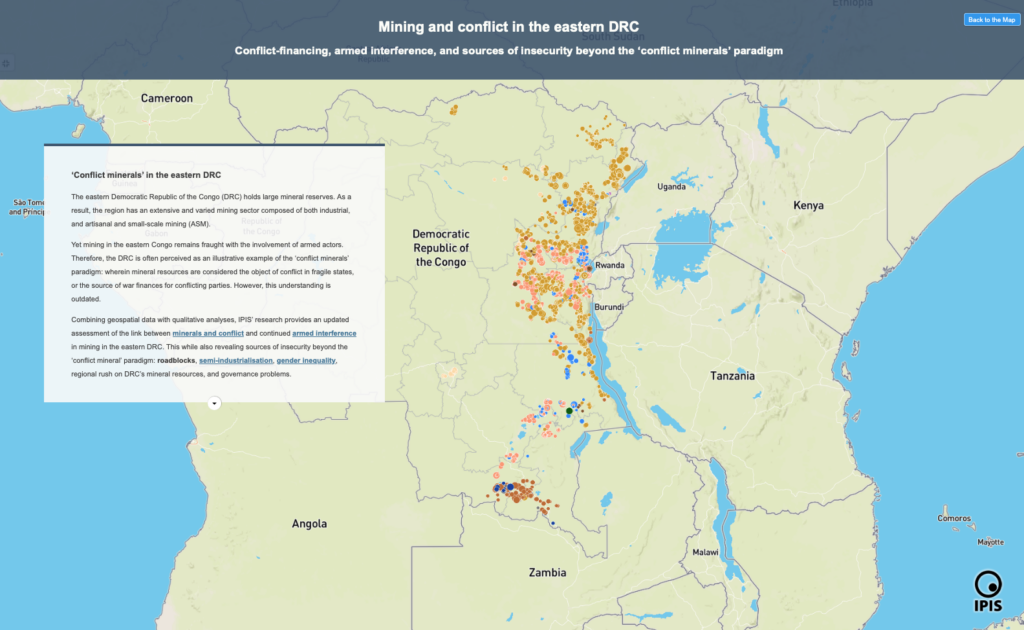
Mining and conflict in the eastern DRC: An interactive story map
Conflict-financing, armed interference, and sources of insecurity beyond the ‘conflict minerals’ paradigm In this story map, IPIS presents its findings on the linkage between mining
Analysis of the interactive map of artisanal mining areas in eastern Democratic Republic of Congo (2023 update)
Since 2009, IPIS has mapped and collected data at more than 2,800 Artisanal and Small-scale Mining (ASM) sites in the eastern Democratic Republic of the
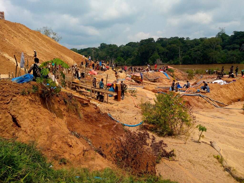
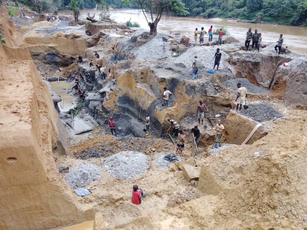
Mapping of artisanal mining sites in western Mambasa, Ituri Province, Democratic Republic of the Congo
The western part of Mambasa territory, in Ituri province, has been overlooked by national authorities and international partners. This despite major expansions of artisanal and