
Bisie. A one-year snapshot of the DRC’s principal cassiterite mine (2011)
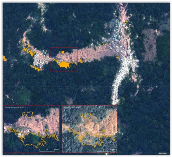
Much has happened in the mining sector of Eastern DRC over the last year. President Kabila imposed a ban on all mining activities last fall, during which production fell considerably. As soon as the suspension was lifted in the spring of this year, the major global electronic companies stopped buying minerals from the region, provoking […]
Simplified maps illustrating the link between natural resources and armed conflict in the DR Congo (2011)
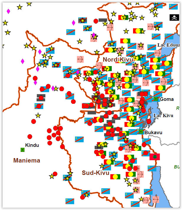
Simplified maps illustrating the link between natural resources and armed conflict in the DR Congo (in French) (January 2011) At the request of different users of the IPIS web maps, and with the support of the Belgian Development Cooperation (DGD), IPIS has produced a series of six simplified and printable PDF maps illustrating the link […]
The complexity of resource governance in a context of state fragility: An analysis of the mining sector in the Kivu hinterlands (2010)
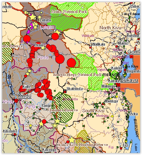
The report ‘Mining activity and mineral trade in the Kivu hinterland’ was commissioned by the Directorate General for Development (DG DEV) of the European Commission and aims to fill an information gap by identifying the principal mining sites and analysing the trade networks of the ‘eastern hinterland’ of the Democratic Republic of the Congo (DRC), […]
Mining Concessions in the DR Congo (2010)
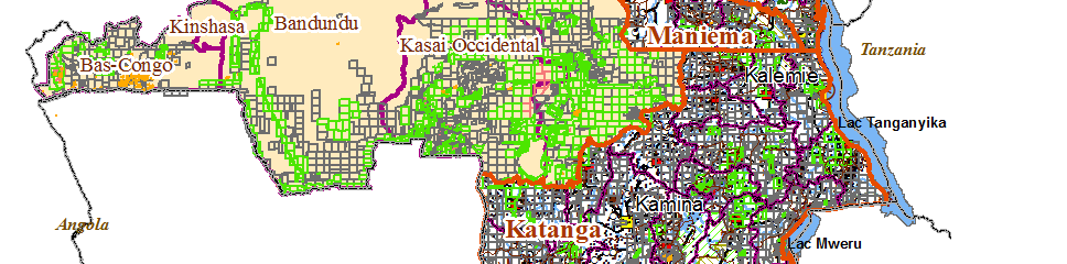
Mining Concessions in the DR Congo (August 2010) IPIS has produced an interactive web map of all mining concessions in the Democratic Republic of the Congo. The current map follows a concession map we published in August 2009 (as an addition to our Interactive Map of Militarised Mining Areas in the Kivus – MiMiKi), which […]
Mapping Conflict Motives: ‘Province Orientale’ (DRC) (2010)
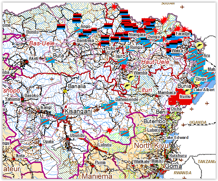
The districts of Ituri, Haut-Uele, Bas-Uele and the territory of Bafwasende continue to suffer from armed groups. Generally speaking, the strength of the armed groups throughout Orientale is limited and their effectives are few. Moreover, there is a considerable presence of the Congolese army. The Uele districts are the two most northern districts of Orientale […]
Accompanying note on the interactive map of militarised mining areas in the Kivus (2009)
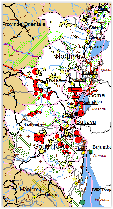
The MiMiKi map is a snapshot of the situation as it was in the period May-July 2009. All the armed groups deployed in the region profit directly from the mining activities. Armed groups have positions at more than half of the sites listed on the MiMiKi map where they obtain an (extra) income. The FARDC […]
Mapping Conflict Motives: Katanga. (Update May- September 2008)
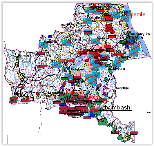
This report is the third (and for the moment the last) in a series of updates following an initial report on conflict motives in the Congolese province of Katanga. It analyses the most important security developments from May 2008 until September 2008. Download in pdf or open with issuu reader. The web maps We have […]
Mapping Conflict Motives: Katanga. (Update December 2007 – May 2008)
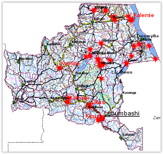
This report is the second in a series of updates following an initial report on conflict motives in the Congolese province of Katanga. It analyses the most important security developments from December 2007 until May 2008. Download in pdf or open with issuu reader. December 2007-May 2008 This report is the second in a […]
Mapping Conflict Motives: Eastern DRC (March 2008)
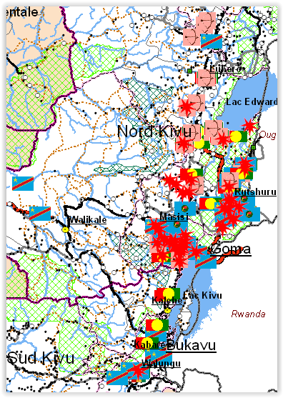
The eastern DRC is still plagued by violent conflict. The centre of the conflict is the ‘Petit Nord’ region where two large armed groups, a coalition of smaller bands of armed men and the government army are all involved in a persisting battle causing enormous human suffering. In the neighbouring regions of the ‘Grand Nord’ […]
Mapping interests in conflict areas: Katanga. (Update September-November 2007)
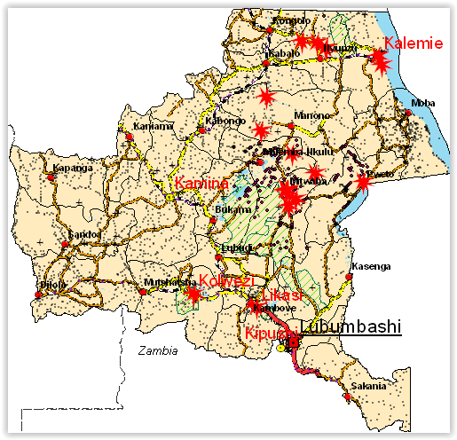
The International Peace Information Service (IPIS), a Belgium based research NGO, is a member of the Fatal Transactions consortium, which carries out the action ‘From Fatal to Fair Transactions’ with co-funding from the EU. IPIS’ contribution to this action is to develop a tool for the analysis of conflict drivers. Making use of GIS (Geographic […]
Mapping interests in conflict areas: Katanga (August 2007)
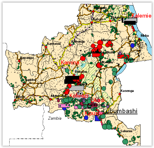
Revised version August 2007. ‘Mapping interests in conflict areas: Katanga’ reports on the presence of (ex-) combatants in the Congolese province of Katanga. It focuses on two broad categories: the ‘Forces Armées de la République Démocratique du Congo’ (FARDC) and the Mayi-Mayi militias. There is no significant presence of other armed groups in the region. […]