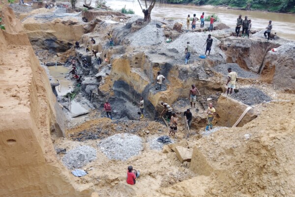
Analyse de la carte interactive des zones d’exploitation minière artisanale dans l’est de la République démocratique du Congo (Mise à jour 2023)
22 décembre 2023Depuis 2009, IPIS a cartographié et collecté des données sur plus de 2 800 sites d’exploitation minière artisanale et à petite échelle (EMAPE) dans l’est de la République démocratique du Congo (RDC). Dans ce rapport, IPIS fournit sa mise à jour 2023 de l’état de l’EMAPE dans l’est de la RDC, basée sur des données provenant de plus de 829 sites artisanaux et de petite échelle dans la zone entre 202
Responsible mining scorecard in eastern DRC
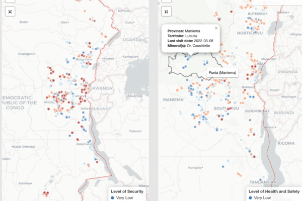
31 août 2022Over the years, IPIS has systematically collected mine site and trade hub level data on artisanal and small-scale mining (ASM) in eastern DRC. This data collection has enabled IPIS to generate a sizable database of more than 3,000 ASM sites that draws both on sites visited by IPIS and data from third party sources including the Congolese mining cadastre and the Mini
New large-scale mapping project of artisanal and small-scale mining in eastern DRC launched
10 novembre 2021Over the next two years, IPIS – in partnership with USAID, Tetra Tech and the Congolese Ministry of Mines (SAEMAPE) – will undertake a large-scale mapping effort of artisanal and small-scale mining sites in the eastern Democratic Republic of Congo (DRC), with the aim to provide observers, suppliers and policymakers with reliable data to understand artisanal mineral supply chains and conflict finan

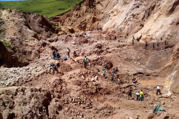
Story map of ASM sites in the DRC
6 octobre 2020Explore IPIS’ web map of the eastern Democratic Republic of the Congo (DRC) with a guided narrative In its new story map, IPIS presents data gathered on eastern DRC’s artisanal mining sector and highlights key information from its reports investigating the interactions between natural resources and conflict dynamics in the region. Data was gathered on around 2,700 mining sites, and the principal m
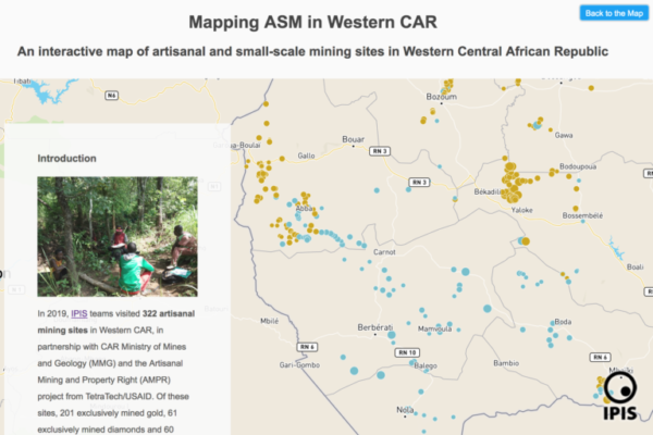
Story map of ASM sites in Central African Republic
4 juin 2020Discover a new approach to IPIS’ interactive webmap of artisanal and small-scale mining (ASM) sites in the Central African Republic through this interactive story map. In partnership with national authorities in Central African Republic (CAR) and USAID’s Artisanal Mining and Property Rights project, IPIS mapped and analysed the artisanal mining sector in the western part of the country, and outlin
Missing Maps Mapathon / Wednesday, 26 October 2016
4 octobre 2016IPIS, Missing Maps and OpenStreetMap Belgium organise another Missing Maps MAPATHON on Wednesday October 26, at the IPIS library! IPIS Research and Openstreetmap Belgium invite you to come map for the Missing Maps project with us. By doing so, you will learn how to create the open maps that make the work of NGOs like Doctors Without Borders or IPIS Research easier. After the event, you will be abl

Missing Maps mapathon / Wednesday, 29 June 2016
8 juin 2016IPIS, Missing Maps and OpenStreetMap Belgium organise another Missing Maps MAPATHON on Wednesday, June 29, at the IPIS library! IPIS Research and Openstreetmap Belgium invite you to come map for the Missing Maps project with us. By doing so, you will learn how to create the open maps that make the work of NGOs like Doctors Without Borders or IPIS Research easier. After the event, you will be able
Missing Maps mapathon / Wednesday, 23 March 2016
17 février 2016IPIS, Missing Maps and OpenStreetMap Belgium organise the mapping event ‘Missing Maps mapathon’ on Wednesday March 23 at the IPIS library! IPIS Research and Openstreetmap Belgium invite you to come map for the Missing Maps project with us. Doing so, you will learn how to create the open maps that make the work of NGOs like Doctors Without Borders or IPIS Research easier. After the event, you will
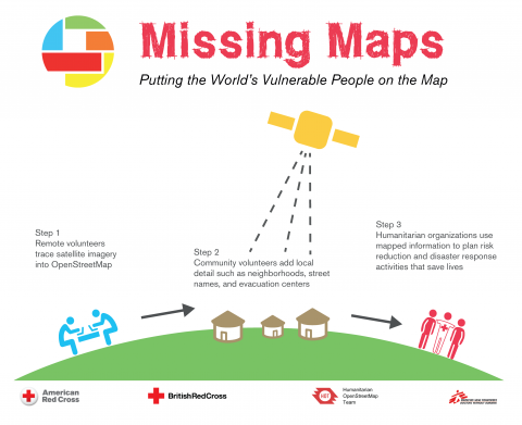
COMING SOON! Missing Maps mapathon / Wednesday, 9 December 2015
12 novembre 2015IPIS, Missing Maps and OpenStreetMap Belgium organise the mapping event ‘Missing Maps mapathon’ on Wednesday December 9th at the IPIS library! The Missing Maps project is an open collaboration between the Humanitarian OpenStreetMap Team (HOT), Doctors without Borders UK, and the British and American Red Cross. The goal of the project is to map the areas of the world that are the most sensitive to