Missing Maps mapathon / Wednesday, 23 March 2016
February 17, 2016IPIS, Missing Maps and OpenStreetMap Belgium organise the mapping event ‘Missing Maps mapathon’ on Wednesday March 23 at the IPIS library! IPIS Research and Openstreetmap Belgium invite you to come map for the Missing Maps project with us. Doing so, you will learn how to create the open maps that make the work of NGOs like Doctors Without Borders or IPIS Research easier. After the event, you will
Presentation of SAESSCAM database on Artisanal and Small-scale Mining
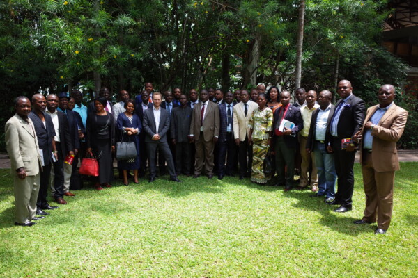
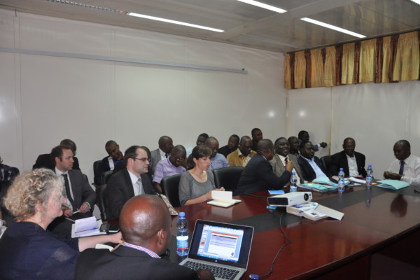
November 26, 2015From November 17 to 19, IPIS presented its work during a multi stakeholder meeting in Kinshasa as part of a project to support artisanal and small scale mining in DRC. In partnership with Pact and Estelle Levin LTD, IPIS has provided capacity reinforcement for the Service d’Assistance et d’Encadrement du Small Scale Mining (SAESSCAM), a governmental agency. IPIS focused on reviewing existing data
Mineral supply chains and conflict links in eastern democratic republic of congo
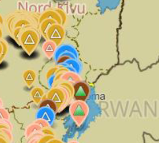
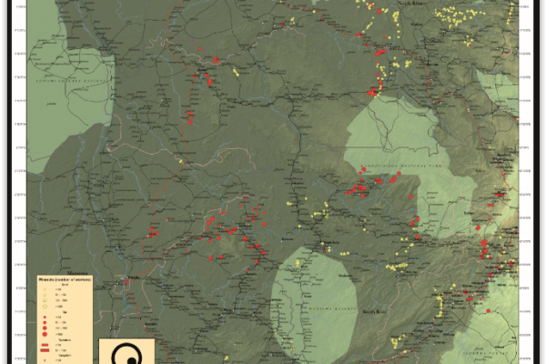
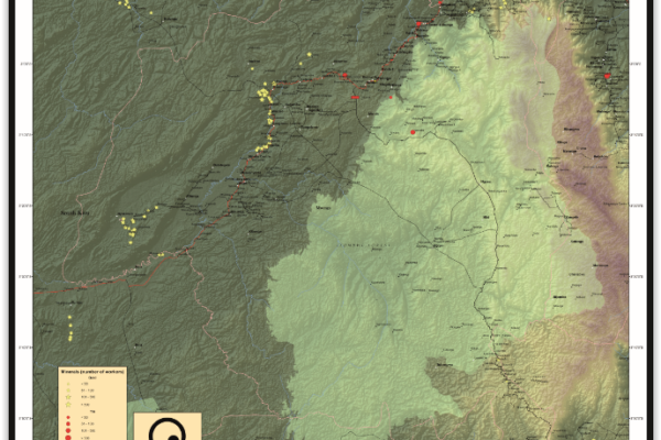
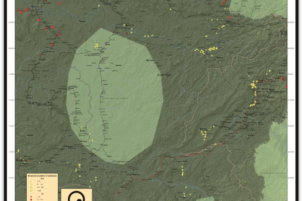
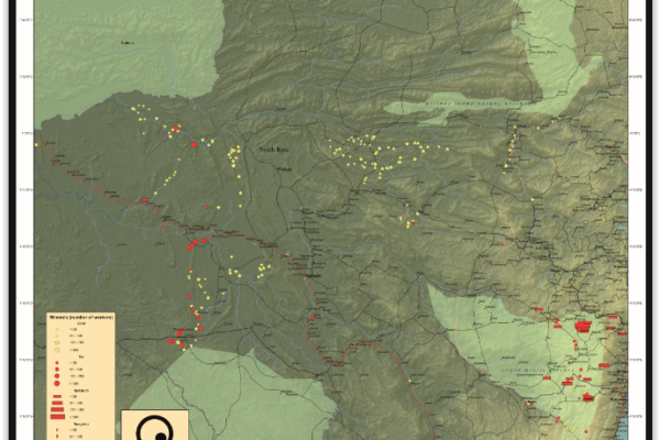
November 25, 2015Between 2009 and 2010 IPIS collected data on over 550 mining sites as part a conflict mapping exercise focusing on Eastern Democratic Republic of Congo (DRC). With the collaboration of Congolese researchers, IPIS collected the coordinates of the most important mining sites and information on on-site security in North and South Kivu provinces, Maniema, Northern Katanga and southeast Province Orient
COMING SOON! Missing Maps mapathon / Wednesday, 9 December 2015
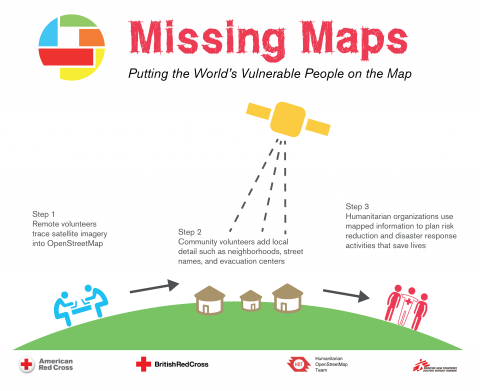
November 12, 2015IPIS, Missing Maps and OpenStreetMap Belgium organise the mapping event ‘Missing Maps mapathon’ on Wednesday December 9th at the IPIS library! The Missing Maps project is an open collaboration between the Humanitarian OpenStreetMap Team (HOT), Doctors without Borders UK, and the British and American Red Cross. The goal of the project is to map the areas of the world that are the most sensitive to
Renforcement des capacités en gestion de données
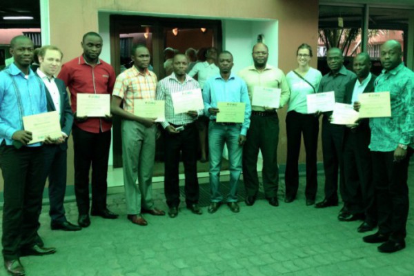
July 24, 2015English version below. Du 19 au 23 juillet 2015, l’Equipe d’IPIS a organisé une formation à Kinshasa destinée aux agents de la Division des Mines, du Cadastre Minier et du Service d’accompagnement et d’encadrement du Small-scale mining (SAESSCAM). Cette formation de quatre jours a permis de renforcer les capacités des membres de ces organisations gouvernementales notamment dans les d
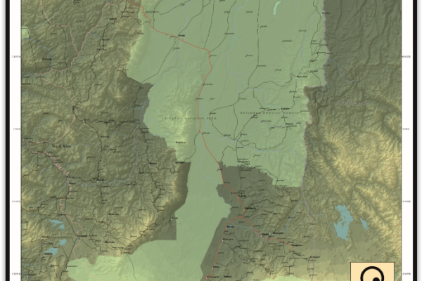
Maniema province – A0 map (2015)
June 4, 2015This is an A0 map of the Lubutu, Punia and Pangi Territories in Maniema Province, DRC
The Right to Water and Sanitation: A Practical Guide
June 1, 2015This guide is designed to raise awareness on the importance of the right to water and sanitation. It is addressed to those who work at the grassroots, and aims at helping them with practical ways to address the challenges of poverty and water issues. The guide adopts a bottom-up approach to highlight the steps that citizens and communities can take together with governments to address water and sa
Exploitations artisanales et à petite échelle en RD Congo
April 1, 2015Launching ceremony of the artisanal and small scale mining project with Pact, ELL and IPIS in Kinshasa. Picture by Pact. – English below – Du 23 au 26 février, IPIS a participé au séminaire de lancement d’un nouveau projet “d’Elaboration d’un document stratégique sur les exploitations artisanales et à petite échelle”. En partenariat avec Pact et Estelle Levin LTD, IPIS travaille au renforcement de
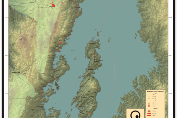
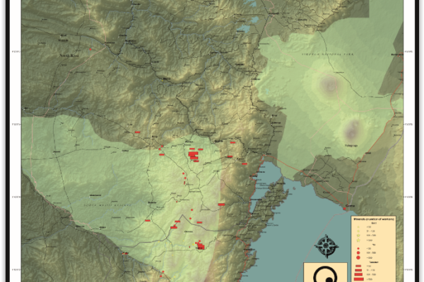
Idjwi Territory – A0 Map
March 5, 2015Idjwi Territory, South Kivu Province, DRC Idjwi Territory, South Kivu Province, DRC (Detail)
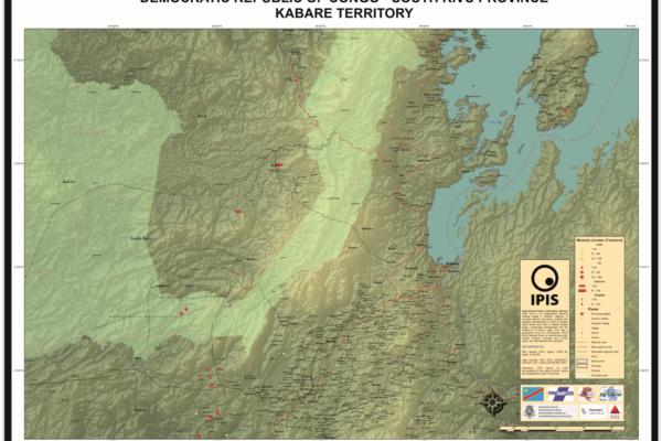
Kabare Territory, South Kivu – A0 Map
March 5, 2015Kabare Territory, South Kivu Province, DRC Kabare Territory, South Kivu Province, DRC (Detail)
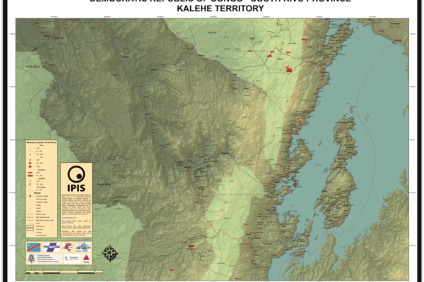
Kalehe Territory – A0 Map
March 5, 2015Kalehe Territory, South Kivu Province, DRC Kalehe Territory, South Kivu Province, DRC (Detail)
Mwenga Territory – A0 Map
March 5, 2015Mwenga Territory, South Kivu Province, DRC Mwenga Territory, South Kivu Province, DRC (Detail)
Shabunda Territory – A0 Map
March 5, 2015Shabunda Territory, South Kivu Province, DRC Shabunda Territory, South Kivu Province, DRC (Detail)
Uvira Territory – A0 Map
March 5, 2015Uvira Territory, South Kivu Province, DRC Uvira Territory, South Kivu Province, DRC (Detail)
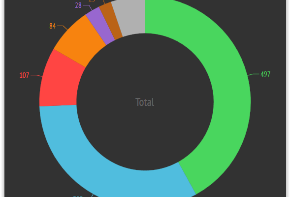
Infographic – Mapping mining areas in eastern DRC
January 28, 2015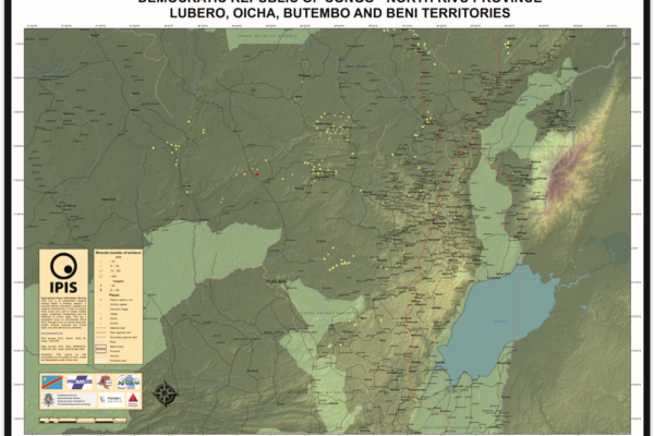
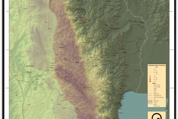
Lubero, Oicha, Butembo and Beni Territories – A0 Map
December 5, 2014Lubero, Oicha, Butembo and Beni Territories, North Kivu Province, DRC Lubero, Oicha, Butembo and Beni Territories, North Kivu Province, DRC (Detail)
Masisi Territory – A0 Map
December 5, 2014Masisi Territory, North Kivu Province, DRC Masisi Territory, North Kivu Province, DRC (Detail)
Rutshuru Territory – A0 Map
December 5, 2014Rutshuru Territory, North Kivu Province, DRC Rutshuru Territory, North Kivu Province, DRC (Detail)
Walikale Territory – A0 Map
December 5, 2014Walikale Territory, North Kivu Province, DRC Walikale Territory, North Kivu Province, DRC (Detail)
De Belgische ontwikkelingssamenwerking en fragiele staten: een kloof tussen beleid en praktijk?
May 8, 2014Zo goed als de helft van de Belgische middelen voor ontwikkelingshulp gaat naar partnerlanden waar de overheid niet de capaciteit, wil en/of legitimiteit heeft om de publieke zaken efficiënt te beheren, voor veiligheid te zorgen en om de bevolking uit de armoede te halen. Omdat traditionele hulprecepten in deze ‘fragiele staten’ op hun limieten stuiten, is er de laatste decennia een internationaal