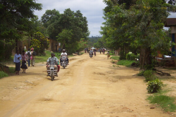
Extractive Orders: a political geography of public authority in Ituri, DR Congo
April 19, 2016Public authority is an essentially contested concept in the Democratic Republic of Congo (DRC). Not only is the ‘state of the state’ subject to profound disagreement in academic debates, but public authority on the ground is also the focal point of heated contestation. While some argue that the DRC does not exist as a state from the perspective of normative understandings of statehood, others argu
Mineral supply chains and conflict links in eastern democratic republic of congo
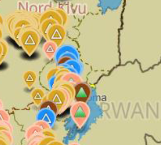
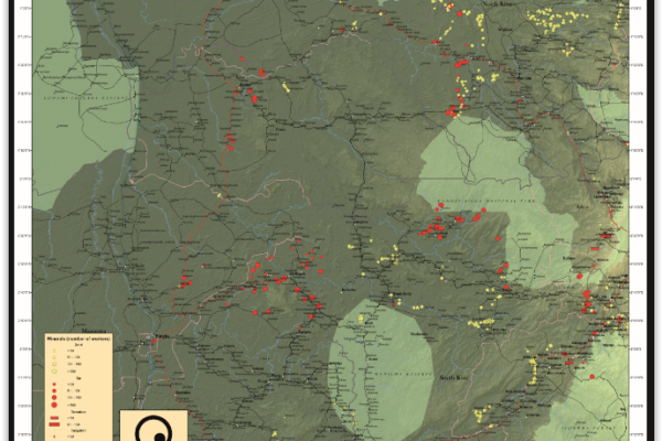
November 25, 2015Between 2009 and 2010 IPIS collected data on over 550 mining sites as part a conflict mapping exercise focusing on Eastern Democratic Republic of Congo (DRC). With the collaboration of Congolese researchers, IPIS collected the coordinates of the most important mining sites and information on on-site security in North and South Kivu provinces, Maniema, Northern Katanga and southeast Province Orient
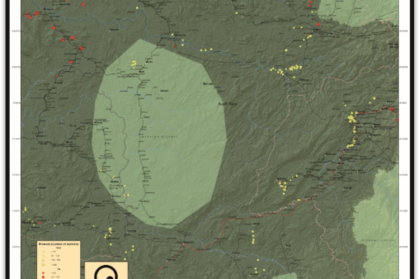
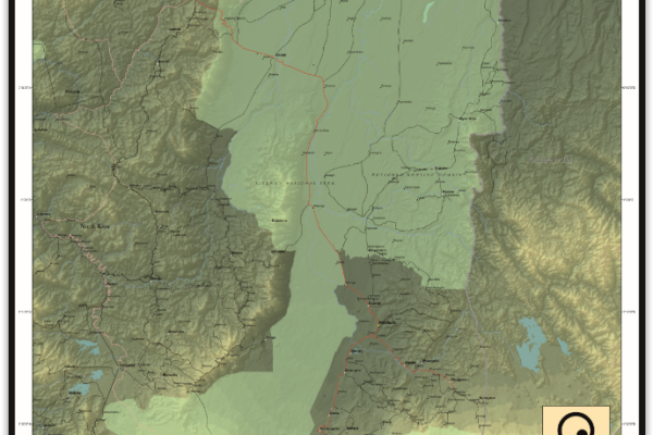
Maniema province – A0 map (2015)
June 4, 2015This is an A0 map of the Lubutu, Punia and Pangi Territories in Maniema Province, DRC
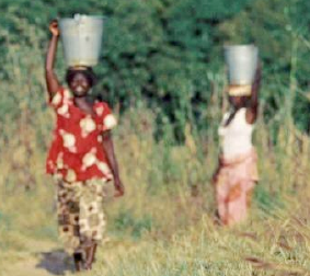
The Right to Water and Sanitation: A Practical Guide
June 1, 2015This guide is designed to raise awareness on the importance of the right to water and sanitation. It is addressed to those who work at the grassroots, and aims at helping them with practical ways to address the challenges of poverty and water issues. The guide adopts a bottom-up approach to highlight the steps that citizens and communities can take together with governments to address water and sa
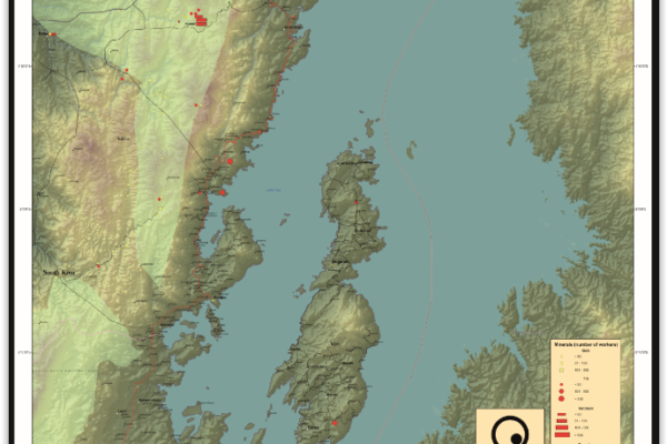
Idjwi Territory – A0 Map
March 5, 2015Idjwi Territory, South Kivu Province, DRC Idjwi Territory, South Kivu Province, DRC (Detail)
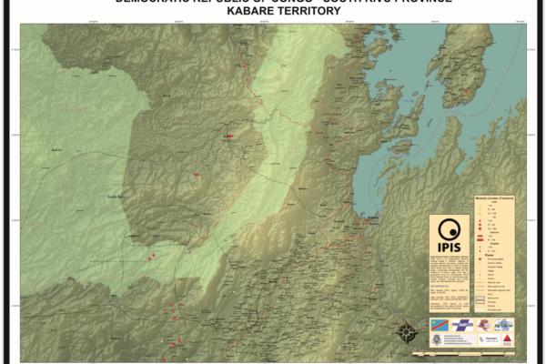
Kabare Territory, South Kivu – A0 Map
March 5, 2015Kabare Territory, South Kivu Province, DRC Kabare Territory, South Kivu Province, DRC (Detail)
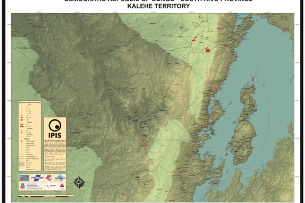
Kalehe Territory – A0 Map
March 5, 2015Kalehe Territory, South Kivu Province, DRC Kalehe Territory, South Kivu Province, DRC (Detail)
Mwenga Territory – A0 Map
March 5, 2015Mwenga Territory, South Kivu Province, DRC Mwenga Territory, South Kivu Province, DRC (Detail)
Shabunda Territory – A0 Map
March 5, 2015Shabunda Territory, South Kivu Province, DRC Shabunda Territory, South Kivu Province, DRC (Detail)
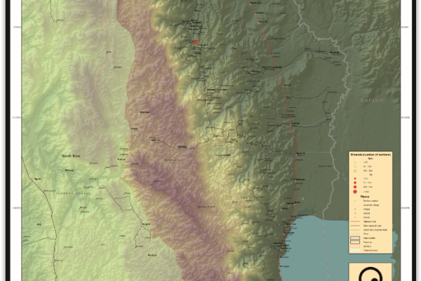
Uvira Territory – A0 Map
March 5, 2015Uvira Territory, South Kivu Province, DRC Uvira Territory, South Kivu Province, DRC (Detail)
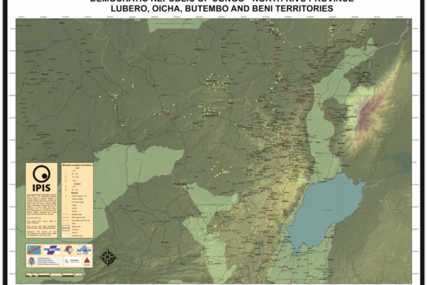
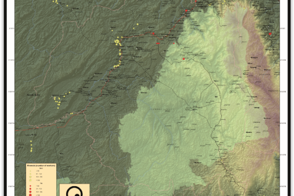
Lubero, Oicha, Butembo and Beni Territories – A0 Map
December 5, 2014Lubero, Oicha, Butembo and Beni Territories, North Kivu Province, DRC Lubero, Oicha, Butembo and Beni Territories, North Kivu Province, DRC (Detail)
Masisi Territory – A0 Map
December 5, 2014Masisi Territory, North Kivu Province, DRC Masisi Territory, North Kivu Province, DRC (Detail)
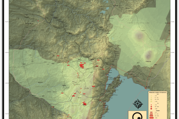
Rutshuru Territory – A0 Map
December 5, 2014Rutshuru Territory, North Kivu Province, DRC Rutshuru Territory, North Kivu Province, DRC (Detail)
Walikale Territory – A0 Map
December 5, 2014Walikale Territory, North Kivu Province, DRC Walikale Territory, North Kivu Province, DRC (Detail)
De Belgische ontwikkelingssamenwerking en fragiele staten: een kloof tussen beleid en praktijk?
May 8, 2014Zo goed als de helft van de Belgische middelen voor ontwikkelingshulp gaat naar partnerlanden waar de overheid niet de capaciteit, wil en/of legitimiteit heeft om de publieke zaken efficiënt te beheren, voor veiligheid te zorgen en om de bevolking uit de armoede te halen. Omdat traditionele hulprecepten in deze ‘fragiele staten’ op hun limieten stuiten, is er de laatste decennia een internationaal
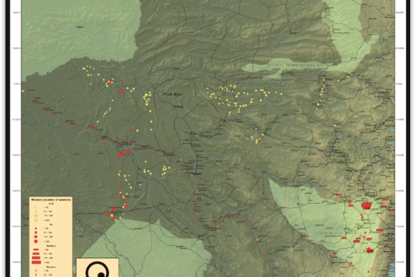
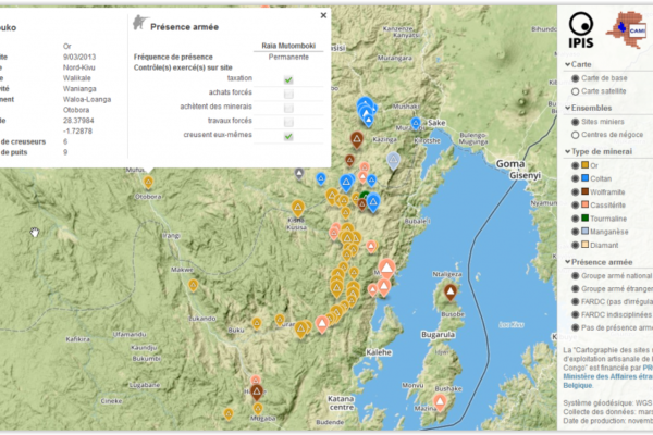
Analysis of the interactive map of artisanal mining areas in Eastern DRC – May 2014 Update
April 30, 2014In collaboration with the Congolese mining cadastre (CAMI), mining service SAESSCAM and representatives from local civil society organisations, IPIS organised a series of field visits to monitor artisanal mining activities and the involvement of armed groups and criminal networks in mineral exploitation and trade. This resulted in the publication of an interactive web map providing information on
Initiatives en matière de ‘minerais de conflit’ en RD Congo: perceptions des communautés minières locales
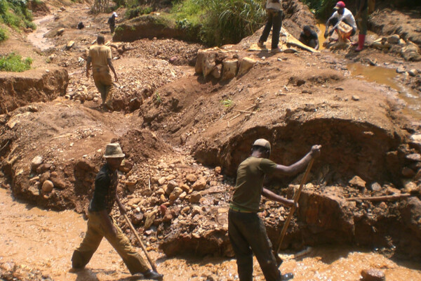
December 16, 2013L’exploitation minière est une importante source de revenus pour de nombreuses communautés dans l’est de la République démocratique du Congo (RDC). Cette même richesse minière joue cependant aussi un rôle majeur dans la persistance de l’insécurité dans certaines parties du pays. Les revenus générés par le commerce des minerais fournissent des moyens d’opération aux groupes armés ainsi qu’un financ
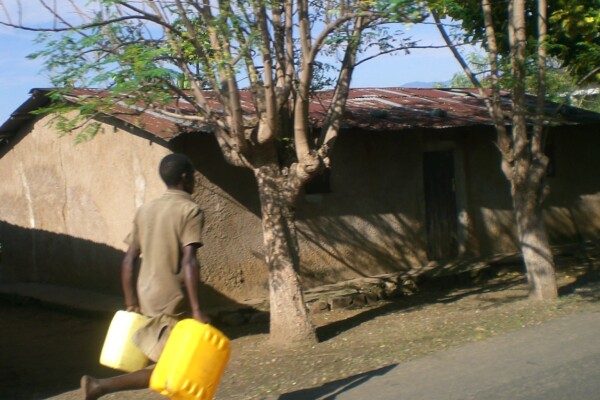
In search of clean water: human rights and the mining industry in Katanga, DRC
November 26, 2013Today, around 1,8 billion people in the world do not have access to safe water. In the Democratic Republic of the Congo, the most water-rich country in Africa, 51 million people lack access to potable water; only 26% of the population has access to safe drinking water. This is one of the lowest access rates in the world. In the Katanga province, rich in cobalt and copper, some industrial mining co
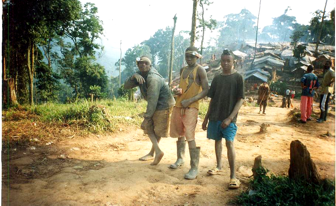
Travail des enfants dans le site minier d’exploitation artisanale de Bisie en territoire de Walikale. Une crise oubliée en République Démocratique du Congo
November 19, 2013Plus de deux décennies après l’entrée en vigueur de la Convention relative aux droits de l’enfant (1989) en République Démocratique du Congo (RDC), la situation des enfants dans le territoire de Walikale demeure critique. Certes, le travail des enfants est un problème mondial, mais c’est essentiellement dans les pays en développement qu’il compte la grande majorité. L’expérience montre que le défi
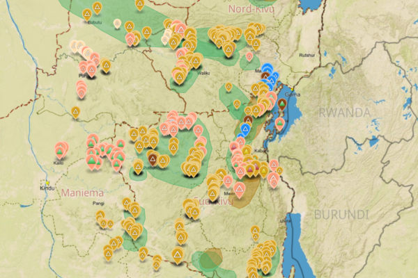
Analysis of the interactive map of artisanal mining areas in Eastern DR Congo (2013)
November 13, 2013In August 2009 the ‘International Peace Information Service’ (IPIS) published a first map of militarised mining areas in Eastern DR Congo. By 2012, the international interest in the issue had grown but the map was out-dated. To find a structural solution, IPIS sat down with the Congolese mining cadastre (CAMI) and agreed to set up a permanent system to monitor artisanal mining activities and the i