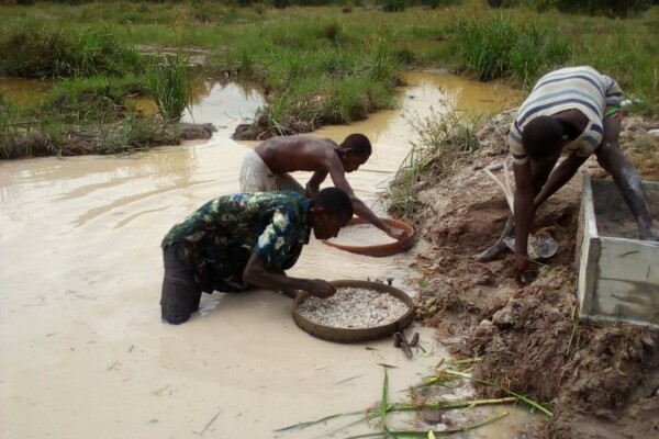
Grassroots research on local diamond mining impact
March 1, 2022During 2021, IPIS supported members of the Kimberley Process Civil Society Coalition (KP CSC) in a series of grassroots studies on the human rights, socio-economic and environmental impact of diamond mining in eight African countries. IPIS provided online trainings on field survey methodology as well as editorial support to ten civil society organisations who carried out independent field res
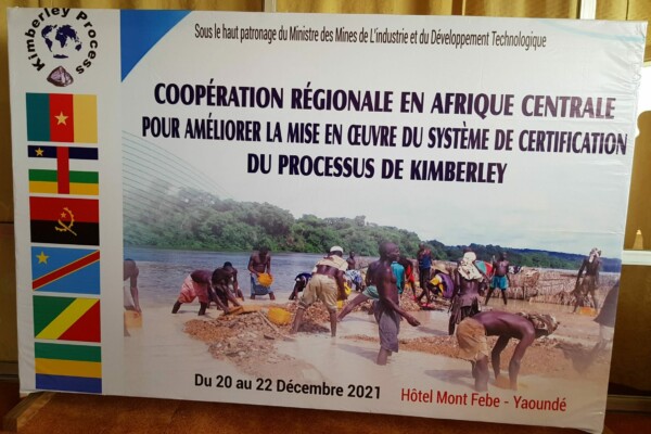
Report of high-level workshop on the fight against fraud and smuggling of rough diamonds in Central Africa
February 14, 2022Regional Cooperation to Enhance the Implementation of the Kimberley Process in Central Africa In December 2021, the Working Group on Artisanal and Alluvial Production (WGAAP) of the Kimberley Process (KP) and the Cameroonian government hosted the second Central African regional cooperation workshop in Yaoundé to build understanding, share experiences and formulate recommendations on the fight agai
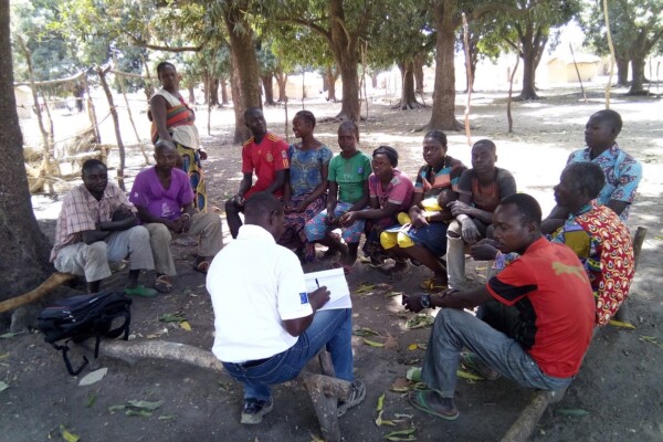
Promoting peaceful and seasonal migration in Northern Central African Republic
February 9, 2021“You can negotiate with an armed group, not with the drought” The borderlands of the Central African Republic (CAR) are home to one of the largest seasonal livestock migrations (transhumance) in the world. Decades of unrest and crisis, however, have brutally disrupted most aspects of herding—the routes taken, the people involved, governance mechanisms, as well as relations to local populations. To
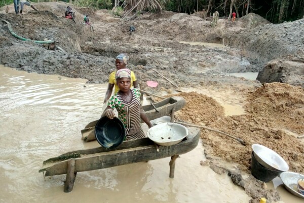
The Impact of Covid-19 on artisanal mining in Western Central African Republic
January 21, 2021To assess the socio-economic impact of the Covid-19 pandemic on the artisanal and small-scale mining (ASM) sector in Western Central African Republic (CAR), IPIS conducted a series of phone surveys with key informants located on 260 gold and diamond mining sites. The Covid-19 pandemic has been particularly harsh on the artisanal mining sector in Western CAR, emphasizing existing trends since the 2
The impact of Covid-19 on artisanal mines in western CAR
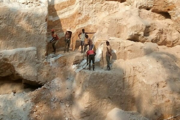
October 16, 2020To assess the socio-economic impact of the Covid-19 pandemic on the artisanal and small-scale sector in the Central African Republic, IPIS conducted a series of phone interviews targeting key informants to collect information on minerals production, prices and illegal taxation on gold and diamond artisanal mining sites in western CAR.
The impact of Covid-19 on Gold and Diamond artisanal mines in Western Central African Republic
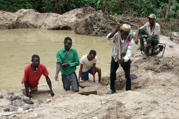
July 24, 2020Since the outbreak of the COVID-19 pandemic, IPIS closely monitors the impact of the Covid-19 pandemic on 3T, Gold and Diamond mines and national supply chains in Tanzania, the Central African Republic (CAR) and the DR Congo. Through structured quantitative and qualitative data collection, IPIS measures the impact on a large amount of mining sites. IPIS is working through its long-established netw
Story map of ASM sites in Central African Republic
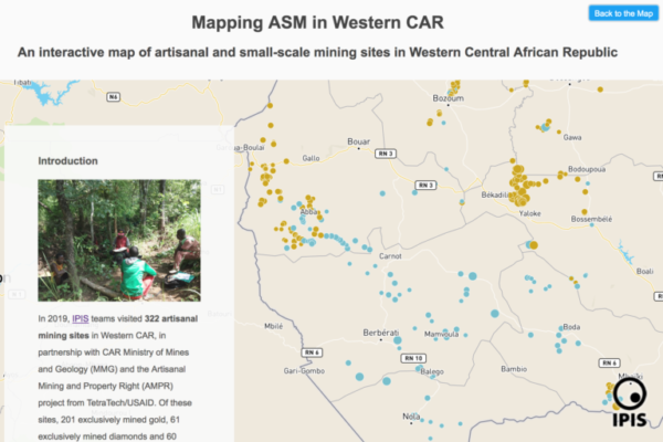
June 4, 2020Discover a new approach to IPIS’ interactive webmap of artisanal and small-scale mining (ASM) sites in the Central African Republic through this interactive story map. In partnership with national authorities in Central African Republic (CAR) and USAID’s Artisanal Mining and Property Rights project, IPIS mapped and analysed the artisanal mining sector in the western part of the country, and outlin
Mapping artisanal mining sites in the Western Central African Republic (2019)
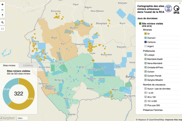
April 7, 2020This report presents an analysis of the artisanal mining sector in western Central African Republic (CAR) and outlines some of the challenges surrounding gold and diamond mining, trade and export. From April to July 2019, the International Peace Information Service (IPIS), in partnership with national authorities, carried out a mapping of artisanal mining sites in western CAR. A total of 322 sites
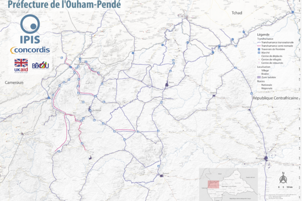
Map Pastoralism Ouham Pendé (2019)
September 12, 2019Each year the annual migration of transnational transhumance through the prefecture of Ouham-Pende, in northwestern Central African Republic (CAR), uproots a deep-seated mistrust between nomadic and sedentary communities. Escalating militancy and environmental pressures in the region has only amplified these issues in recent years.In partnership with Concordis International, IPIS hopes to enhance
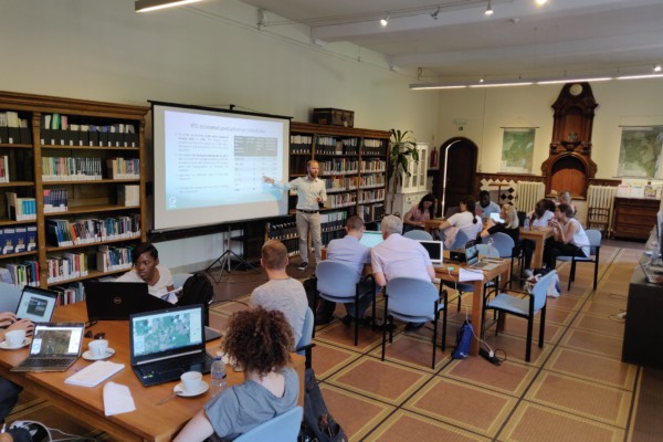
IPIS welcomes University of Antwerp Summer School for workshop on artisanal diamond mining
September 2, 2019On August 28th, 2019, 21 students from the University of Antwerp’s ‘Mine to Finger’ Summer School on diamonds were engaged on “The use of digital maps and open data in the analysis of artisanal mining” with a case-study of the Central African Republic (CAR). The students, with diverse backgrounds, engaged in critical and nuanced discussions on artisanal diamond mining. The workshop kicked-off with
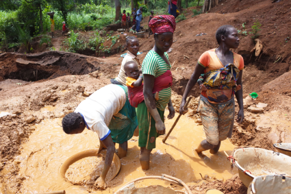
Mapping ASM sites in the Central African Republic: An update from our field teams
July 2, 2019Since February 2019, IPIS is partnering with the Artisanal Mining and Property Rights (AMPR) project from the U.S. Agency for International Development (USAID) to increase awareness and understanding of the opportunities and challenges of establishing responsible gold supply chains in the Central African Republic (CAR). As part of this project, IPIS is supporting the Ministry of Mines in mapping a
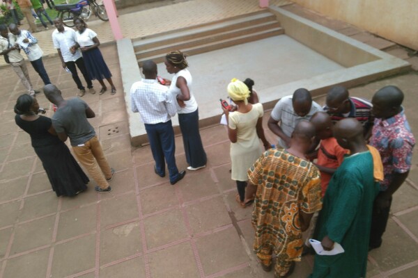
New project of mapping artisanal and small-scale mining sites in the Central African Republic
May 2, 2019Following a successful training in Bangui with members from civil society organizations and field officers from the Kimberley Process focal point at the Ministry of mines and geology of the Central African Republic (CAR), IPIS will start field based research to map artisanal and small-scale gold and diamond mining sites in Western CAR. This study will focus on quantitative research through Mobile
Article – The Political Economy of Roadblocks in the Central African Republic
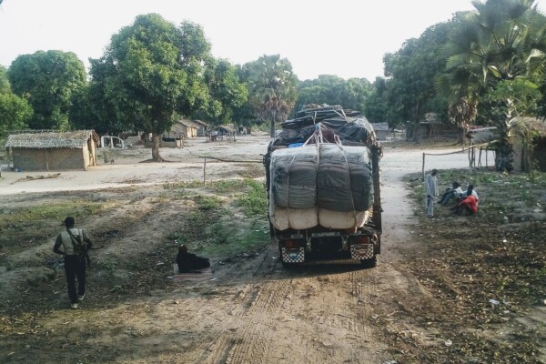
October 2, 2018From September 2016 to September 2017, the International Peace Information Service (IPIS) and the Danish Institute for International Studies (DIIS) conducted a mapping of roadblocks in the Central African Republic. This data collection campaign also features more than 200 interviews with various actors and was combined with data from other reports on roadblocks to form a comprehensive study on the

Central African Republic – Ouham-Pende Basemap (2019)
September 17, 2018Each year the annual migration of transnational transhumance through the prefecture of Ouham-Pende, in northwestern Central African Republic (CAR), uproots a deep-seated mistrust between nomadic and sedentary communities. Escalating militancy and environmental pressures in the region has only amplified these issues in recent years. These maps, created by IPIS, detail the towns, villages, roads, ID
Central African Republic: A Conflict Mapping (2018)
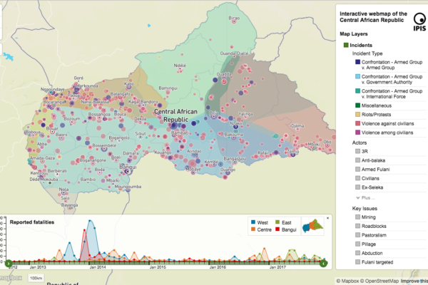
September 16, 2018In a new report and webmap on the longstanding crisis in the Central African Republic (CAR), IPIS points out that access to resources remains the predominant driver of both armament and conflict in CAR. All armed groups operating in CAR are engaged in predation on one or more economic sectors. Such predation is not only a key determinant of an armed group’s movements and activities, but prov
The Politics of Pillage: the political economy of roadblocks in the Central African Republic (2017)
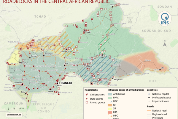
December 7, 2017IPIS puts roadblocks on the map as key mechanism of conflict funding besides natural resources, revealing its devastating scope in funding armed actors in Democratic Republic of Congo and Central African Republic Mapping over a thousand roadblocks, IPIS uncovers the shocking extent of armed predation on trade routes in conflict-ridden Central Africa. Roadblocks, IPIS claims, have netted armed grou
Pastoralism corridors in Central African Republic (2017)
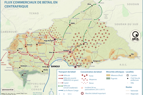
December 1, 2017While pastoralism can generates wealth and economic interdependence between farmers and cattle herders, it can also causes tension and conflicts. In the current Central African Republic crisis context, transnational livestock migrations, particularly by Chadian and Sudanese herdsmen to CAR, have led to clashes between pastoralists and the local population. IPIS has developed a map showing the main
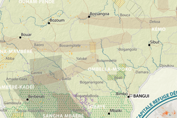
République Centrafricaine: Portait d’un territoire riche en crises (2012 – 2017)
September 19, 2017This poster is a compilation of maps and graphics related to the situation in the Central African Republic. A map of natural resources and poaching corridors presents the known wealth of this country, often considered as conflict drivers in the absence of well functioning state authorities. A small map presents the current armed groups area of influence as well as the number of reported violent in
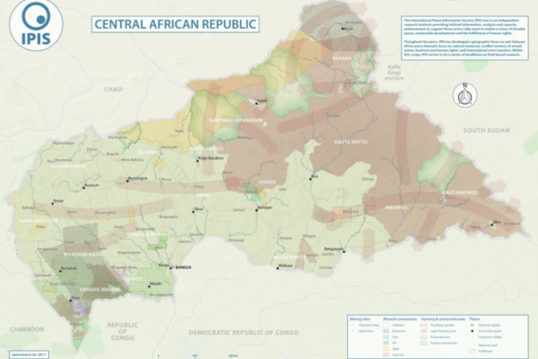
Natural Resources in Central African Republic (2017)
September 12, 2017With an area of 622 984km2, the Central African Republic is the 20th largest country in Africa and one of the poorest in the world. Its economy is highly dependent of the primary sector. Whereas distribution of income is deeply unequal, the unstable political situation and the violent confrontations between different armed groups all around the country weaken the economic growth, especially from
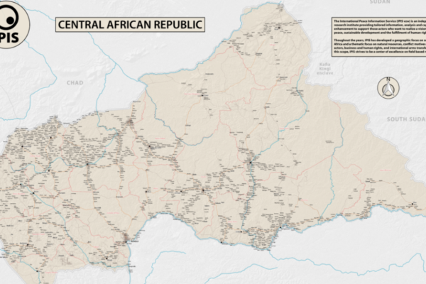
Central African Republic – Road Map (2017)
June 1, 2017In 2013 the Central African Republic entered a period of great instability. The predominantly Muslim rebel coalition, Seleka, seized power. A group of mostly Christian militias, the Anti-balaka, rose up to counter the Seleka. Years of atrocities, horrors and fighting followed. In 2016 a democratic election was held, a sign of hope for the people of the CAR. However, dissolved fractions of the Sele

