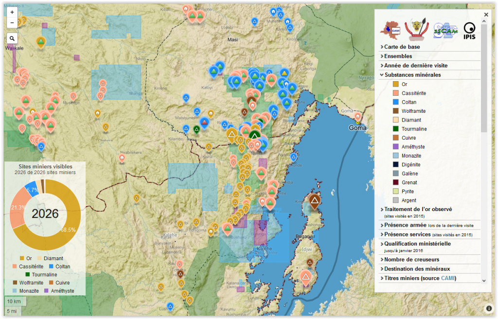
The Belgian research group IPIS has collected data on 2026 artisanal mining sites in eastern DRC over the last couple of years. IPIS observed an armed presence in more than half of the mines.
In an interactive map, updated in 2015, IPIS provides information about the on-site presence of armed groups and the Congolese army (FARDC) as well as indicators of the relative importance of the site. It also shows whether mining sites have been ‘validated’ (licensed to operate) by the Congolese government or if they are covered by supply chain control mechanisms. The accompanying report “Analysis of the interactive map of artisanal mining areas in eastern DR Congo” provides an analysis of the collected data and guidance on how to use the interactive map.
Download the report in PDF or open with ISSUU reader
Click on the map to consult the interactive webmap:
The infographic below summarises the key findings of the report: