Roadblocks in Masisi and Walikale: Predation on movement in turbulent times
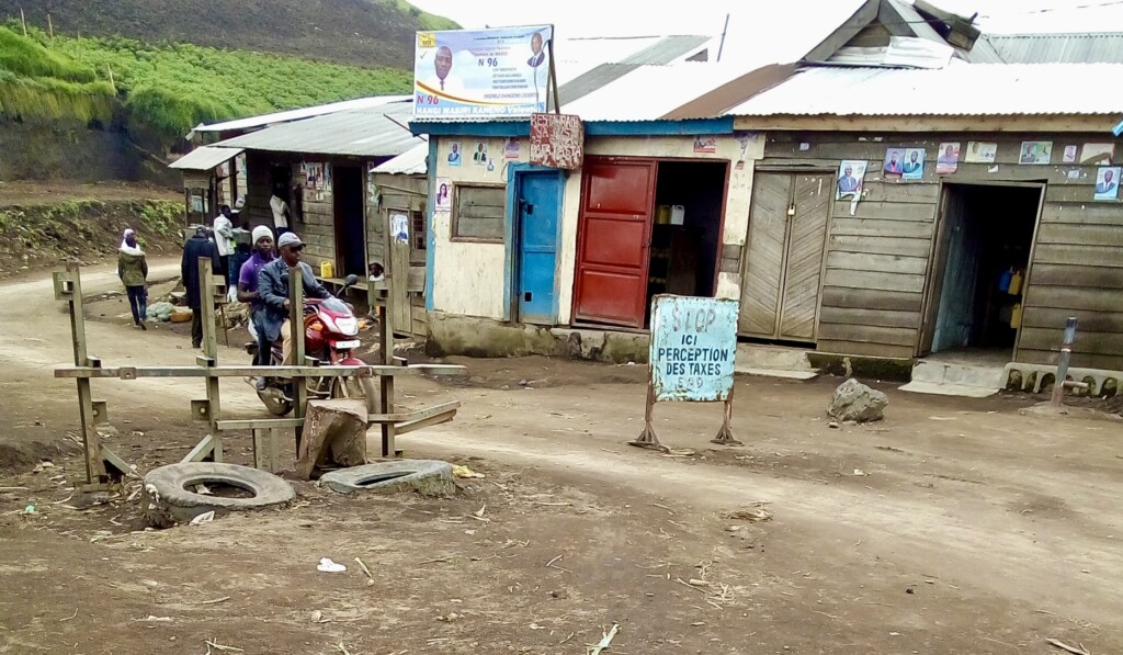
While minerals have centered in research on conflict financing in the Democratic Republic of the Congo, armed actors often rely on alternative sources of revenue to finance their struggles. Among these are the operation of roadblocks. In this report, produced together with ASSODIP and the Danish Institute for International Studies, IPIS studies the linkage between […]
Mapping the political economy of checkpoints in Somalia
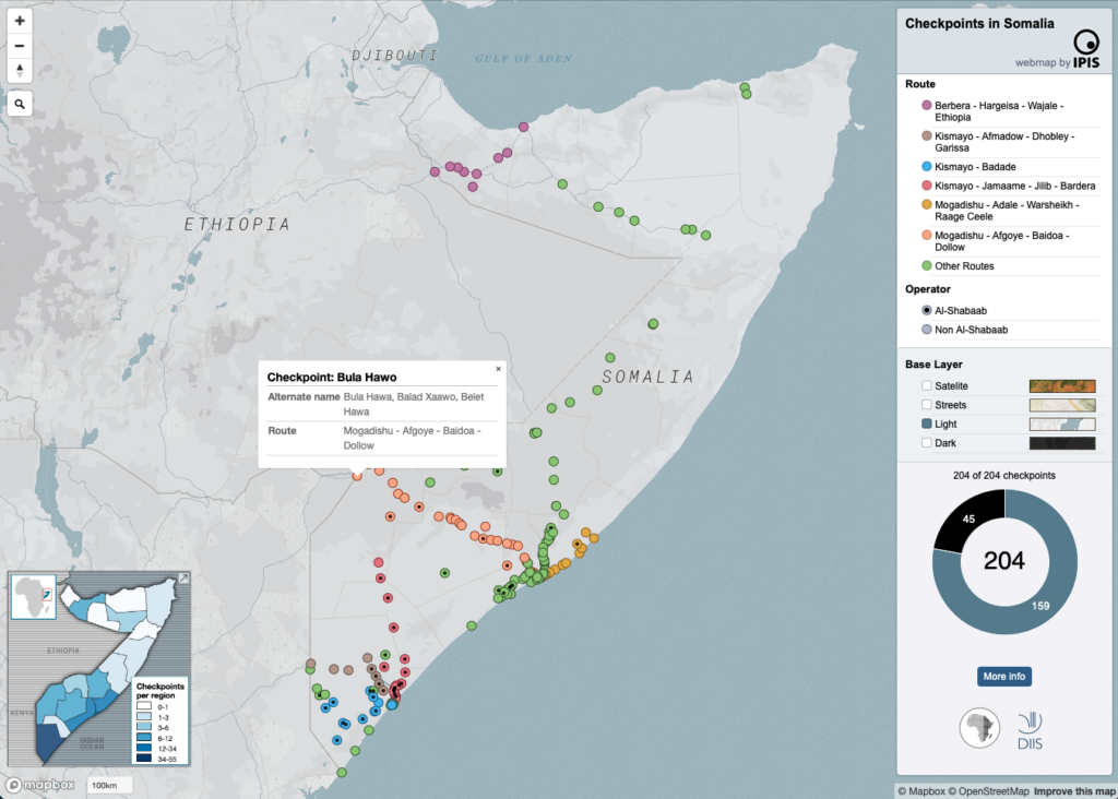
The maps inform users on the locations of roadblocks across Somalia, the distribution of violence at checkpoints as well as the density of checkpoints per administrative region. Different maps also identify varying characteristics of the roadblocks, including their operator, location on a primary/secondary road and the amount paid at the checkpoint as toll.
Maps of checkpoints in South Sudan
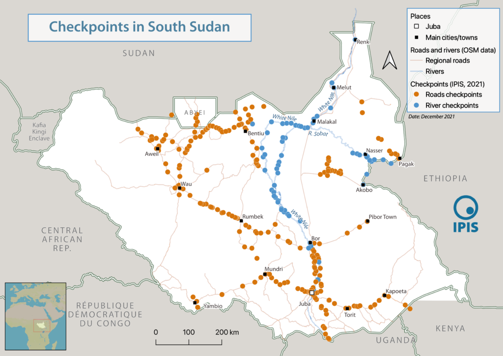
A selection of key maps that accompany the 2021 publication “Checkpoint economy: the political economy of checkpoints in South Sudan, ten years after independence”. Interactive webmap of road-and river checkpoints in South Sudan: A static overview map of all road- and river checkpoints in South Sudan (2020 – 2021 data): A static map with details […]
Central African Republic: A Conflict Mapping (2018)
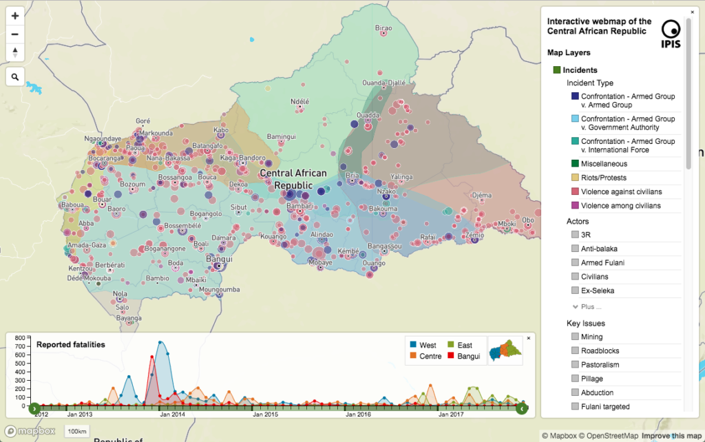
In a new report and webmap on the longstanding crisis in the Central African Republic (CAR), IPIS points out that access to resources remains the predominant driver of both armament and conflict in CAR. All armed groups operating in CAR are engaged in predation on one or more economic sectors. Such predation is not only […]
Roadblocks and artisanal mining sites – North and South Kivu Provinces (2018)
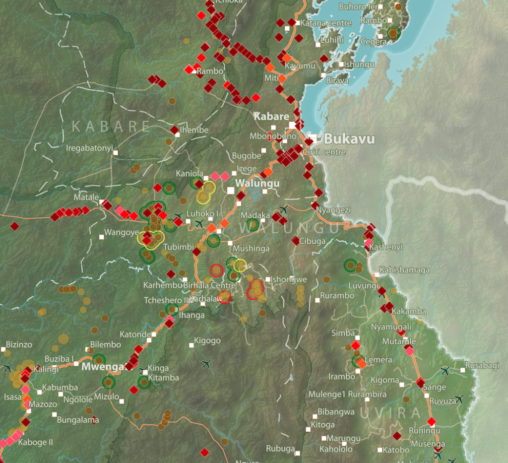
This map show the location of roadblocks and artisanal mining sites in the Kivu provinces. It was made by combining data from our recent report on roadblocks in the area, and data from our recent update of our database and webmap on artisanal mining sites in eastern DRC. Download the full image
Pillage route: l’économie politique des barrages routiers à Walikale et Masisi (2017)
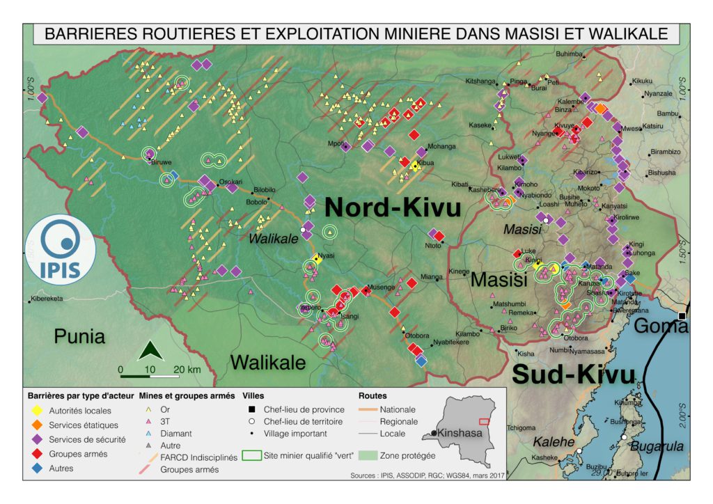
French version below – version française ci-dessous Roadblocks are a ubiquitous phenomenon in Eastern Congo. In an effort to map the scope of this phenomenon as well as its significance in the political economy of conflict, IPIS has embarked on a collaboration with the Danish Institute for International Studies. The point of departure is […]