
IPIS continues to call for reform in the Kimberley Process
December 18, 2017IPIS attended the Kimberley Process Plenary (9-14 December) as a member of the KP Civil Society Coalition. Over the last couple of years, IPIS has repeatedly voiced its concerns on the functioning of the KP. Within the CSO coalition, IPIS has been calling for meaningful reforms, both on the scope of the definition of conflict diamonds and the internal controls on governments to e
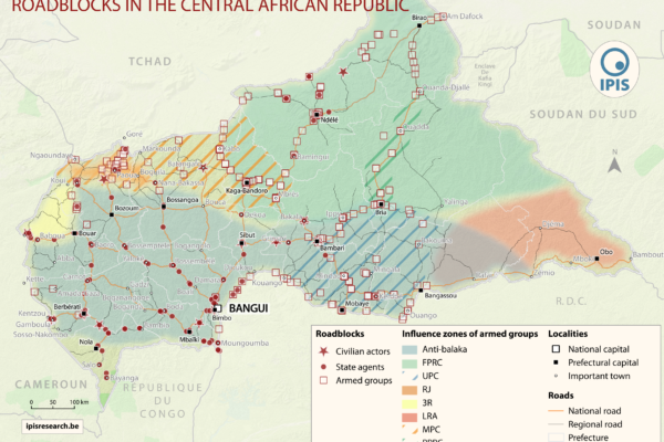
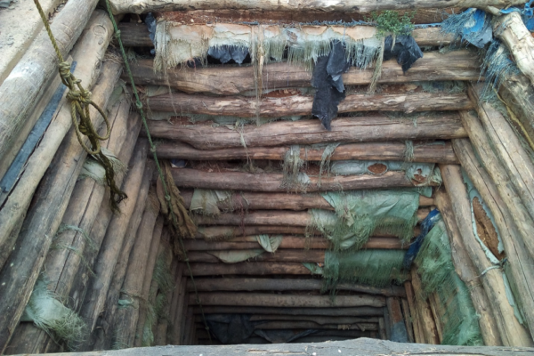
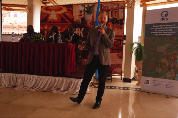
Roadblock rebels: IPIS maps important mechanism of conflict funding in Central Africa
December 6, 2017IPIS puts roadblocks on the map as key mechanism of conflict funding besides natural resources, revealing its devastating scope in funding armed actors in Democratic Republic of Congo and Central African Republic Mapping over a thousand roadblocks, two IPIS reports released today have uncovered the shocking extent of armed predation on trade routes in conflict-ridden Central Africa. Roadbloc
New Mapathon with special focus on DRC National Parks at IPIS
November 23, 2017IPIS, Missing Maps and OpenStreetMap Belgium organise another Missing Maps Mapathon on Wednesday December 6, in the IPIS library. Why do we organise this? NGOs working in the South need decent maps in order to reach people who need help. However, in many places the map is not yet complete. That’s why we need your help! How do we help? We teach volunteers how to trace satellite imagery in
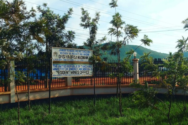
Training and workshop on mapping the socio-economic and human rights impact of mining in northwest Tanzania
November 14, 2017On Monday 23 October, IPIS organised a workshop in Mwanza to launch the data collection phase of its mapping project on the socio-economic and human rights impact of mining in northwest Tanzania. This served to introduce the project and obtain additional input and feedback on the most pressing information gaps in the sector. The workshop was organised for a broad audience of Tanzanian mining and h
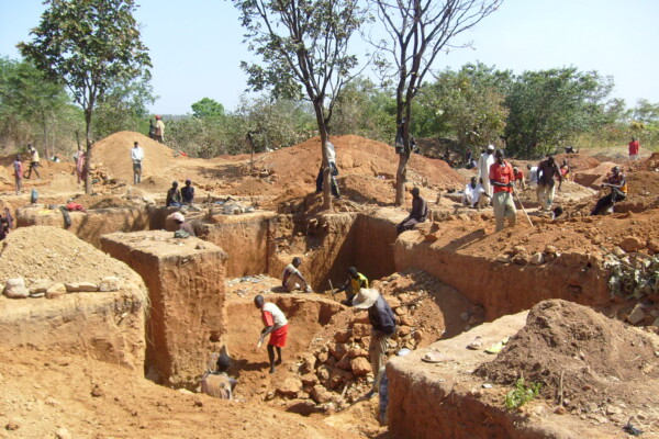
IPIS witnesses land disputes, environmental challenges, use of toxic mercury and human rights violations in small and large scale-mining in Northwest Tanzania
October 24, 2017Ikungu Mining and Processing on the shores of lake Victoria (Photo: IPIS) With the support of the Belgian Development Cooperation, IPIS has launched a mapping project of the socio-economic and human rights impact of small and large-scale mining in Northwest Tanzania. IPIS aims at collecting reliable and accessible data to contribute to improving the governance of the extractive sector in Tanzania.
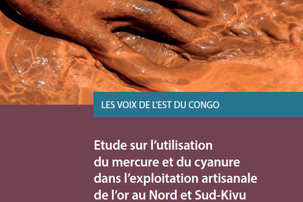
IPIS committed to help end mercury poisoning from artisanal gold mining
September 25, 2017From 24 to 29 September 2017 the first meeting of the Conference of the Parties to the Minamata Convention on Mercury will take place in Geneva, Switzerland. The Convention was approved by delegates from over 140 countries in 2013, and entered into force in August 2017. It is a multilateral environmental agreement addressing specific human activities which are contributing to widespread mercury po
IPIS launches e-learning for a thorough understanding of the global Arms Trade Treaty
September 12, 2017As governments gather in Geneva to discuss how to regulate the global arms trade by implementing the Arms Trade Treaty, the Belgian Research Group IPIS is launching a set of self-learning digital modules to promote understanding of the Treaty. The e-learning modules are designed to support the early ratification and effective implementation of the Treaty. The modules can be accessed in English, Fr
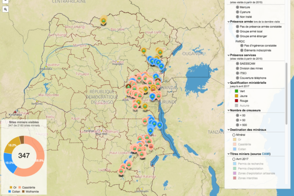
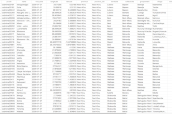
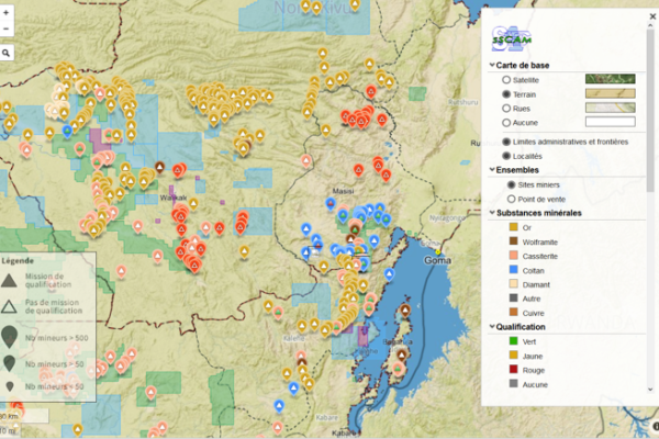
DRC webmap updated with newest mining site qualifications
July 18, 2017IPIS recently updated its interactive webmap on artisanal mining sites in Eastern DRC with data on mining site qualifications from 2016 and the first half of 2017. This minor update is part of a continuous effort to provide an up to date view of the situation on the ground, which is in constant evolution. The webmap’s main data layer originates from mining site visits carried out by IPIS since 200
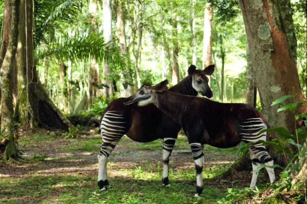
Mapping the Okapi Wildlife Reserve: images from the previous IPIS Mapathon
May 16, 2017On Wednesday April 26, IPIS opened its library to host another Missing Maps Mapathon, in collaboration with OpenStreetMap Belgium. We happily welcomed 25 participants, including students from the Antwerp University and new and more experienced OpenSteetMap contributors. The evening started with a gentle introduction on how to trace buildings, roads and other features from
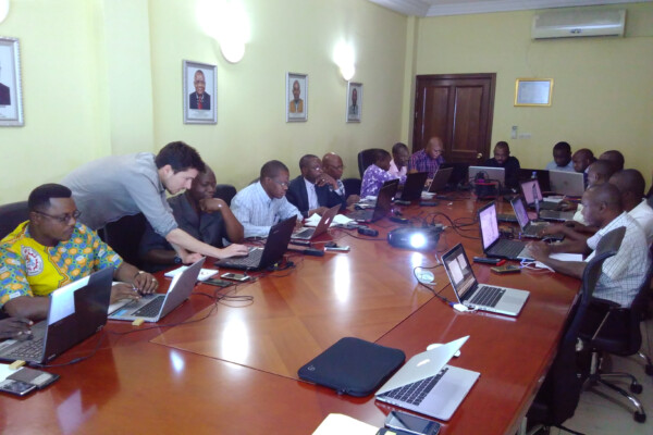
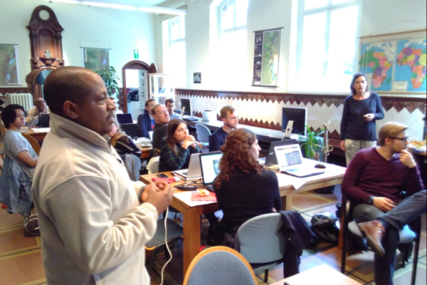
Capacity enhancement workshop on cartography with DRC mining authorities
May 16, 2017Capacity enhancement workshop on cartography with DRC mining authorities In the framework of its long standing partnership with DRC mining authorities, IPIS held a workshop in Kinshasa from May 8th to 12th, engaging with technical staff of ‘Cadastre Minier’, ‘SAESSCAM’ and ‘Division des mines’. The workshop focussed on Open Source solutions for mapping and web-mapping, such as ‘QGIS’ and ‘qgis2web
IPIS opens up its data!
May 2, 2017Data collection on peace, development and human rights is an essential part of the research work we do at IPIS. Because we believe in the power of Open Data to stimulate research that contributes to our vision of durable peace, sustainable development and the fulfilment of human rights, we are happy to announce that we are now providing structured access to some of our key datasets. Our data colle
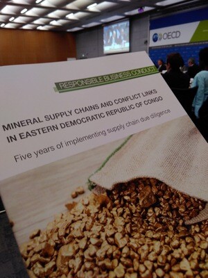
IPIS at the OECD Forum on responsible mineral supply chain
April 28, 2017IPIS is delighted to participate in the 11th Forum on responsible mineral supply chains in Paris, from 2 to 4 May . This meeting will provide the opportunity to review and discuss the implementation of the OECD Due Diligence Guidance for Minerals, the ICGLR Regional Certification Mechanism and other initiatives to enable responsible mineral supply chains. IPIS will play an active role on May 4, a
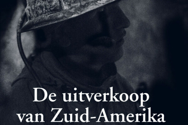
Boekvoorstelling Raf Custers “De uitverkoop van Zuid-Amerika”
April 20, 2017Op 11 mei 2017 om 19u00 is Raf Custers te gast bij IPIS om zijn boek “De uitverkoop van Zuid-Amerika” voor te stellen. Na een reis van 11 maanden door Brazilië, Uruguay, Argentinië, Chili en Bolivië beschrijft Raf Custers hoe burgers in Zuid-Amerika het opnemen tegen multinationale ondernemingen en overheden die hun natuurlijke rijkdommen, hun grondstoffen en hun leefwereld uitverkopen. De boekvoo
IPIS hosts new Missing Maps Mapathon with special focus on DRC National Parks
March 30, 2017IPIS, Missing Maps and OpenStreetMap Belgium organise another Missing Maps Mapathon on Wednesday April 26, in the IPIS library. Why do we organise this? NGOs working in the South need decent maps in order to reach people who need help. However, in many places the map is not yet complete. That’s why we need your help! How do we help? We teach volunteers how to trace satellite imagery
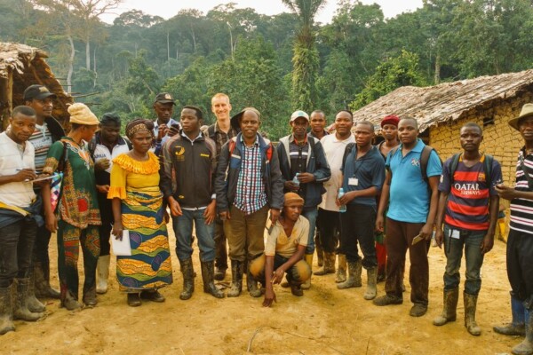
New IPIS project on mining, human rights and digitalization in Tanzania
March 13, 2017From late February to early March, two IPIS researchers were in Tanzania to lay the foundations for a new project funded by the Belgian development cooperation. It concerns a mapping of the socio-economic and human rights situation of artisanal and industrial mining in Northwest Tanzania. The project will run for 30 months (until June 2019), and has two main phases. In a first phase, IPIS will und
Launch of SAESSCAM database on artisanal and small-scale mining
March 3, 2017On February 23rd, IPIS presented in Kinshasa the results of a two years project done in partnership with Pact and Estelle Levin Ltd to support the activities of SAESSCAM (“Service d’accompagnement et d’encadrement du Small-scale mining”), a service of Congolese Ministry of mines. During this project IPIS developed and launched SAESSCAM ASM database, a database to register production and socio-econ
Training on cartography and artisanal mine site inspections in Mambasa
December 23, 2016French version below – version française ci-dessous Training on cartography and artisanal mine site inspections – Mambasa, Ituri, DRCongo From 10 to 14 December 2016, IPIS organised a training on cartography and artisanal mine site inspections in Mambasa, Ituri. The aim of this training was to launch and prepare the ground for IPIS’ artisanal gold monitoring pilot, financed by the Public-Private A
Het conflict in de Centraal-Afrikaanse Republiek in kaart gebracht.
December 1, 2016IPIS organiseert op dinsdag 20 december een filmvoorstelling en panelgesprek over het aanhoudende conflict in de Centraal-Afrikaanse Republiek. De Centraal-Afrikaanse Republiek (CAR) was de voorbije jaren het toneel van een bloedig conflict, een staatsgreep en voortdurend geweld. Het onderzoekscentrum IPIS analyseerde de motieven van de partijen bij het conflict, de conflictdynamiek, de roadblocks
SAESSCAM database on artisanal and small-scale mining
November 15, 2016As part of a project to support good governance in the artisanal and small-scale mining sector in the Democratic Republic of Congo (DRC), IPIS has delivered a functional web application and database for SAESSCAM agents to record production data from artisanal mining sites as well as a publicly accessible interactive webmap. IPIS is engaged in a PROMINES project, in partnership with Pact and Estell
Forum on Conflict Minerals Supply Chain Compliance and Transparency (30 Nov – 2 Dec 2016)
November 15, 2016Business Intelligence Services (BIS group) announces the Conflict Minerals Supply Chain Compliance and Transparency Forum taking place on 30thNovember – 2nd December 2016, in Berlin, Germany. The meeting will focus on the industry and supplier engagement to eliminate conflict minerals, concepts and practice of collaboration among and across industries, methods for risk mapping for affected compone