Mapping Conflict Motives: Katanga. (Update May- September 2008)
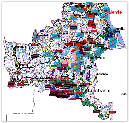
This report is the third (and for the moment the last) in a series of updates following an initial report on conflict motives in the Congolese province of Katanga. It analyses the most important security developments from May 2008 until September 2008. Download in pdf or open with issuu reader. The web maps We have […]
Mapping Conflict Motives: Katanga. (Update December 2007 – May 2008)
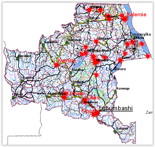
This report is the second in a series of updates following an initial report on conflict motives in the Congolese province of Katanga. It analyses the most important security developments from December 2007 until May 2008. Download in pdf or open with issuu reader. December 2007-May 2008 This report is the second in a […]
Mapping interests in conflict areas: Katanga. (Update September-November 2007)
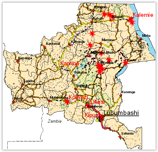
The International Peace Information Service (IPIS), a Belgium based research NGO, is a member of the Fatal Transactions consortium, which carries out the action ‘From Fatal to Fair Transactions’ with co-funding from the EU. IPIS’ contribution to this action is to develop a tool for the analysis of conflict drivers. Making use of GIS (Geographic […]