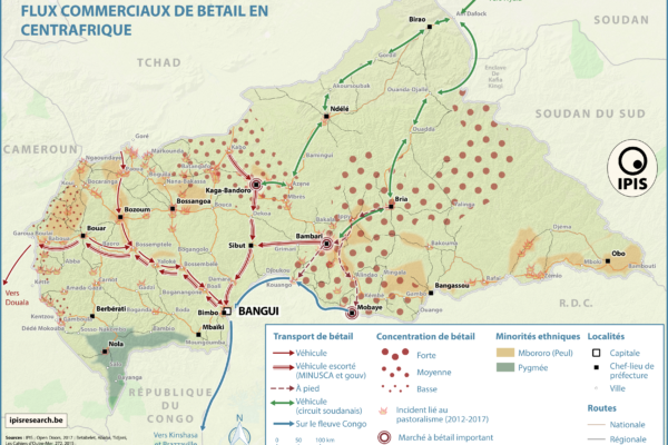
Pastoralism corridors in Central African Republic (2017)
December 1, 2017While pastoralism can generates wealth and economic interdependence between farmers and cattle herders, it can also causes tension and conflicts. In the current Central African Republic crisis context, transnational livestock migrations, particularly by Chadian and Sudanese herdsmen to CAR, have led to clashes between pastoralists and the local population. IPIS has developed a map showing the main
République Centrafricaine: Portait d’un territoire riche en crises (2012 – 2017)
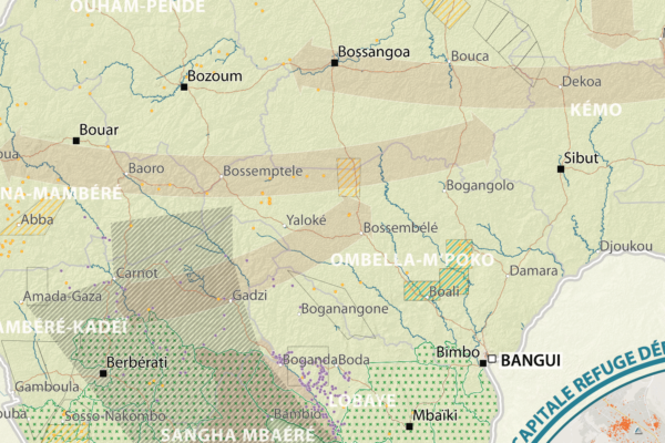
September 19, 2017This poster is a compilation of maps and graphics related to the situation in the Central African Republic. A map of natural resources and poaching corridors presents the known wealth of this country, often considered as conflict drivers in the absence of well functioning state authorities. A small map presents the current armed groups area of influence as well as the number of reported violent in
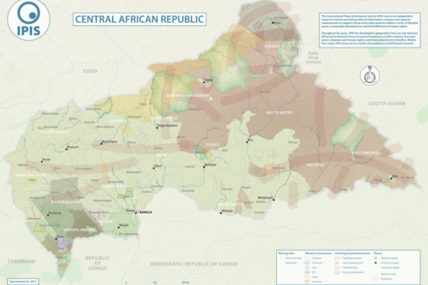
Natural Resources in Central African Republic (2017)
September 12, 2017With an area of 622 984km2, the Central African Republic is the 20th largest country in Africa and one of the poorest in the world. Its economy is highly dependent of the primary sector. Whereas distribution of income is deeply unequal, the unstable political situation and the violent confrontations between different armed groups all around the country weaken the economic growth, especially from
Central African Republic – Road Map (2017)
June 1, 2017In 2013 the Central African Republic entered a period of great instability. The predominantly Muslim rebel coalition, Seleka, seized power. A group of mostly Christian militias, the Anti-balaka, rose up to counter the Seleka. Years of atrocities, horrors and fighting followed. In 2016 a democratic election was held, a sign of hope for the people of the CAR. However, dissolved fractions of the Sele